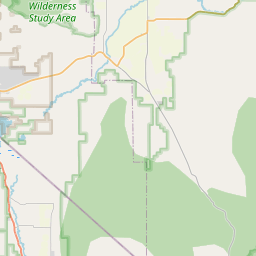
Yerington Map, Satellite view of Yerington, Nevada
Yerington is a city located in Lyon County, Nevada, USA.
Location informations of Yerington
Latitude of city of Yerington is 38.98575 and longitude of city of Yerington is -119.16293- What Country is Yerington In? Yerington is located in the United States of America.
- What State is Yerington located in? Yerington is located in Nevada.
- What County is Yerington In? The County of Yerington is Lyon County
Yerington, Nevada (NV), USA Geographic Information
| Country | United States |
| Country Code | US |
| State Name | Nevada |
| Latitude | 38.98575 |
| Longitude | -119.16293 |
| DMS Lat | 38°59'8.7" N |
| DMS Long | 119°9'46.548" W |
| DMS coordinates : | 38°59'8.7" N 119°9'46.548" W |
Current Date and Time in Yerington, Nevada, USA
| Yerington Time Zone : America/Los_Angeles |
What day is it in Yerington right now?Thursday (May 22, 2025) |
What time is it?Current local time and date at Yerington is 5/22/2025 - 3:40:41 PM |
Postcode / zip code of Yerington
Yerington is the actual or alternate city name associated with 1 ZIP Codes by the US Postal Service.
List of all postal codes in Yerington, Nevada, United States.
89447 Zip Code
Online Map of Yerington - road map, satellite view and street view


Check out our interactive map of Yerington, Nevada and you'll easily find your way around the Yerington major roads and highways.
Satellite Map of Yerington, NV, USA
This is online map of the address Yerington, NV, United States. You may use button to move and zoom in / out. The map information is for reference only.
Yerington Municipal Airport (2.08 Km / 1.29 Miles)
Nish Ag Air Airport (5.31 Km / 3.30 Miles)
Wide Load Airstrip (14.97 Km / 9.30 Miles)
Easy Street Airstrip (16.48 Km / 10.24 Miles)
Desert Bighorn Flat Airstrip (16.74 Km / 10.40 Miles)
Alkali Lake Landing Area (17.69 Km / 10.99 Miles)
Gold Mine Number 2 Airstrip (17.84 Km / 11.08 Miles)
Gold Mine Airstrip (17.85 Km / 11.09 Miles)
Three Shotgun Shells Airfield (21.05 Km / 13.08 Miles)
Hop Skip and Jump / Julian Lane Airstrip (21.13 Km / 13.13 Miles)
Too Short Airstrip (21.43 Km / 13.32 Miles)
Rosaschi Air Park (22.23 Km / 13.81 Miles)
Quinns Mesa Airstrip (23.84 Km / 14.82 Miles)
One Time Airstrip (24.21 Km / 15.04 Miles)
Yerington Elementary School (331 m / 0.21 Miles)
Yerington Intermediate School (561 m / 0.35 Miles)
Yerington High School (571 m / 0.35 Miles)