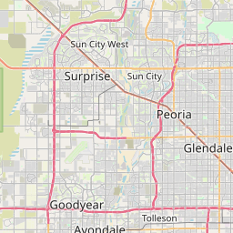
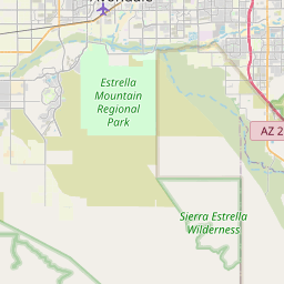
Youngtown Map, Satellite view of Youngtown, Arizona
Youngtown is a town located in Maricopa County, Arizona, USA.
Location informations of Youngtown
Latitude of city of Youngtown is 33.59393 and longitude of city of Youngtown is -112.30294- What Country is Youngtown In? Youngtown is located in the United States of America.
- What State is Youngtown located in? Youngtown is located in Arizona.
- What County is Youngtown In? The County of Youngtown is Maricopa County
Youngtown, Arizona (AZ), USA Geographic Information
| Country | United States |
| Country Code | US |
| State Name | Arizona |
| Latitude | 33.59393 |
| Longitude | -112.30294 |
| DMS Lat | 33°35'38.148" N |
| DMS Long | 112°18'10.584" W |
| DMS coordinates : | 33°35'38.148" N 112°18'10.584" W |
Current Date and Time in Youngtown, Arizona, USA
| Youngtown Time Zone : America/Phoenix |
What day is it in Youngtown right now?Sunday (May 18, 2025) |
What time is it?Current local time and date at Youngtown is 19:40:19 (05/18/2025) : (America/Phoenix) |
Postcode / zip code of Youngtown
Youngtown is the actual or alternate city name associated with 1 ZIP Codes by the US Postal Service.
List of all postal codes in Youngtown, Arizona, United States.
85363 Zip Code
Online Map of Youngtown - road map, satellite view and street view


Check out our interactive map of Youngtown, Arizona and you'll easily find your way around the Youngtown major roads and highways.
Satellite Map of Youngtown, AZ, USA
This is online map of the address Youngtown, AZ, United States. You may use button to move and zoom in / out. The map information is for reference only.
Banner Boswell Memorial Hospital Heliport (2.19 Km / 1.36 Miles)
C. Andrew Laird Heliport (3.55 Km / 2.21 Miles)
El Mirage-Village Square Airport (3.64 Km / 2.26 Miles)
Luke Auxiliary Field 3 (7.21 Km / 4.48 Miles)
Glendale Airhaven Airport (7.36 Km / 4.57 Miles)
Sunstate-Glendale Helistop (7.48 Km / 4.65 Miles)
Glendale Municipal Airport (7.49 Km / 4.65 Miles)
Fram Field (7.56 Km / 4.70 Miles)
Dysart Airport (7.72 Km / 4.80 Miles)
Thunderbird #1 Auxiliary Airfield A-2 (8.92 Km / 5.54 Miles)
Agua Fria Generating Station Heliport (9.29 Km / 5.78 Miles)
Boulais Heliport (9.78 Km / 6.08 Miles)
Del E Webb Memorial Hospital Heliport (9.79 Km / 6.08 Miles)
Luke Air Force Base (9.90 Km / 6.15 Miles)
Airscrew Performance Flightpark Ultralightport (10.70 Km / 6.65 Miles)
Rex Williams Field / Moseley Field (11.10 Km / 6.89 Miles)
Banner Thunderbird Medical Center Heliport (11.54 Km / 7.17 Miles)
Thunderbird Field 1 (11.76 Km / 7.30 Miles)
Litchfield Park Airport (12.22 Km / 7.59 Miles)
Honeywell Inc. Heliport (12.75 Km / 7.92 Miles)
Riverview School (983 m / 0.61 Miles)
Desert Mirage Preparatory Academy (1.15 Km / 0.71 Miles)
El Mirage School (2.53 Km / 1.57 Miles)
Thompson Ranch Elementary (2.76 Km / 1.72 Miles)
Paramount Academy (3.28 Km / 2.04 Miles)
Dysart Elementary School (3.37 Km / 2.09 Miles)
Dysart High School (3.41 Km / 2.12 Miles)
West-MEC - Dysart High School (3.45 Km / 2.14 Miles)
Ombudsman - Charter Northwest (3.85 Km / 2.39 Miles)
Country Meadows Elementary School (4.12 Km / 2.56 Miles)
Surprise Elementary School (4.42 Km / 2.75 Miles)
List of places near to Youngtown
| Name | Distance |
|---|---|
| El Mirage | 2.28 Km / 1.42 Miles |
| Sun City | 2.91 Km / 1.81 Miles |
| Surprise | 4.95 Km / 3.08 Miles |
| Sun City West | 8.36 Km / 5.19 Miles |
| Litchfield Park | 12.29 Km / 7.64 Miles |
| Glendale | 12.46 Km / 7.74 Miles |
| Citrus Park | 14.03 Km / 8.72 Miles |
| Tolleson | 16.50 Km / 10.25 Miles |
| Avondale | 18.13 Km / 11.27 Miles |
| Goodyear | 18.37 Km / 11.41 Miles |
| Peoria | 21.42 Km / 13.31 Miles |