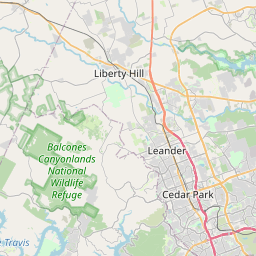
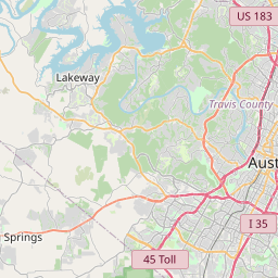
Brushy Creek Map, Satellite view of Brushy Creek, Texas
Brushy Creek is a census-designated place (CDP) located in Williamson County, Texas, USA.
Location informations of Brushy Creek
Latitude of city of Brushy Creek is 30.51353 and longitude of city of Brushy Creek is -97.73973- What Country is Brushy Creek In? Brushy Creek is located in the United States of America.
- What State is Brushy Creek located in? Brushy Creek is located in Texas.
- What County is Brushy Creek In? The County of Brushy Creek is Williamson County
Brushy Creek, Texas (TX), USA Geographic Information
| Country | United States |
| Country Code | US |
| State Name | Texas |
| Latitude | 30.51353 |
| Longitude | -97.73973 |
| DMS Lat | 30°30'48.708" N |
| DMS Long | 97°44'23.028" W |
| DMS coordinates : | 30°30'48.708" N 97°44'23.028" W |
Current Date and Time in Brushy Creek, Texas, USA
| Brushy Creek Time Zone : America/Chicago |
What day is it in Brushy Creek right now?Monday (April 7, 2025) |
What time is it?Current local time and date at Brushy Creek is 4/7/2025 - 5:05:00 AM |
Postcode / zip code of Brushy Creek
Brushy Creek is the actual or alternate city name associated with 2 ZIP Codes by the US Postal Service.
List of all postal codes in Brushy Creek, Texas, United States.
78681 Zip Code 78717 Zip Code
Online Map of Brushy Creek - road map, satellite view and street view


Check out our interactive map of Brushy Creek, Texas and you'll easily find your way around the Brushy Creek major roads and highways.
Satellite Map of Brushy Creek, TX, USA
This is online map of the address Brushy Creek, TX, United States. You may use button to move and zoom in / out. The map information is for reference only.
St. David's Round Rock Medical Center Heliport (2.57 Km / 1.60 Miles)
Hank Sasser Airport at Breakaway (3.95 Km / 2.45 Miles)
Dell Childrens North Hospital Heliport (6.64 Km / 4.13 Miles)
Cedar Park Regional Medical Center Heliport (7.37 Km / 4.58 Miles)
Baylor Scott & White Round Rock Medical Center Heliport (7.80 Km / 4.85 Miles)
Tri-Modal Air Park (8.87 Km / 5.51 Miles)
Aero Heliport (10.13 Km / 6.29 Miles)
Ascension Seton Williamson Helipad (10.23 Km / 6.35 Miles)
Pegasus Place Airstrip (10.45 Km / 6.49 Miles)
Green Airport (11.38 Km / 7.07 Miles)
St. David's North Austin Medical Center Heliport (11.68 Km / 7.25 Miles)
Ascension Seton Northwest Helipad (12.14 Km / 7.54 Miles)
Kittie Hill Airport (12.43 Km / 7.72 Miles)
Austin Executive Airpark (13.09 Km / 8.13 Miles)
Lone Oak Barn Heliport (13.31 Km / 8.27 Miles)
St Davids Georgetown Hospital Helipad (13.32 Km / 8.27 Miles)
Hummingbird Heliport (13.61 Km / 8.45 Miles)
Baylor Scott & White Pflugerville Medical Center Emergency Helipad (15.88 Km / 9.87 Miles)
Skyline Ranch Airport (16.46 Km / 10.23 Miles)
KVUE-TV Heliport (16.49 Km / 10.24 Miles)
BRUSHY CREEK EL (268 m / 0.17 Miles)
PATSY SOMMER EL (1.54 Km / 0.96 Miles)
FERN BLUFF EL (1.90 Km / 1.18 Miles)
GREAT OAKS EL (1.97 Km / 1.23 Miles)
PEARSON RANCH MIDDLE (2.16 Km / 1.34 Miles)
EL DAEP (2.39 Km / 1.49 Miles)
JAMES GARLAND WALSH MIDDLE (2.44 Km / 1.52 Miles)
CEDAR VALLEY MIDDLE (2.44 Km / 1.52 Miles)
ELSA ENGLAND EL (2.46 Km / 1.53 Miles)
CACTUS RANCH EL (3.50 Km / 2.17 Miles)
CHISHOLM TRAIL MIDDLE (3.76 Km / 2.34 Miles)
ROUND ROCK H S (3.89 Km / 2.42 Miles)
OLD TOWN EL (3.94 Km / 2.45 Miles)
7TH H S - NORTHEAST (4.10 Km / 2.55 Miles)
NEW NORTHEAST AREA EL (4.10 Km / 2.55 Miles)
NEW EL AT RYANS CROSSING (4.10 Km / 2.55 Miles)
NEW MIDDLE AT MCNEIL (4.10 Km / 2.55 Miles)
NEW 6TH H S - PEARSON RANCH (4.10 Km / 2.55 Miles)
NEW LAKELINE AREA EL (4.10 Km / 2.55 Miles)
GOALS (4.18 Km / 2.59 Miles)
List of places near to Brushy Creek
| Name | Distance |
|---|---|
| Round Rock | 7.19 Km / 4.47 Miles |
| Cedar Park | 7.68 Km / 4.77 Miles |
| Wells Branch | 9.47 Km / 5.88 Miles |
| Leander | 13.54 Km / 8.41 Miles |
| Georgetown | 14.54 Km / 9.03 Miles |
| Pflugerville | 15.08 Km / 9.37 Miles |
| Jonestown | 17.71 Km / 11.00 Miles |
| Volente | 18.04 Km / 11.21 Miles |
| Hutto | 18.77 Km / 11.66 Miles |
| Hudson Bend | 21.08 Km / 13.10 Miles |
| Serenada | 22.45 Km / 13.95 Miles |
| Weir | 23.19 Km / 14.41 Miles |
| Austin | 23.65 Km / 14.70 Miles |
| Liberty Hill | 24.28 Km / 15.09 Miles |
| Lago Vista | 24.55 Km / 15.25 Miles |
| West Lake Hills | 24.70 Km / 15.35 Miles |