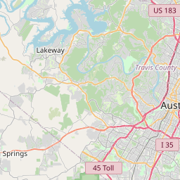
West Lake Hills Map, Satellite view of West Lake Hills, Texas
West Lake Hills is a city located in Travis County, Texas, USA.
Location informations of West Lake Hills
Latitude of city of West Lake Hills is 30.29798 and longitude of city of West Lake Hills is -97.80195- What Country is West Lake Hills In? West Lake Hills is located in the United States of America.
- What State is West Lake Hills located in? West Lake Hills is located in Texas.
- What County is West Lake Hills In? The County of West Lake Hills is Travis County
West Lake Hills, Texas (TX), USA Geographic Information
| Country | United States |
| Country Code | US |
| State Name | Texas |
| Latitude | 30.29798 |
| Longitude | -97.80195 |
| DMS Lat | 30°17'52.728" N |
| DMS Long | 97°48'7.02" W |
| DMS coordinates : | 30°17'52.728" N 97°48'7.02" W |
Current Date and Time in West Lake Hills, Texas, USA
| West Lake Hills Time Zone : America/Chicago |
What day is it in West Lake Hills right now?Tuesday (June 3, 2025) |
What time is it?Current local time and date at West Lake Hills is 6/3/2025 - 10:59:42 PM |
Postcode / zip code of West Lake Hills
West Lake Hills is the actual or alternate city name associated with 1 ZIP Codes by the US Postal Service.
List of all postal codes in West Lake Hills, Texas, United States.
78746 Zip Code
Online Map of West Lake Hills - road map, satellite view and street view


Check out our interactive map of West Lake Hills, Texas and you'll easily find your way around the West Lake Hills major roads and highways.
Satellite Map of West Lake Hills, TX, USA
This is online map of the address West Lake Hills, TX, United States. You may use button to move and zoom in / out. The map information is for reference only.
Barton Oaks Heliport (4.30 Km / 2.67 Miles)
Mabry Army National Guard Heliport (4.88 Km / 3.03 Miles)
Seton Medical Center H-4 Heliport (5.37 Km / 3.34 Miles)
Barton Creek Resort Heliport (5.51 Km / 3.43 Miles)
Heart Hospital of Austin Heliport (5.88 Km / 3.65 Miles)
Capitol National Bank Building Heliport (6.25 Km / 3.89 Miles)
Crystal Mountain Residential Helipad (6.61 Km / 4.10 Miles)
Ossiport Heliport (6.86 Km / 4.27 Miles)
Embassy Suites Garage Helipad (6.87 Km / 4.27 Miles)
Dell Seton Medical Center Heliport (6.94 Km / 4.31 Miles)
Brackenridge Hospital Heliport (6.99 Km / 4.34 Miles)
St. David's Medical Center Heliport (7.27 Km / 4.52 Miles)
Two Coves Residential Helipad (7.72 Km / 4.79 Miles)
South Austin Medical Center Heliport (8.50 Km / 5.28 Miles)
Saint Davids Healthcare Heliport (8.53 Km / 5.30 Miles)
Haile Airport (8.55 Km / 5.31 Miles)
Dell Children's Medical Center Heliport (9.07 Km / 5.64 Miles)
Penn Field (9.23 Km / 5.73 Miles)
KVUE-TV Heliport (9.70 Km / 6.03 Miles)
Austin Robert Mueller Municipal Airport (9.81 Km / 6.09 Miles)
EANES EL (1.88 Km / 1.17 Miles)
VALLEY VIEW EL (2.48 Km / 1.54 Miles)
FOREST TRAIL EL (2.53 Km / 1.57 Miles)
TRAVIS CO J J A E P (2.68 Km / 1.67 Miles)
WESTLAKE H S (2.76 Km / 1.71 Miles)
WESTLAKE ALTER (2.76 Km / 1.72 Miles)
ADULT TRANSITION SERVICES (2.78 Km / 1.73 Miles)
HILL COUNTRY MIDDLE (2.99 Km / 1.86 Miles)
O HENRY MIDDLE (3.00 Km / 1.86 Miles)
CEDAR CREEK EL (3.26 Km / 2.02 Miles)
CASIS EL (3.56 Km / 2.21 Miles)
AUSTIN H S (4.25 Km / 2.64 Miles)
MATHEWS EL (4.51 Km / 2.80 Miles)
BRIDGE POINT EL (4.65 Km / 2.89 Miles)
BRYKER WOODS EL (4.97 Km / 3.09 Miles)
List of places near to West Lake Hills
| Name | Distance |
|---|---|
| Rollingwood | 2.57 Km / 1.60 Miles |
| Lost Creek | 4.09 Km / 2.54 Miles |
| Austin | 4.74 Km / 2.95 Miles |
| Barton Creek | 6.61 Km / 4.11 Miles |
| Sunset Valley | 8.03 Km / 4.99 Miles |
| Bee Cave | 13.78 Km / 8.56 Miles |
| Shady Hollow | 15.89 Km / 9.87 Miles |
| San Leanna | 17.00 Km / 10.56 Miles |
| Hudson Bend | 17.69 Km / 10.99 Miles |
| Manchaca | 17.73 Km / 11.02 Miles |
| Volente | 17.98 Km / 11.17 Miles |
| Bear Creek | 18.29 Km / 11.36 Miles |
| The Hills | 18.43 Km / 11.45 Miles |
| Lakeway | 19.80 Km / 12.30 Miles |
| Wells Branch | 20.23 Km / 12.57 Miles |
| Point Venture | 20.72 Km / 12.87 Miles |
| Hays | 20.76 Km / 12.90 Miles |
| Hornsby Bend | 21.73 Km / 13.50 Miles |
| Cedar Park | 23.66 Km / 14.70 Miles |
| Buda | 23.94 Km / 14.88 Miles |
| Manor | 23.99 Km / 14.91 Miles |
| Creedmoor | 24.04 Km / 14.94 Miles |
| Brushy Creek | 24.70 Km / 15.35 Miles |
| Jonestown | 24.86 Km / 15.45 Miles |