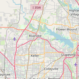
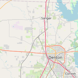
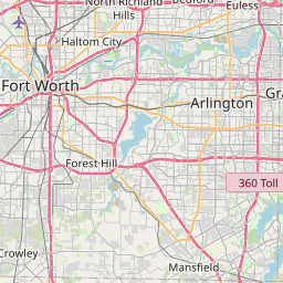
Carrollton Map, Satellite view of Carrollton, Texas
Carrollton is a city located in Collin County, Dallas County, Denton County, Texas, USA.
Location informations of Carrollton
Latitude of city of Carrollton is 32.98939 and longitude of city of Carrollton is -96.89994- What Country is Carrollton In? Carrollton is located in the United States of America.
- What State is Carrollton located in? Carrollton is located in Texas.
- What County is Carrollton In? Carrollton, Texas sits in Three different counties: Collin County, Dallas County, Denton County
Carrollton, Texas (TX), USA Geographic Information
| Country | United States |
| Country Code | US |
| State Name | Texas |
| Latitude | 32.98939 |
| Longitude | -96.89994 |
| DMS Lat | 32°59'21.804" N |
| DMS Long | 96°53'59.784" W |
| DMS coordinates : | 32°59'21.804" N 96°53'59.784" W |
Current Date and Time in Carrollton, Texas, USA
| Carrollton Time Zone : America/Chicago |
What day is it in Carrollton right now?Friday (May 23, 2025) |
What time is it?Current local time and date at Carrollton is 5/23/2025 - 9:22:03 AM |
Postcode / zip code of Carrollton
Carrollton is the actual or alternate city name associated with 9 ZIP Codes by the US Postal Service.
List of all postal codes in Carrollton, Texas, United States.
75001 Zip Code 75006 Zip Code 75007 Zip Code 75010 Zip Code 75011 Zip Code 75019 Zip Code 75056 Zip Code 75067 Zip Code 75093 Zip Code
Area Codes Carrollton, Texas, USA
Carrollton, Texas covers 3 Area Codes
214 Area Code 469 Area Code 972 Area CodeOnline Map of Carrollton - road map, satellite view and street view


Check out our interactive map of Carrollton, Texas and you'll easily find your way around the Carrollton major roads and highways.
Satellite Map of Carrollton, TX, USA
This is online map of the address Carrollton, TX, United States. You may use button to move and zoom in / out. The map information is for reference only.
Hig Heliport (2.83 Km / 1.76 Miles)
Opela Heliport (3.93 Km / 2.44 Miles)
Carrollton Regional Medical Center Heliport (4.53 Km / 2.81 Miles)
Addison Airport (6.36 Km / 3.95 Miles)
Air Park Dallas Airport (7.00 Km / 4.35 Miles)
Texas Health Presbyterian Hospital Plano Heliport (8.39 Km / 5.21 Miles)
Toyota of Dallas Inc Heliport (9.10 Km / 5.66 Miles)
Baylor Health Center At Irving Coppell Heliport (9.81 Km / 6.10 Miles)
Baylor Regional Medical Center At Plano Heliport (10.62 Km / 6.60 Miles)
Las Colinas Medical Center Heliport (10.99 Km / 6.83 Miles)
Medical City Lewisville Heliport (11.56 Km / 7.18 Miles)
Microfocus Heliport (12.32 Km / 7.65 Miles)
Campus at Legacy Heliport (12.53 Km / 7.79 Miles)
Legacy Hangar Heliport (12.72 Km / 7.90 Miles)
Medical City Plano Heliport (12.98 Km / 8.07 Miles)
Childrens Medical Center Plano Heliport (13.46 Km / 8.37 Miles)
Medical City Dallas Hospital Heliport (14.47 Km / 8.99 Miles)
Crespi Helistop (14.47 Km / 8.99 Miles)
Medical City Dallas Rooftop Heliport (14.53 Km / 9.03 Miles)
Dallas Rehabilitation Institute Heliport (15.77 Km / 9.80 Miles)
MCCOY EL (883 m / 0.55 Miles)
RAINWATER EL (1.08 Km / 0.67 Miles)
SMITH H S (1.36 Km / 0.85 Miles)
CARROLLTON CLASSICAL ACADEMY (1.36 Km / 0.85 Miles)
BLANTON EL (1.49 Km / 0.92 Miles)
BLALACK MIDDLE (1.60 Km / 0.99 Miles)
CREEKVIEW H S (1.90 Km / 1.18 Miles)
THOMPSON EL (1.94 Km / 1.21 Miles)
DAVIS EL (1.98 Km / 1.23 Miles)
ROSEMEADE EL (2.07 Km / 1.29 Miles)
GOOD EL (2.27 Km / 1.41 Miles)
KENT EL (2.30 Km / 1.43 Miles)
HUIE SPECIAL EDUC CTR (2.31 Km / 1.44 Miles)
HARMONY SCIENCE ACADEMY - CARROLLTON (2.77 Km / 1.72 Miles)
HARMONY SCHOOL OF INNOVATION - CARROLLTON (2.80 Km / 1.74 Miles)
LONG MIDDLE (2.91 Km / 1.81 Miles)
FURNEAUX EL (3.07 Km / 1.91 Miles)
SALAZAR DISTRICT ALTERNATIVE EDUCATION PROGRAM (3.10 Km / 1.92 Miles)
POLK MIDDLE (3.36 Km / 2.09 Miles)
HOMESTEAD EL (3.45 Km / 2.14 Miles)
List of places near to Carrollton
| Name | Distance |
|---|---|
| Farmers Branch | 7.00 Km / 4.35 Miles |
| Addison | 7.28 Km / 4.52 Miles |
| Hebron | 7.61 Km / 4.73 Miles |
| Coppell | 8.94 Km / 5.56 Miles |
| Lewisville | 9.93 Km / 6.17 Miles |
| The Colony | 11.15 Km / 6.93 Miles |
| Plano | 15.73 Km / 9.77 Miles |
| Grapevine | 17.58 Km / 10.92 Miles |
| Highland Village | 17.80 Km / 11.06 Miles |
| Richardson | 18.00 Km / 11.18 Miles |
| University Park | 18.06 Km / 11.22 Miles |
| Hackberry | 18.20 Km / 11.31 Miles |
| Lakewood Village | 18.23 Km / 11.33 Miles |
| Lake Dallas | 18.59 Km / 11.55 Miles |
| Little Elm | 19.58 Km / 12.17 Miles |
| Frisco | 19.82 Km / 12.32 Miles |
| Hickory Creek | 19.91 Km / 12.37 Miles |
| Irving | 20.03 Km / 12.45 Miles |
| Highland Park | 20.06 Km / 12.46 Miles |
| Flower Mound | 20.58 Km / 12.79 Miles |
| Double Oak | 21.37 Km / 13.28 Miles |
| Copper Canyon | 21.83 Km / 13.56 Miles |
| Shady Shores | 22.97 Km / 14.27 Miles |
| Bartonville | 23.53 Km / 14.62 Miles |
| Southlake | 23.54 Km / 14.63 Miles |
| Lantana | 23.74 Km / 14.75 Miles |
| Corinth | 23.89 Km / 14.84 Miles |
| Oak Point | 23.90 Km / 14.85 Miles |
| Euless | 23.99 Km / 14.91 Miles |
| Paloma Creek South | 24.72 Km / 15.36 Miles |
| Allen | 24.84 Km / 15.43 Miles |