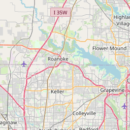
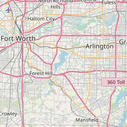
Irving Map, Satellite view of Irving, Texas
Irving is a city located in Dallas County, Texas, USA.
Location informations of Irving
Latitude of city of Irving is 32.81402 and longitude of city of Irving is -96.94889- What Country is Irving In? Irving is located in the United States of America.
- What State is Irving located in? Irving is located in Texas.
- What County is Irving In? The County of Irving is Dallas County
Irving, Texas (TX), USA Geographic Information
| Country | United States |
| Country Code | US |
| State Name | Texas |
| Latitude | 32.81402 |
| Longitude | -96.94889 |
| DMS Lat | 32°48'50.472" N |
| DMS Long | 96°56'56.004" W |
| DMS coordinates : | 32°48'50.472" N 96°56'56.004" W |
Current Date and Time in Irving, Texas, USA
| Irving Time Zone : America/Chicago |
What day is it in Irving right now?Wednesday (April 16, 2025) |
What time is it?Current local time and date at Irving is 08:58:43 (04/16/2025) : (America/Chicago) |
Postcode / zip code of Irving
Irving is the actual or alternate city name associated with 12 ZIP Codes by the US Postal Service.
List of all postal codes in Irving, Texas, United States.
75014 Zip Code 75015 Zip Code 75016 Zip Code 75017 Zip Code 75038 Zip Code 75039 Zip Code 75050 Zip Code 75060 Zip Code 75061 Zip Code 75062 Zip Code 75063 Zip Code 75234 Zip Code
Area Codes Irving, Texas, USA
Irving, Texas covers 3 Area Codes
214 Area Code 469 Area Code 972 Area CodeOnline Map of Irving - road map, satellite view and street view


Check out our interactive map of Irving, Texas and you'll easily find your way around the Irving major roads and highways.
Satellite Map of Irving, TX, USA
This is online map of the address Irving, TX, United States. You may use button to move and zoom in / out. The map information is for reference only.
Baylor Scott & White Medical Center Irving Heliport (2.57 Km / 1.59 Miles)
Mc David Honda Heliport (3.32 Km / 2.06 Miles)
Jasper Lee Airport (4.41 Km / 2.74 Miles)
Mc David Pontiac Company Heliport (5.38 Km / 3.34 Miles)
Dallas Rehabilitation Institute Heliport (7.59 Km / 4.72 Miles)
Redmond Taylor Army Heliport (9.18 Km / 5.71 Miles)
UT Southwestern Medical Center Heliport (9.24 Km / 5.74 Miles)
Stemmons Place Heliport (9.35 Km / 5.81 Miles)
Greater Southwest International Airport-Amon Carter Field (9.56 Km / 5.94 Miles)
Dallas Love Field (9.79 Km / 6.08 Miles)
Las Colinas Medical Center Heliport (9.90 Km / 6.15 Miles)
Parkland Health & Hospital System Heliport (10.23 Km / 6.36 Miles)
Parkland Hospital Nr 2 Heliport (10.28 Km / 6.38 Miles)
Parkland Hospital #1 Heliport (10.65 Km / 6.62 Miles)
Baylor Health Center At Irving Coppell Heliport (11.01 Km / 6.84 Miles)
Flyers Field (11.02 Km / 6.85 Miles)
Grand Prairie Army Airfield (11.56 Km / 7.18 Miles)
Heliport-Facility 5a Heliport (11.74 Km / 7.30 Miles)
Toyota of Dallas Inc Heliport (11.77 Km / 7.32 Miles)
Infomart Heliport (12.01 Km / 7.46 Miles)
LORENZO DE ZAVALA MIDDLE (800 m / 0.50 Miles)
BARBARA CARDWELL CAREER PREPARATORY CENTER (927 m / 0.58 Miles)
HALEY J EL (966 m / 0.60 Miles)
BOWIE MIDDLE (1.10 Km / 0.68 Miles)
PIERCE EARLY CHILDHOOD (1.13 Km / 0.70 Miles)
IRVING H S (1.22 Km / 0.76 Miles)
BRITAIN EL (1.33 Km / 0.83 Miles)
AUSTIN MIDDLE (1.53 Km / 0.95 Miles)
PREMIER H S OF SOUTH IRVING (1.64 Km / 1.02 Miles)
KEYES EL (1.81 Km / 1.13 Miles)
UPLIFT EDUCATION - INFINITY PREPARATORY MIDDLE SCH (1.89 Km / 1.18 Miles)
UPLIFT INFINITY H S (1.93 Km / 1.20 Miles)
UPLIFT EDUCATION - INFINITY PREPARATORY PRI (1.93 Km / 1.20 Miles)
GOOD EL (1.95 Km / 1.21 Miles)
GILBERT F M EL (2.02 Km / 1.25 Miles)
TOWNLEY EL (2.14 Km / 1.33 Miles)
NIMITZ H S (2.40 Km / 1.49 Miles)
KINKEADE EARLY CHILDHOOD (2.56 Km / 1.59 Miles)
LIVELY EL (2.62 Km / 1.63 Miles)
STUDENT REASSIGNMENT CTR (2.69 Km / 1.67 Miles)
Aviation Institute of Maintenance-Dallas (2.54 Km / 1.58 Miles)
Tint School of Makeup & Cosmetology (3.63 Km / 2.25 Miles)
Michael's Barber & Hair Stylist Academy (3.89 Km / 2.42 Miles)
University of Dallas (4.51 Km / 2.80 Miles)
List of places near to Irving
| Name | Distance |
|---|---|
| Cockrell Hill | 10.41 Km / 6.47 Miles |
| Euless | 12.69 Km / 7.89 Miles |
| Farmers Branch | 13.44 Km / 8.35 Miles |
| University Park | 14.45 Km / 8.98 Miles |
| Highland Park | 14.82 Km / 9.21 Miles |
| Grand Prairie | 15.73 Km / 9.77 Miles |
| Coppell | 17.05 Km / 10.59 Miles |
| Dallas | 17.20 Km / 10.69 Miles |
| Arlington | 17.24 Km / 10.71 Miles |
| Grapevine | 17.90 Km / 11.12 Miles |
| Duncanville | 18.43 Km / 11.45 Miles |
| Bedford | 18.45 Km / 11.46 Miles |
| Addison | 19.87 Km / 12.35 Miles |
| Carrollton | 20.03 Km / 12.45 Miles |
| Colleyville | 20.64 Km / 12.83 Miles |
| Hurst | 20.74 Km / 12.89 Miles |
| Pantego | 22.35 Km / 13.89 Miles |
| Dalworthington Gardens | 22.92 Km / 14.24 Miles |
| Southlake | 24.34 Km / 15.12 Miles |