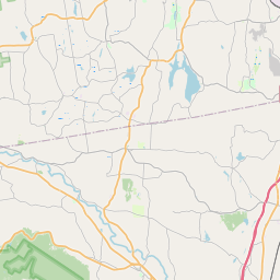
Castleton-on-Hudson Map, Satellite view of Castleton-on-Hudson, New York
Castleton-on-Hudson is a village located in Rensselaer County, New York, USA.
Location informations of Castleton-on-Hudson
Latitude of city of Castleton-on-Hudson is 42.51841 and longitude of city of Castleton-on-Hudson is -73.75123- What Country is Castleton-on-Hudson In? Castleton-on-Hudson is located in the United States of America.
- What State is Castleton-on-Hudson located in? Castleton-on-Hudson is located in New York.
- What County is Castleton-on-Hudson In? The County of Castleton-on-Hudson is Rensselaer County
Castleton-on-Hudson, New York (NY), USA Geographic Information
| Country | United States |
| Country Code | US |
| State Name | New York |
| Latitude | 42.51841 |
| Longitude | -73.75123 |
| DMS Lat | 42°31'6.276" N |
| DMS Long | 73°45'4.428" W |
| DMS coordinates : | 42°31'6.276" N 73°45'4.428" W |
Current Date and Time in Castleton-on-Hudson, New York, USA
| Castleton-on-Hudson Time Zone : America/New_York |
What day is it in Castleton-on-Hudson right now?Saturday (July 26, 2025) |
What time is it?Current local time and date at Castleton-on-Hudson is 16:17:12 (07/26/2025) : (America/New_York) |
Postcode / zip code of Castleton-on-Hudson
Castleton-on-Hudson is the actual or alternate city name associated with 1 ZIP Codes by the US Postal Service.
List of all postal codes in Castleton-on-Hudson, New York, United States.
12033 Zip Code
Area Codes Castleton-on-Hudson, New York, USA
Castleton-on-Hudson, New York covers 1 Area Codes
518 Area CodeOnline Map of Castleton-on-Hudson - road map, satellite view and street view


Check out our interactive map of Castleton-on-Hudson, New York and you'll easily find your way around the Castleton-on-Hudson major roads and highways.
Satellite Map of Castleton-on-Hudson, NY, USA
This is online map of the address Castleton-on-Hudson, NY, United States. You may use button to move and zoom in / out. The map information is for reference only.
Cross' Farm Airport (4.88 Km / 3.03 Miles)
South Albany Airport (8.25 Km / 5.12 Miles)
Bethlehem Energy Center Heliport (8.59 Km / 5.34 Miles)
Ny State Police - Troop T Heliport (11.23 Km / 6.98 Miles)
Alexander Farm Airport (13.04 Km / 8.11 Miles)
Amch Heliport (14.95 Km / 9.29 Miles)
Tgp-254 Heliport (15.98 Km / 9.93 Miles)
Wayne Delp Airport (16.89 Km / 10.49 Miles)
Ny Arng Heliport (17.79 Km / 11.06 Miles)
Snyder's Lake Seaplane Base (18.10 Km / 11.24 Miles)
Troy Armory Heliport (19.54 Km / 12.14 Miles)
Kline Kill Airport (20.93 Km / 13.00 Miles)
Westerlo Airport (22.74 Km / 14.13 Miles)
Greenville-Rainbow Airport (23.68 Km / 14.71 Miles)
Rensselaer County Airport (23.77 Km / 14.77 Miles)
Deer Run Airport (23.85 Km / 14.82 Miles)
CASTLETON ELEMENTARY SCHOOL (1.36 Km / 0.85 Miles)
MAPLE HILL JUNIOR/SENIOR HIGH SCHOOL (3.32 Km / 2.07 Miles)
MAPLE HILL MIDDLE SCHOOL (3.48 Km / 2.16 Miles)
List of places near to Castleton-on-Hudson
| Name | Distance |
|---|---|
| Schodack | 5.76 Km / 3.58 Miles |
| Ravena | 7.70 Km / 4.78 Miles |
| East Greenbush (CDP) | 9.02 Km / 5.60 Miles |
| Bethlehem | 9.72 Km / 6.04 Miles |
| East Greenbush | 10.50 Km / 6.52 Miles |
| Coeymans | 10.59 Km / 6.58 Miles |
| Niverville | 11.36 Km / 7.06 Miles |
| Hampton Manor | 11.55 Km / 7.18 Miles |
| Nassau | 11.57 Km / 7.19 Miles |
| Kinderhook (Town) | 13.17 Km / 8.18 Miles |
| Valatie | 13.31 Km / 8.27 Miles |
| Stuyvesant | 13.67 Km / 8.49 Miles |
| Rensselaer | 13.82 Km / 8.59 Miles |
| New Baltimore | 14.26 Km / 8.86 Miles |
| Kinderhook | 14.36 Km / 8.92 Miles |
| Albany | 14.92 Km / 9.27 Miles |
| Nassau (Town) | 17.25 Km / 10.72 Miles |
| Chatham (Town) | 17.29 Km / 10.74 Miles |
| New Scotland | 18.07 Km / 11.23 Miles |
| West Sand Lake | 18.15 Km / 11.28 Miles |
| North Greenbush | 18.49 Km / 11.49 Miles |
| Coxsackie | 19.10 Km / 11.87 Miles |
| Menands | 19.43 Km / 12.07 Miles |
| East Nassau | 20.09 Km / 12.48 Miles |
| Averill Park | 20.66 Km / 12.84 Miles |
| Voorheesville | 20.94 Km / 13.01 Miles |
| Sand Lake | 21.12 Km / 13.12 Miles |
| Coxsackie (Town) | 21.30 Km / 13.24 Miles |
| Chatham | 21.41 Km / 13.30 Miles |
| Westmere | 21.48 Km / 13.35 Miles |
| Wynantskill | 21.68 Km / 13.47 Miles |
| Stockport | 22.41 Km / 13.92 Miles |
| Colonie | 23.18 Km / 14.40 Miles |
| Ghent (CDP) | 23.80 Km / 14.79 Miles |
| Troy | 23.85 Km / 14.82 Miles |
| Watervliet | 23.89 Km / 14.84 Miles |
| Ghent | 24.12 Km / 14.99 Miles |
| Poestenkill (CDP) | 24.47 Km / 15.20 Miles |
| Westerlo | 24.60 Km / 15.29 Miles |
| Colonie (Town) | 24.92 Km / 15.48 Miles |
| Greenville (CDP) | 25.00 Km / 15.53 Miles |