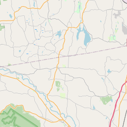
Westmere Map, Satellite view of Westmere, New York
Westmere is a census-designated place (CDP) located in Albany County, New York, USA.
Location informations of Westmere
Latitude of city of Westmere is 42.69119 and longitude of city of Westmere is -73.86873- What Country is Westmere In? Westmere is located in the United States of America.
- What State is Westmere located in? Westmere is located in New York.
- What County is Westmere In? The County of Westmere is Albany County
Westmere, New York (NY), USA Geographic Information
| Country | United States |
| Country Code | US |
| State Name | New York |
| Latitude | 42.69119 |
| Longitude | -73.86873 |
| DMS Lat | 42°41'28.284" N |
| DMS Long | 73°52'7.428" W |
| DMS coordinates : | 42°41'28.284" N 73°52'7.428" W |
Current Date and Time in Westmere, New York, USA
| Westmere Time Zone : America/New_York |
What day is it in Westmere right now?Thursday (May 22, 2025) |
What time is it?Current local time and date at Westmere is 5/22/2025 - 9:30:02 AM |
Postcode / zip code of Westmere
Westmere is the actual or alternate city name associated with 3 ZIP Codes by the US Postal Service.
List of all postal codes in Westmere, New York, United States.
12084 Zip Code 12159 Zip Code 12203 Zip Code
Online Map of Westmere - road map, satellite view and street view


Check out our interactive map of Westmere, New York and you'll easily find your way around the Westmere major roads and highways.
Satellite Map of Westmere, NY, USA
This is online map of the address Westmere, NY, United States. You may use button to move and zoom in / out. The map information is for reference only.
Ny Arng Heliport (4.00 Km / 2.48 Miles)
Jerry Phibbs Airport (7.93 Km / 4.93 Miles)
Albany International Airport (8.39 Km / 5.21 Miles)
Amch Heliport (8.85 Km / 5.50 Miles)
Ny State Police - Troop T Heliport (10.86 Km / 6.75 Miles)
Troy Armory Heliport (13.49 Km / 8.38 Miles)
Bethlehem Energy Center Heliport (13.60 Km / 8.45 Miles)
South Albany Airport (14.79 Km / 9.19 Miles)
General Electric R&D Center Heliport (15.11 Km / 9.39 Miles)
Hillcrest Country Club Airport (15.54 Km / 9.65 Miles)
Cross' Farm Airport (16.64 Km / 10.34 Miles)
Wells Seaplane Base (17.88 Km / 11.11 Miles)
Heldeberg Airstrip (18.34 Km / 11.39 Miles)
Schenectady County Airport (18.60 Km / 11.56 Miles)
Snyder's Lake Seaplane Base (19.17 Km / 11.91 Miles)
Duanesburg Airport (22.84 Km / 14.19 Miles)
Westerlo Airport (22.89 Km / 14.22 Miles)
West Township Airport (23.43 Km / 14.56 Miles)
Mohawk Valley Airport (23.61 Km / 14.67 Miles)
Rensselaer County Airport (23.63 Km / 14.68 Miles)
WESTMERE ELEMENTARY SCHOOL (843 m / 0.52 Miles)
FARNSWORTH MIDDLE SCHOOL (2.30 Km / 1.43 Miles)
TECH VALLEY HIGH SCHOOL (2.68 Km / 1.67 Miles)
GUILDERLAND ELEMENTARY SCHOOL (2.91 Km / 1.81 Miles)
EAGLE POINT ELEMENTARY SCHOOL (4.72 Km / 2.93 Miles)
ROESSLEVILLE SCHOOL (4.81 Km / 2.99 Miles)
FOREST PARK ELEMENTARY SCHOOL (4.91 Km / 3.05 Miles)
Excelsior College (1.66 Km / 1.03 Miles)
SUNY at Albany (3.66 Km / 2.27 Miles)
Bryant & Stratton College-Albany (4.86 Km / 3.02 Miles)
List of places near to Westmere
| Name | Distance |
|---|---|
| Colonie | 4.14 Km / 2.57 Miles |
| Voorheesville | 6.42 Km / 3.99 Miles |
| Guilderland | 7.84 Km / 4.87 Miles |
| Colonie (Town) | 8.70 Km / 5.41 Miles |
| Niskayuna (CDP) | 10.03 Km / 6.23 Miles |
| Albany | 10.15 Km / 6.31 Miles |
| New Scotland | 11.33 Km / 7.04 Miles |
| Rensselaer | 11.62 Km / 7.22 Miles |
| Menands | 11.78 Km / 7.32 Miles |
| Bethlehem | 12.23 Km / 7.60 Miles |
| Niskayuna | 12.45 Km / 7.74 Miles |
| Altamont | 13.53 Km / 8.41 Miles |
| Rotterdam (CDP) | 13.54 Km / 8.41 Miles |
| Hampton Manor | 13.88 Km / 8.62 Miles |
| Watervliet | 14.35 Km / 8.92 Miles |
| Schenectady | 14.85 Km / 9.23 Miles |
| Troy | 15.04 Km / 9.35 Miles |
| Green Island | 15.63 Km / 9.71 Miles |
| Green Island (Town) | 15.72 Km / 9.77 Miles |
| North Greenbush | 16.45 Km / 10.22 Miles |
| Cohoes | 16.58 Km / 10.30 Miles |
| East Greenbush | 16.77 Km / 10.42 Miles |
| Scotia | 16.95 Km / 10.53 Miles |
| East Greenbush (CDP) | 17.63 Km / 10.95 Miles |
| Rotterdam | 17.82 Km / 11.07 Miles |
| Wynantskill | 18.35 Km / 11.40 Miles |
| Waterford | 19.01 Km / 11.81 Miles |
| Clifton Park | 19.03 Km / 11.82 Miles |
| Knox | 19.37 Km / 12.04 Miles |
| Waterford (Town) | 19.42 Km / 12.07 Miles |
| Duane Lake | 20.70 Km / 12.86 Miles |
| Castleton-on-Hudson | 21.48 Km / 13.35 Miles |
| Princetown | 21.63 Km / 13.44 Miles |
| West Sand Lake | 21.91 Km / 13.61 Miles |
| Halfmoon | 21.99 Km / 13.66 Miles |
| Coeymans | 22.24 Km / 13.82 Miles |
| Duanesburg (CDP) | 23.04 Km / 14.32 Miles |
| East Glenville | 23.12 Km / 14.37 Miles |
| Schodack | 23.37 Km / 14.52 Miles |
| Berne | 23.50 Km / 14.60 Miles |
| Brunswick | 23.95 Km / 14.88 Miles |
| Glenville | 24.00 Km / 14.91 Miles |
| Poestenkill (CDP) | 24.86 Km / 15.45 Miles |