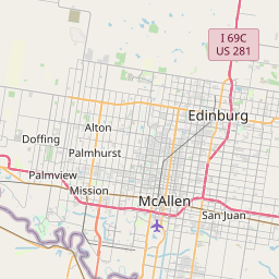
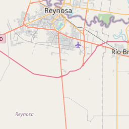
César Chávez Map, Satellite view of César Chávez, Texas
César Chávez is a census-designated place (CDP) located in Hidalgo County, Texas, USA.
Location informations of César Chávez
Latitude of city of César Chávez is 26.31184 and longitude of city of César Chávez is -98.11161- What Country is César Chávez In? César Chávez is located in the United States of America.
- What State is César Chávez located in? César Chávez is located in Texas.
- What County is César Chávez In? The County of César Chávez is Hidalgo County
César Chávez, Texas (TX), USA Geographic Information
| Country | United States |
| Country Code | US |
| State Name | Texas |
| Latitude | 26.31184 |
| Longitude | -98.11161 |
| DMS Lat | 26°18'42.624" N |
| DMS Long | 98°6'41.796" W |
| DMS coordinates : | 26°18'42.624" N 98°6'41.796" W |
Current Date and Time in César Chávez, Texas, USA
| César Chávez Time Zone : America/Chicago |
What day is it in César Chávez right now?Saturday (April 26, 2025) |
What time is it?Current local time and date at César Chávez is 04:50:58 (04/26/2025) : (America/Chicago) |
Postcode / zip code of César Chávez
César Chávez is the actual or alternate city name associated with 1 ZIP Codes by the US Postal Service.
List of all postal codes in César Chávez, Texas, United States.
78542 Zip Code
Online Map of César Chávez - road map, satellite view and street view


Check out our interactive map of César Chávez, Texas and you'll easily find your way around the César Chávez major roads and highways.
Satellite Map of César Chávez, TX, USA
This is online map of the address César Chávez, TX, United States. You may use button to move and zoom in / out. The map information is for reference only.
Norman & White Airport (6.86 Km / 4.26 Miles)
South Texas Health System Edinburg Helipad (8.93 Km / 5.55 Miles)
Edinburg Municipal Airport (9.60 Km / 5.97 Miles)
TGP 409 Heliport (11.89 Km / 7.39 Miles)
Hidalgo County Sheriff's Jail Heliport (11.95 Km / 7.43 Miles)
South Texas International at Edinburg Airport (14.48 Km / 9.00 Miles)
Omni Ranch Ultralight Flightpark (14.84 Km / 9.22 Miles)
Cannon Aviation Airport (15.66 Km / 9.73 Miles)
Skalitsky Airport (16.35 Km / 10.16 Miles)
Gross Private Airport (16.99 Km / 10.56 Miles)
Pharr Airport (17.12 Km / 10.64 Miles)
Woods Airport (17.36 Km / 10.79 Miles)
Rio Grande Regional Hospital Helipad (17.60 Km / 10.94 Miles)
Mid-Valley Dusters Inc Airport (17.80 Km / 11.06 Miles)
South Texas Health System Heart Heliport (17.84 Km / 11.08 Miles)
South Texas Health System McAllen Helipad (17.87 Km / 11.11 Miles)
Air Evac 104 Heliport (18.13 Km / 11.26 Miles)
McAllen Miller International Airport (19.66 Km / 12.22 Miles)
Mid Valley Airport (20.34 Km / 12.64 Miles)
Texas Department of Public Safety Weslaco Heliport (20.39 Km / 12.67 Miles)
ECONOMEDES H S (958 m / 0.60 Miles)
EISENHOWER EL (1.83 Km / 1.13 Miles)
HIDALGO CO J J A E P (1.99 Km / 1.24 Miles)
JUVENILE DETENTION CTR (1.99 Km / 1.24 Miles)
HIDALGO CO J J A E P (2.00 Km / 1.24 Miles)
MEMORIAL MIDDLE (2.02 Km / 1.25 Miles)
LONE STAR H S SOUTH (2.44 Km / 1.52 Miles)
VILLARREAL EL (2.74 Km / 1.70 Miles)
MONTE CRISTO EL (2.87 Km / 1.78 Miles)
EDINBURG ALTERNATIVE EDUCATION ACADEMY (3.62 Km / 2.25 Miles)
LINCOLN EL (3.67 Km / 2.28 Miles)
L B JOHNSON EL (4.03 Km / 2.50 Miles)
AUSTIN ELEM (4.08 Km / 2.53 Miles)
IDEA EDINBURG ACADEMY (4.23 Km / 2.63 Miles)
IDEA EDINBURG COLLEGE PREPARATORY (4.23 Km / 2.63 Miles)
CANO-GONZALEZ EL (4.27 Km / 2.65 Miles)
MACARIA DELA GARZA GORENA EL (4.36 Km / 2.71 Miles)
DR THOMAS ESPARZA EL (4.51 Km / 2.80 Miles)
SAN CARLOS EL (4.53 Km / 2.81 Miles)
BETTS EL (4.67 Km / 2.90 Miles)
List of places near to César Chávez
| Name | Distance |
|---|---|
| Doolittle | 4.01 Km / 2.49 Miles |
| San Carlos | 4.34 Km / 2.70 Miles |
| Edinburg | 5.28 Km / 3.28 Miles |
| Murillo | 5.42 Km / 3.37 Miles |
| Muniz | 6.54 Km / 4.06 Miles |
| La Blanca | 7.66 Km / 4.76 Miles |
| Lopezville | 9.50 Km / 5.90 Miles |
| North Alamo | 10.75 Km / 6.68 Miles |
| Faysville | 11.21 Km / 6.97 Miles |
| Elsa | 11.99 Km / 7.45 Miles |
| Alamo | 14.30 Km / 8.89 Miles |
| San Juan | 14.31 Km / 8.89 Miles |
| Pharr | 14.86 Km / 9.23 Miles |
| Olivarez | 15.09 Km / 9.38 Miles |
| Edcouch | 15.19 Km / 9.44 Miles |
| Monte Alto | 15.52 Km / 9.64 Miles |
| Midway North | 16.67 Km / 10.36 Miles |
| Donna | 16.82 Km / 10.45 Miles |
| McAllen | 16.88 Km / 10.49 Miles |
| South Alamo | 17.22 Km / 10.70 Miles |
| Hargill | 17.49 Km / 10.87 Miles |
| Mila Doce | 18.05 Km / 11.22 Miles |
| La Villa | 18.30 Km / 11.37 Miles |
| Midway South | 19.48 Km / 12.10 Miles |
| Scissors | 19.98 Km / 12.41 Miles |
| Alton | 20.29 Km / 12.61 Miles |
| Weslaco | 20.78 Km / 12.91 Miles |
| Palmhurst | 21.42 Km / 13.31 Miles |
| Laguna Seca | 22.04 Km / 13.70 Miles |
| West Sharyland | 22.07 Km / 13.71 Miles |
| Indian Hills | 22.36 Km / 13.89 Miles |
| Villa Verde | 22.97 Km / 14.27 Miles |
| Mission | 23.83 Km / 14.81 Miles |
| Llano Grande | 24.79 Km / 15.40 Miles |
| La Homa | 24.85 Km / 15.44 Miles |