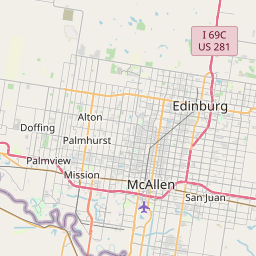
Indian Hills Map, Satellite view of Indian Hills, Texas
Indian Hills is a census-designated place (CDP) located in Hidalgo County, Texas, USA.
Location informations of Indian Hills
Latitude of city of Indian Hills is 26.21285 and longitude of city of Indian Hills is -97.91639- What Country is Indian Hills In? Indian Hills is located in the United States of America.
- What State is Indian Hills located in? Indian Hills is located in Texas.
- What County is Indian Hills In? The County of Indian Hills is Hidalgo County
Indian Hills, Texas (TX), USA Geographic Information
| Country | United States |
| Country Code | US |
| State Name | Texas |
| Latitude | 26.21285 |
| Longitude | -97.91639 |
| DMS Lat | 26°12'46.26" N |
| DMS Long | 97°54'59.004" W |
| DMS coordinates : | 26°12'46.26" N 97°54'59.004" W |
Current Date and Time in Indian Hills, Texas, USA
| Indian Hills Time Zone : America/Chicago |
What day is it in Indian Hills right now?Tuesday (May 27, 2025) |
What time is it?Current local time and date at Indian Hills is 21:04:35 (05/27/2025) : (America/Chicago) |
Postcode / zip code of Indian Hills
Indian Hills is the actual or alternate city name associated with 1 ZIP Codes by the US Postal Service.
List of all postal codes in Indian Hills, Texas, United States.
78570 Zip Code
Online Map of Indian Hills - road map, satellite view and street view


Check out our interactive map of Indian Hills, Texas and you'll easily find your way around the Indian Hills major roads and highways.
Satellite Map of Indian Hills, TX, USA
This is online map of the address Indian Hills, TX, United States. You may use button to move and zoom in / out. The map information is for reference only.
Texas Department of Public Safety Weslaco Heliport (5.28 Km / 3.28 Miles)
Old Reb Airport (5.84 Km / 3.63 Miles)
Mid Valley Airport (6.88 Km / 4.28 Miles)
Flying 'K' Ranch Ultralightport (7.68 Km / 4.77 Miles)
Skalitsky Airport (9.22 Km / 5.73 Miles)
Knapp Medical Center Heliport (9.23 Km / 5.73 Miles)
Cannon Aviation Airport (10.38 Km / 6.45 Miles)
Woods Airport (13.15 Km / 8.17 Miles)
Progreso Airport (14.75 Km / 9.17 Miles)
San Pedro Ranch Airport (16.11 Km / 10.01 Miles)
Harlingen Municipal Airport / Harvey Richards Field (16.31 Km / 10.14 Miles)
Donna Dusting Service Airport (17.27 Km / 10.73 Miles)
Shofner Farms Airport (18.90 Km / 11.74 Miles)
Mid-Valley Dusters Inc Airport (22.80 Km / 14.17 Miles)
Alamo Aerial Applicators Airport (23.60 Km / 14.66 Miles)
Farmer's Co-Op Airport (23.73 Km / 14.75 Miles)
Bennack Flying Services Airport (24.16 Km / 15.01 Miles)
Valley Baptist Medical Center (VBMC) Heliport (24.82 Km / 15.42 Miles)
Harlingen Medical Center Helipad (24.91 Km / 15.48 Miles)
Valley Baptist Medical Center Helipad (24.98 Km / 15.52 Miles)
SGT WILLIAM G HARRELL MIDDLE (3.74 Km / 2.32 Miles)
List of places near to Indian Hills
| Name | Distance |
|---|---|
| Heidelberg | 4.01 Km / 2.49 Miles |
| Mila Doce | 4.51 Km / 2.80 Miles |
| Mercedes | 7.02 Km / 4.36 Miles |
| Ratamosa | 7.14 Km / 4.44 Miles |
| Olivarez | 7.76 Km / 4.82 Miles |
| Solis | 9.22 Km / 5.73 Miles |
| Bixby | 9.24 Km / 5.74 Miles |
| Weslaco | 9.51 Km / 5.91 Miles |
| La Villa | 9.62 Km / 5.98 Miles |
| Edcouch | 10.04 Km / 6.24 Miles |
| La Feria North | 10.13 Km / 6.29 Miles |
| Santa Rosa | 10.34 Km / 6.42 Miles |
| Llano Grande | 10.58 Km / 6.57 Miles |
| Midway North | 10.61 Km / 6.59 Miles |
| La Feria | 11.00 Km / 6.84 Miles |
| Tierra Bonita | 11.14 Km / 6.92 Miles |
| Elsa | 11.78 Km / 7.32 Miles |
| Villa Verde | 12.15 Km / 7.55 Miles |
| Midway South | 12.16 Km / 7.56 Miles |
| Progreso | 14.01 Km / 8.71 Miles |
| Relampago | 14.21 Km / 8.83 Miles |
| Donna | 14.33 Km / 8.90 Miles |
| La Blanca | 15.02 Km / 9.33 Miles |
| Yznaga | 15.42 Km / 9.58 Miles |
| Primera | 15.86 Km / 9.85 Miles |
| Scissors | 15.95 Km / 9.91 Miles |
| Palm Valley | 16.23 Km / 10.08 Miles |
| Progreso Lakes | 16.25 Km / 10.10 Miles |
| Santa Maria | 16.35 Km / 10.16 Miles |
| Iglesia Antigua | 16.52 Km / 10.27 Miles |
| Las Palmas II | 17.88 Km / 11.11 Miles |
| Muniz | 17.93 Km / 11.14 Miles |
| Bluetown | 18.01 Km / 11.19 Miles |
| San Carlos | 18.04 Km / 11.21 Miles |
| Zapata Ranch | 18.24 Km / 11.33 Miles |
| Combes | 18.64 Km / 11.58 Miles |
| Monte Alto | 18.65 Km / 11.59 Miles |
| Juarez | 18.68 Km / 11.61 Miles |
| Sebastian | 19.16 Km / 11.91 Miles |
| South Alamo | 20.16 Km / 12.53 Miles |
| Alamo | 20.87 Km / 12.97 Miles |
| North Alamo | 20.96 Km / 13.02 Miles |
| Murillo | 21.41 Km / 13.30 Miles |
| Rangerville | 21.63 Km / 13.44 Miles |
| Harlingen | 22.12 Km / 13.74 Miles |
| Lasana | 22.26 Km / 13.83 Miles |
| César Chávez | 22.36 Km / 13.89 Miles |
| San Juan | 23.98 Km / 14.90 Miles |
| Lopezville | 24.44 Km / 15.19 Miles |
| Los Indios | 24.97 Km / 15.52 Miles |