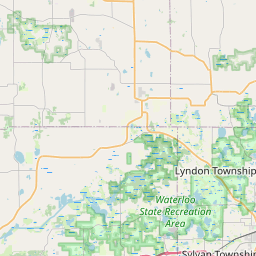
Dexter Map, Satellite view of Dexter, Michigan
Dexter is a city located in Washtenaw County, Michigan, USA.
Location informations of Dexter
Latitude of city of Dexter is 42.33837 and longitude of city of Dexter is -83.88856- What Country is Dexter In? Dexter is located in the United States of America.
- What State is Dexter located in? Dexter is located in Michigan.
- What County is Dexter In? The County of Dexter is Washtenaw County
Dexter, Michigan (MI), USA Geographic Information
| Country | United States |
| Country Code | US |
| State Name | Michigan |
| Latitude | 42.33837 |
| Longitude | -83.88856 |
| DMS Lat | 42°20'18.132" N |
| DMS Long | 83°53'18.816" W |
| DMS coordinates : | 42°20'18.132" N 83°53'18.816" W |
Current Date and Time in Dexter, Michigan, USA
| Dexter Time Zone : America/Detroit |
What day is it in Dexter right now?Monday (May 19, 2025) |
What time is it?Current local time and date at Dexter is 5/19/2025 - 10:38:59 AM |
Postcode / zip code of Dexter
Dexter is the actual or alternate city name associated with 1 ZIP Codes by the US Postal Service.
List of all postal codes in Dexter, Michigan, United States.
48130 Zip Code
Online Map of Dexter - road map, satellite view and street view


Check out our interactive map of Dexter, Michigan and you'll easily find your way around the Dexter major roads and highways.
Satellite Map of Dexter, MI, USA
This is online map of the address Dexter, MI, United States. You may use button to move and zoom in / out. The map information is for reference only.
Gooding Airport (8.94 Km / 5.55 Miles)
Cackleberry Airport (9.76 Km / 6.06 Miles)
White O'Morn Heliport (13.66 Km / 8.49 Miles)
Overflow Pad (Lower Pad) Heliport (14.11 Km / 8.77 Miles)
Ummc Heliport (14.43 Km / 8.97 Miles)
Survival Flight Heliport (14.53 Km / 9.03 Miles)
CS Mott Helipad (14.71 Km / 9.14 Miles)
Mynning Airport (14.92 Km / 9.27 Miles)
Ann Arbor Municipal Airport (17.40 Km / 10.81 Miles)
Winters Field (18.41 Km / 11.44 Miles)
Carriage Lane Airport (18.47 Km / 11.48 Miles)
Richmond Field (18.60 Km / 11.55 Miles)
Rossettie Airport (19.78 Km / 12.29 Miles)
Schiller Heliport (20.86 Km / 12.96 Miles)
St Joseph Mercy Ann Arbor Hospital Heliport (21.01 Km / 13.06 Miles)
Saline Airport (22.78 Km / 14.15 Miles)
Dexter Alternative School (636 m / 0.40 Miles)
Jenkins Early Childhood Learning Center (781 m / 0.49 Miles)
Bates Elementary School (1.05 Km / 0.65 Miles)
Creekside Intermediate School (1.10 Km / 0.68 Miles)
Wylie Elementary School (1.12 Km / 0.69 Miles)
Mill Creek Middle School (1.33 Km / 0.83 Miles)
Cornerstone Elementary School (1.34 Km / 0.83 Miles)
Dexter High School (1.99 Km / 1.24 Miles)
List of places near to Dexter
| Name | Distance |
|---|---|
| Scio | 5.91 Km / 3.67 Miles |
| Webster | 5.98 Km / 3.72 Miles |
| Dexter (Township) | 6.51 Km / 4.05 Miles |
| Lima | 6.92 Km / 4.30 Miles |
| Barton Hills | 10.01 Km / 6.22 Miles |
| Chelsea | 11.08 Km / 6.88 Miles |
| Lodi | 13.60 Km / 8.45 Miles |
| Pinckney | 13.99 Km / 8.69 Miles |
| Northfield | 14.42 Km / 8.96 Miles |
| Whitmore Lake | 14.44 Km / 8.97 Miles |
| Ann Arbor (Charter Township) | 14.86 Km / 9.23 Miles |
| Freedom | 15.30 Km / 9.51 Miles |
| Ann Arbor | 15.31 Km / 9.51 Miles |
| Hamburg | 15.51 Km / 9.64 Miles |
| Putnam | 15.58 Km / 9.68 Miles |
| Lyndon | 16.39 Km / 10.18 Miles |
| Sylvan | 16.44 Km / 10.22 Miles |
| Pittsfield | 20.28 Km / 12.60 Miles |
| Green Oak | 20.57 Km / 12.78 Miles |
| Saline | 21.02 Km / 13.06 Miles |
| Unadilla | 21.31 Km / 13.24 Miles |
| Sharon | 21.60 Km / 13.42 Miles |
| Brighton | 23.04 Km / 14.32 Miles |
| South Lyon | 23.73 Km / 14.75 Miles |
| Genoa | 23.76 Km / 14.76 Miles |
| Salem | 23.86 Km / 14.83 Miles |
| Superior | 23.99 Km / 14.91 Miles |
| Manchester | 24.25 Km / 15.07 Miles |
| Waterloo | 24.68 Km / 15.34 Miles |
| Saline (Township) | 24.82 Km / 15.42 Miles |
| Marion | 24.87 Km / 15.45 Miles |