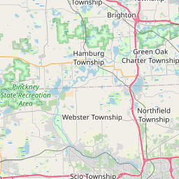
Pittsfield Map, Satellite view of Pittsfield, Michigan
Pittsfield is a charter-township located in Washtenaw County, Michigan, USA.
Location informations of Pittsfield
Latitude of city of Pittsfield is 42.20841 and longitude of city of Pittsfield is -83.71560- What Country is Pittsfield In? Pittsfield is located in the United States of America.
- What State is Pittsfield located in? Pittsfield is located in Michigan.
- What County is Pittsfield In? The County of Pittsfield is Washtenaw County
Pittsfield, Michigan (MI), USA Geographic Information
| Country | United States |
| Country Code | US |
| State Name | Michigan |
| Latitude | 42.20841 |
| Longitude | -83.7156 |
| DMS Lat | 42°12'30.276" N |
| DMS Long | 83°42'56.16" W |
| DMS coordinates : | 42°12'30.276" N 83°42'56.16" W |
Current Date and Time in Pittsfield, Michigan, USA
| Pittsfield Time Zone : America/Detroit |
What day is it in Pittsfield right now?Wednesday (August 13, 2025) |
What time is it?Current local time and date at Pittsfield is 8/13/2025 - 7:35:38 AM |
Postcode / zip code of Pittsfield
Pittsfield is the actual or alternate city name associated with 6 ZIP Codes by the US Postal Service.
List of all postal codes in Pittsfield, Michigan, United States.
48103 Zip Code 48104 Zip Code 48105 Zip Code 48108 Zip Code 48176 Zip Code 48197 Zip Code
Online Map of Pittsfield - road map, satellite view and street view


Check out our interactive map of Pittsfield, Michigan and you'll easily find your way around the Pittsfield major roads and highways.
Satellite Map of Pittsfield, MI, USA
This is online map of the address Pittsfield, MI, United States. You may use button to move and zoom in / out. The map information is for reference only.
Ann Arbor Municipal Airport (2.96 Km / 1.84 Miles)
St Joseph Mercy Ann Arbor Hospital Heliport (8.01 Km / 4.98 Miles)
CS Mott Helipad (8.25 Km / 5.13 Miles)
Survival Flight Heliport (8.46 Km / 5.25 Miles)
Ummc Heliport (8.68 Km / 5.39 Miles)
Overflow Pad (Lower Pad) Heliport (9.03 Km / 5.61 Miles)
Saline Airport (9.33 Km / 5.80 Miles)
Runyon Landing Strip (13.31 Km / 8.27 Miles)
Downwind Acres Airport (13.69 Km / 8.50 Miles)
Belleville Airport (14.43 Km / 8.96 Miles)
Willow Run Airport (15.60 Km / 9.69 Miles)
Laszlo Airport (17.27 Km / 10.73 Miles)
Milan Airport (17.68 Km / 10.98 Miles)
Gooding Airport (19.73 Km / 12.26 Miles)
A T I Heliport (19.73 Km / 12.26 Miles)
Carl's Airport (20.61 Km / 12.80 Miles)
Johnston Airport (21.41 Km / 13.30 Miles)
Maybee Airport (22.25 Km / 13.83 Miles)
Tecumseh Mills Airport (23.60 Km / 14.66 Miles)
Mynning Airport (23.73 Km / 14.74 Miles)
Multicultural Academy (1.29 Km / 0.80 Miles)
Clifford E Bryant Comm School (2.68 Km / 1.66 Miles)
Ann Arbor Learning Community (2.98 Km / 1.85 Miles)
Harvest Elementary School (3.23 Km / 2.01 Miles)
Scarlett Middle School (3.51 Km / 2.18 Miles)
Saline High School (3.52 Km / 2.19 Miles)
Mary D Mitchell School (3.68 Km / 2.29 Miles)
Huron Valley Womens (4.32 Km / 2.69 Miles)
Pathways To Success Academic Campus (4.37 Km / 2.72 Miles)
Ann Arbor Preschool and Family Center (4.62 Km / 2.87 Miles)
Center for Forensic Psychiatry (4.73 Km / 2.94 Miles)
John Allen School (4.77 Km / 2.96 Miles)
Central Academy (4.81 Km / 2.99 Miles)
List of places near to Pittsfield
| Name | Distance |
|---|---|
| Ann Arbor | 7.00 Km / 4.35 Miles |
| Saline | 7.15 Km / 4.44 Miles |
| York | 9.06 Km / 5.63 Miles |
| Ypsilanti | 9.20 Km / 5.72 Miles |
| Ypsilanti (Charter Township) | 9.61 Km / 5.97 Miles |
| Lodi | 11.25 Km / 6.99 Miles |
| Ann Arbor (Charter Township) | 12.35 Km / 7.67 Miles |
| Augusta | 13.31 Km / 8.27 Miles |
| Barton Hills | 13.37 Km / 8.31 Miles |
| Superior | 14.23 Km / 8.84 Miles |
| Milan | 14.35 Km / 8.92 Miles |
| Scio | 14.44 Km / 8.97 Miles |
| Saline (Township) | 14.46 Km / 8.99 Miles |
| Belleville | 18.98 Km / 11.79 Miles |
| Van Buren | 19.10 Km / 11.87 Miles |
| Milan (Township) | 19.19 Km / 11.92 Miles |
| Dexter | 20.28 Km / 12.60 Miles |
| Northfield | 20.30 Km / 12.61 Miles |
| Freedom | 20.46 Km / 12.71 Miles |
| Macon | 20.89 Km / 12.98 Miles |
| London | 21.09 Km / 13.10 Miles |
| Lima | 21.11 Km / 13.12 Miles |
| Webster | 21.33 Km / 13.25 Miles |
| Sumpter | 21.82 Km / 13.56 Miles |
| Canton | 21.89 Km / 13.60 Miles |
| Salem | 22.09 Km / 13.73 Miles |
| Bridgewater | 22.39 Km / 13.91 Miles |
| Whitmore Lake | 23.75 Km / 14.76 Miles |