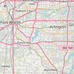
Duncanville Map, Satellite view of Duncanville, Texas
Duncanville is a city located in Dallas County, Texas, USA.
Location informations of Duncanville
Latitude of city of Duncanville is 32.65180 and longitude of city of Duncanville is -96.90834- What Country is Duncanville In? Duncanville is located in the United States of America.
- What State is Duncanville located in? Duncanville is located in Texas.
- What County is Duncanville In? The County of Duncanville is Dallas County
Duncanville, Texas (TX), USA Geographic Information
| Country | United States |
| Country Code | US |
| State Name | Texas |
| Latitude | 32.6518 |
| Longitude | -96.90834 |
| DMS Lat | 32°39'6.48" N |
| DMS Long | 96°54'30.024" W |
| DMS coordinates : | 32°39'6.48" N 96°54'30.024" W |
Current Date and Time in Duncanville, Texas, USA
| Duncanville Time Zone : America/Chicago |
What day is it in Duncanville right now?Tuesday (May 27, 2025) |
What time is it?Current local time and date at Duncanville is 20:30:41 (05/27/2025) : (America/Chicago) |
Postcode / zip code of Duncanville
Duncanville is the actual or alternate city name associated with 3 ZIP Codes by the US Postal Service.
List of all postal codes in Duncanville, Texas, United States.
75116 Zip Code 75137 Zip Code 75138 Zip Code
Area Codes Duncanville, Texas, USA
Duncanville, Texas covers 3 Area Codes
214 Area Code 469 Area Code 972 Area CodeOnline Map of Duncanville - road map, satellite view and street view


Check out our interactive map of Duncanville, Texas and you'll easily find your way around the Duncanville major roads and highways.
Satellite Map of Duncanville, TX, USA
This is online map of the address Duncanville, TX, United States. You may use button to move and zoom in / out. The map information is for reference only.
Charlton Methodist Hospital Heliport (1.47 Km / 0.91 Miles)
Charlton-Careflite Heliport (3.02 Km / 1.88 Miles)
Barsons Utilities Heliport (4.37 Km / 2.72 Miles)
Dallas Executive Airport (4.96 Km / 3.08 Miles)
Desoto Heliport (5.45 Km / 3.39 Miles)
Police H Port-Redbird Heliport (5.86 Km / 3.64 Miles)
Lou Foote Airport / Highway 77 Airport (7.91 Km / 4.91 Miles)
Flyers Field (8.12 Km / 5.05 Miles)
Curry Airport (8.67 Km / 5.39 Miles)
Hampton Field / Clearview Airport (8.94 Km / 5.55 Miles)
Redmond Taylor Army Heliport (10.91 Km / 6.78 Miles)
Aerospatiale Helicopter Corp Heliport (12.97 Km / 8.06 Miles)
Grand Prairie Army Airfield (13.92 Km / 8.65 Miles)
Grand Prairie Municipal Airport (13.98 Km / 8.69 Miles)
Flying B Ranch Airport (14.17 Km / 8.81 Miles)
Airbus Helicopter Heliport (14.21 Km / 8.83 Miles)
Premier Aviation Inc Heliport (14.33 Km / 8.90 Miles)
Methodist Dallas Medical Center Heliport (14.40 Km / 8.95 Miles)
Eagle's Nest Estates Airport (15.57 Km / 9.68 Miles)
Dallas/Fort Worth Medical Center Heliport (15.90 Km / 9.88 Miles)
CENTRAL EL (171 m / 0.11 Miles)
GLENN C HARDIN INT (561 m / 0.35 Miles)
MARY E SMITHEY PACE H S (707 m / 0.44 Miles)
MERRIFIELD EL (813 m / 0.51 Miles)
J HERMAN REED MIDDLE (820 m / 0.51 Miles)
WILLIAM LEE HASTINGS EL (1.31 Km / 0.81 Miles)
FAIRMEADOWS EL (1.69 Km / 1.05 Miles)
UME PREPARATORY ACADEMY - DUNCANVILLE (1.76 Km / 1.09 Miles)
SUMMIT LEARNING CENTER (1.79 Km / 1.11 Miles)
DUNCANVILLE H S (2.25 Km / 1.40 Miles)
WILLIAM H BYRD MIDDLE (2.29 Km / 1.42 Miles)
VILLAGE TECH SCHOOLS (2.36 Km / 1.47 Miles)
JAMES R BILHARTZ JR EL (2.42 Km / 1.50 Miles)
H BOB DANIEL SR INT (2.46 Km / 1.53 Miles)
CLINT Q SMITH EL (2.54 Km / 1.58 Miles)
A W BROWN - F L A EARLY CHILDHOOD CAMPUS (2.77 Km / 1.72 Miles)
GRACE R BRANDENBURG INT (3.21 Km / 1.99 Miles)
S GUS ALEXANDER JR EL (3.25 Km / 2.02 Miles)
CHARLES ACTON EL (3.45 Km / 2.15 Miles)
G W KENNEMER MIDDLE (3.73 Km / 2.32 Miles)
List of places near to Duncanville
| Name | Distance |
|---|---|
| DeSoto | 8.40 Km / 5.22 Miles |
| Cedar Hill | 8.87 Km / 5.51 Miles |
| Cockrell Hill | 9.60 Km / 5.97 Miles |
| Grand Prairie | 11.20 Km / 6.96 Miles |
| Glenn Heights | 12.26 Km / 7.62 Miles |
| Ovilla | 12.51 Km / 7.77 Miles |
| Oak Leaf | 15.45 Km / 9.60 Miles |
| Lancaster | 15.73 Km / 9.77 Miles |
| Red Oak | 17.81 Km / 11.07 Miles |
| Hutchins | 18.29 Km / 11.36 Miles |
| Irving | 18.43 Km / 11.45 Miles |
| Midlothian | 20.50 Km / 12.74 Miles |
| Dallas | 20.58 Km / 12.79 Miles |
| Arlington | 20.89 Km / 12.98 Miles |
| Pecan Hill | 21.67 Km / 13.47 Miles |
| Mansfield | 21.89 Km / 13.60 Miles |
| Wilmer | 22.03 Km / 13.69 Miles |
| Highland Park | 22.95 Km / 14.26 Miles |
| Dalworthington Gardens | 23.80 Km / 14.79 Miles |
| Pantego | 24.23 Km / 15.06 Miles |
| University Park | 24.26 Km / 15.07 Miles |