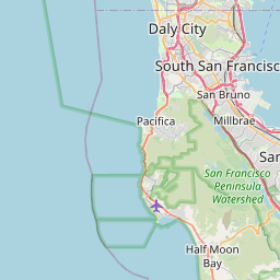
Emerald Lake Hills Map, Satellite view of Emerald Lake Hills, California
Emerald Lake Hills is a census-designated place (CDP) located in San Mateo County, California, USA.
Location informations of Emerald Lake Hills
Latitude of city of Emerald Lake Hills is 37.46466 and longitude of city of Emerald Lake Hills is -122.26802- What Country is Emerald Lake Hills In? Emerald Lake Hills is located in the United States of America.
- What State is Emerald Lake Hills located in? Emerald Lake Hills is located in California.
- What County is Emerald Lake Hills In? The County of Emerald Lake Hills is San Mateo County
Emerald Lake Hills, California (CA), USA Geographic Information
| Country | United States |
| Country Code | US |
| State Name | California |
| Latitude | 37.46466 |
| Longitude | -122.26802 |
| DMS Lat | 37°27'52.776" N |
| DMS Long | 122°16'4.872" W |
| DMS coordinates : | 37°27'52.776" N 122°16'4.872" W |
Current Date and Time in Emerald Lake Hills, California, USA
| Emerald Lake Hills Time Zone : America/Los_Angeles |
What day is it in Emerald Lake Hills right now?Thursday (June 19, 2025) |
What time is it?Current local time and date at Emerald Lake Hills is 6/19/2025 - 7:22:25 PM |
Postcode / zip code of Emerald Lake Hills
Emerald Lake Hills is the actual or alternate city name associated with 1 ZIP Codes by the US Postal Service.
List of all postal codes in Emerald Lake Hills, California, United States.
94062 Zip Code
Area Codes Emerald Lake Hills, California, USA
Emerald Lake Hills, California covers 1 Area Codes
650 Area CodeOnline Map of Emerald Lake Hills - road map, satellite view and street view


Check out our interactive map of Emerald Lake Hills, California and you'll easily find your way around the Emerald Lake Hills major roads and highways.
Satellite Map of Emerald Lake Hills, CA, USA
This is online map of the address Emerald Lake Hills, CA, United States. You may use button to move and zoom in / out. The map information is for reference only.
San Carlos Airport (5.49 Km / 3.41 Miles)
Cooley Field (6.93 Km / 4.30 Miles)
Belmont Airport (7.19 Km / 4.47 Miles)
San Mateo Highlands Airfield (8.22 Km / 5.11 Miles)
Stanford Health Care West Heliport (8.66 Km / 5.38 Miles)
Stanford Health Care East Heliport (8.87 Km / 5.51 Miles)
Bay Meadows Airport (9.62 Km / 5.98 Miles)
Goddard Airport (10.47 Km / 6.50 Miles)
Hiller Airfield (10.72 Km / 6.66 Miles)
San Mateo Airport (10.78 Km / 6.70 Miles)
Ravenswood Substation Helipad (11.82 Km / 7.34 Miles)
Palo Alto Airport of Santa Clara County (13.51 Km / 8.40 Miles)
Mountain View Airport (15.90 Km / 9.88 Miles)
San Francisco International Airport (19.58 Km / 12.17 Miles)
Moffett Federal Airfield (20.08 Km / 12.47 Miles)
Pillar Point Air Force Station Helipad (20.67 Km / 12.85 Miles)
Half Moon Bay Airport (21.26 Km / 13.21 Miles)
Coast Guard Air Station San Francisco (21.48 Km / 13.35 Miles)
International Science Center Heliport (24.91 Km / 15.48 Miles)
Roy Cloud Elementary (1.17 Km / 0.73 Miles)
Canyon Oaks Youth Center (1.86 Km / 1.15 Miles)
Clifford Elementary (2.00 Km / 1.24 Miles)
Roosevelt Elementary (2.07 Km / 1.28 Miles)
Adelante Spanish Immersion (2.37 Km / 1.47 Miles)
John Gill Elementary (2.56 Km / 1.59 Miles)
John F. Kennedy Middle (2.69 Km / 1.67 Miles)
Henry Ford Elementary (3.12 Km / 1.94 Miles)
Heather Elementary (3.15 Km / 1.95 Miles)
White Oaks Elementary (3.23 Km / 2.01 Miles)
Hawes Elementary (3.29 Km / 2.04 Miles)
McKinley Institute of Technology (3.40 Km / 2.11 Miles)
North Star Academy (3.42 Km / 2.13 Miles)
Brittan Acres Elementary (3.50 Km / 2.17 Miles)
Sequoia High (3.54 Km / 2.20 Miles)
Woodside High (3.95 Km / 2.45 Miles)
Redwood High (4.02 Km / 2.50 Miles)
Arroyo (4.03 Km / 2.50 Miles)
Central Middle (4.10 Km / 2.55 Miles)
Orion Alternative (4.13 Km / 2.57 Miles)
Canada College (1.78 Km / 1.11 Miles)
Alder Graduate School of Education (3.50 Km / 2.17 Miles)
List of places near to Emerald Lake Hills
| Name | Distance |
|---|---|
| Redwood City | 3.61 Km / 2.24 Miles |
| Woodside | 4.06 Km / 2.52 Miles |
| San Carlos | 4.77 Km / 2.96 Miles |
| Atherton | 6.21 Km / 3.86 Miles |
| Belmont | 6.21 Km / 3.86 Miles |
| North Fair Oaks | 6.39 Km / 3.97 Miles |
| West Menlo Park | 6.70 Km / 4.16 Miles |
| Menlo Park | 7.67 Km / 4.77 Miles |
| Highlands-Baywood Park | 9.35 Km / 5.81 Miles |
| Portola Valley | 9.41 Km / 5.85 Miles |
| Ladera | 9.47 Km / 5.88 Miles |
| Stanford | 10.07 Km / 6.26 Miles |
| Foster City | 10.44 Km / 6.49 Miles |
| East Palo Alto | 11.21 Km / 6.97 Miles |
| Palo Alto | 11.32 Km / 7.03 Miles |
| San Mateo | 12.05 Km / 7.49 Miles |
| Half Moon Bay | 14.17 Km / 8.80 Miles |
| Los Altos Hills | 14.91 Km / 9.26 Miles |
| Hillsborough | 15.64 Km / 9.72 Miles |
| Burlingame | 15.85 Km / 9.85 Miles |
| La Honda | 16.19 Km / 10.06 Miles |
| Los Altos | 16.21 Km / 10.07 Miles |
| Millbrae | 18.22 Km / 11.32 Miles |
| El Granada | 18.27 Km / 11.35 Miles |
| Mountain View | 18.46 Km / 11.47 Miles |
| Loyola | 19.43 Km / 12.07 Miles |
| Newark | 21.36 Km / 13.27 Miles |
| Loma Mar | 21.82 Km / 13.56 Miles |
| San Bruno | 22.34 Km / 13.88 Miles |
| Moss Beach | 22.74 Km / 14.13 Miles |
| Sunnyvale | 23.07 Km / 14.34 Miles |
| Montara | 23.52 Km / 14.61 Miles |
| South San Francisco | 24.46 Km / 15.20 Miles |