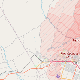
Fort Hood Map, Satellite view of Fort Hood, Texas
Fort Hood is a census-designated place (CDP) located in Bell County, Coryell County, Texas, USA.
Location informations of Fort Hood
Latitude of city of Fort Hood is 31.13460 and longitude of city of Fort Hood is -97.78002- What Country is Fort Hood In? Fort Hood is located in the United States of America.
- What State is Fort Hood located in? Fort Hood is located in Texas.
- What County is Fort Hood In? Fort Hood, Texas sits in Two different counties: Bell County, Coryell County
Fort Hood, Texas (TX), USA Geographic Information
| Country | United States |
| Country Code | US |
| State Name | Texas |
| Latitude | 31.1346 |
| Longitude | -97.78002 |
| DMS Lat | 31°8'4.56" N |
| DMS Long | 97°46'48.072" W |
| DMS coordinates : | 31°8'4.56" N 97°46'48.072" W |
Current Date and Time in Fort Hood, Texas, USA
| Fort Hood Time Zone : America/Chicago |
What day is it in Fort Hood right now?Thursday (April 24, 2025) |
What time is it?Current local time and date at Fort Hood is 11:40:13 (04/24/2025) : (America/Chicago) |
Postcode / zip code of Fort Hood
Fort Hood is the actual or alternate city name associated with 2 ZIP Codes by the US Postal Service.
List of all postal codes in Fort Hood, Texas, United States.
76544 Zip Code 76549 Zip Code
Online Map of Fort Hood - road map, satellite view and street view


Check out our interactive map of Fort Hood, Texas and you'll easily find your way around the Fort Hood major roads and highways.
Satellite Map of Fort Hood, TX, USA
This is online map of the address Fort Hood, TX, United States. You may use button to move and zoom in / out. The map information is for reference only.
Carl R Darnall Army Medical Center Heliport (882 m / 0.55 Miles)
AdventHealth Central Texas Heliport (3.20 Km / 1.99 Miles)
Hood Army Air Field (6.25 Km / 3.88 Miles)
Killeen-Fort Hood Regional Airport / Robert Gray Army Air Field (8.82 Km / 5.48 Miles)
Skylark Field (10.43 Km / 6.48 Miles)
Fort Hood West Airstrip (10.60 Km / 6.59 Miles)
Seton Medical Center Harker Heights Heliport (11.63 Km / 7.23 Miles)
White Airport (15.27 Km / 9.49 Miles)
Fort Hood Northeast Airstrip (19.22 Km / 11.94 Miles)
Fisher Ranch Airport (20.63 Km / 12.82 Miles)
Fort Hood Northeast Heliport (22.56 Km / 14.02 Miles)
J R Ranch Airport (24.77 Km / 15.39 Miles)
CLEAR CREEK EL (1.92 Km / 1.19 Miles)
VENABLE VILLAGE EL (2.28 Km / 1.42 Miles)
KILLEEN ISD EARLY COLLEGE H S (2.61 Km / 1.62 Miles)
CLARKE EL (2.72 Km / 1.69 Miles)
MEADOWS EL (2.89 Km / 1.79 Miles)
LIVE OAK RIDGE MIDDLE (3.08 Km / 1.91 Miles)
METROPLEX SCHOOL (3.11 Km / 1.93 Miles)
PERSHING PARK EL (3.74 Km / 2.32 Miles)
ROBERT M SHOEMAKER H S (3.89 Km / 2.42 Miles)
MAXDALE EL (3.90 Km / 2.42 Miles)
SUGAR LOAF EL (4.38 Km / 2.72 Miles)
DUNCAN EL (4.47 Km / 2.78 Miles)
WEST WARD EL (4.64 Km / 2.88 Miles)
PALO ALTO MIDDLE (4.81 Km / 2.99 Miles)
OVETA CULP HOBBY EL (4.87 Km / 3.02 Miles)
IDUMA EL (4.92 Km / 3.06 Miles)
Central Texas College (3.32 Km / 2.07 Miles)
List of places near to Fort Hood
| Name | Distance |
|---|---|
| Killeen | 5.34 Km / 3.32 Miles |
| Harker Heights | 12.78 Km / 7.94 Miles |
| Copperas Cove | 12.90 Km / 8.02 Miles |
| Nolanville | 17.73 Km / 11.02 Miles |
| Kempner | 22.01 Km / 13.68 Miles |