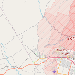
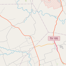
Harker Heights Map, Satellite view of Harker Heights, Texas
Harker Heights is a city located in Bell County, Texas, USA.
Location informations of Harker Heights
Latitude of city of Harker Heights is 31.08351 and longitude of city of Harker Heights is -97.65974- What Country is Harker Heights In? Harker Heights is located in the United States of America.
- What State is Harker Heights located in? Harker Heights is located in Texas.
- What County is Harker Heights In? The County of Harker Heights is Bell County
Harker Heights, Texas (TX), USA Geographic Information
| Country | United States |
| Country Code | US |
| State Name | Texas |
| Latitude | 31.08351 |
| Longitude | -97.65974 |
| DMS Lat | 31°5'0.636" N |
| DMS Long | 97°39'35.064" W |
| DMS coordinates : | 31°5'0.636" N 97°39'35.064" W |
Current Date and Time in Harker Heights, Texas, USA
| Harker Heights Time Zone : America/Chicago |
What day is it in Harker Heights right now?Monday (April 28, 2025) |
What time is it?Current local time and date at Harker Heights is 4/28/2025 - 4:29:31 PM |
Postcode / zip code of Harker Heights
Harker Heights is the actual or alternate city name associated with 3 ZIP Codes by the US Postal Service.
List of all postal codes in Harker Heights, Texas, United States.
76513 Zip Code 76542 Zip Code 76548 Zip Code
Online Map of Harker Heights - road map, satellite view and street view


Check out our interactive map of Harker Heights, Texas and you'll easily find your way around the Harker Heights major roads and highways.
Satellite Map of Harker Heights, TX, USA
This is online map of the address Harker Heights, TX, United States. You may use button to move and zoom in / out. The map information is for reference only.
Seton Medical Center Harker Heights Heliport (2.49 Km / 1.55 Miles)
Skylark Field (2.56 Km / 1.59 Miles)
Hood Army Air Field (8.05 Km / 5.00 Miles)
Carl R Darnall Army Medical Center Heliport (12.69 Km / 7.88 Miles)
White Airport (13.14 Km / 8.16 Miles)
AdventHealth Central Texas Heliport (13.99 Km / 8.69 Miles)
Killeen-Fort Hood Regional Airport / Robert Gray Army Air Field (16.21 Km / 10.07 Miles)
Belton Airport (17.26 Km / 10.72 Miles)
Fort Hood Northeast Airstrip (18.85 Km / 11.72 Miles)
Barge Ranch Airport (19.01 Km / 11.81 Miles)
Fisher Ranch Airport (19.80 Km / 12.30 Miles)
Fort Hood Northeast Heliport (20.12 Km / 12.50 Miles)
Salado Airport (21.38 Km / 13.28 Miles)
The Grove Ranch Airport (21.71 Km / 13.49 Miles)
Woody McClellan Ranch Airport (22.08 Km / 13.72 Miles)
Fort Hood West Airstrip (22.62 Km / 14.06 Miles)
EASTERN HILLS MIDDLE (391 m / 0.24 Miles)
HARKER HEIGHTS EL (926 m / 0.58 Miles)
MOUNTAIN VIEW EL (2.71 Km / 1.68 Miles)
UNION GROVE MIDDLE (2.88 Km / 1.79 Miles)
HARKER HEIGHTS H S (3.08 Km / 1.91 Miles)
SKIPCHA EL (3.31 Km / 2.06 Miles)
HAY BRANCH EL (3.63 Km / 2.25 Miles)
BELL CO JJAEP (3.74 Km / 2.32 Miles)
KILLEEN JJAEP (3.74 Km / 2.32 Miles)
JHW INSPIRE ACADEMY - BELL COUNTY (3.74 Km / 2.32 Miles)
TROY J J A E P (3.74 Km / 2.32 Miles)
BELL CO J J A E P (3.74 Km / 2.32 Miles)
NOLANVILLE EL (3.87 Km / 2.40 Miles)
GATEWAY MIDDLE (3.90 Km / 2.42 Miles)
GATEWAY H S (3.96 Km / 2.46 Miles)
TIMBER RIDGE EL (3.97 Km / 2.46 Miles)
IRA CROSS JR EL (4.07 Km / 2.53 Miles)
CEDAR VALLEY EL (4.46 Km / 2.77 Miles)
LIBERTY HILL MIDDLE (4.68 Km / 2.90 Miles)
KILLEEN H S (4.82 Km / 3.00 Miles)
List of places near to Harker Heights
| Name | Distance |
|---|---|
| Nolanville | 5.19 Km / 3.22 Miles |
| Killeen | 7.48 Km / 4.65 Miles |
| Fort Hood | 12.78 Km / 7.94 Miles |
| Belton | 18.85 Km / 11.71 Miles |
| Salado | 19.06 Km / 11.84 Miles |
| Morgan's Point Resort | 20.66 Km / 12.84 Miles |
| Copperas Cove | 24.58 Km / 15.27 Miles |