Hapeville Map, Satellite view of Hapeville, Georgia
Hapeville is a city located in Fulton County, Georgia, USA.
Location informations of Hapeville
Latitude of city of Hapeville is 33.66011 and longitude of city of Hapeville is -84.41020- What Country is Hapeville In? Hapeville is located in the United States of America.
- What State is Hapeville located in? Hapeville is located in Georgia.
- What County is Hapeville In? The County of Hapeville is Fulton County
Hapeville, Georgia (GA), USA Geographic Information
| Country | United States |
| Country Code | US |
| State Name | Georgia |
| Latitude | 33.66011 |
| Longitude | -84.4102 |
| DMS Lat | 33°39'36.396" N |
| DMS Long | 84°24'36.72" W |
| DMS coordinates : | 33°39'36.396" N 84°24'36.72" W |
Current Date and Time in Hapeville, Georgia, USA
| Hapeville Time Zone : America/New_York |
What day is it in Hapeville right now?Saturday (April 26, 2025) |
What time is it?Current local time and date at Hapeville is 4/26/2025 - 8:32:56 AM |
Postcode / zip code of Hapeville
Hapeville is the actual or alternate city name associated with 1 ZIP Codes by the US Postal Service.
List of all postal codes in Hapeville, Georgia, United States.
30354 Zip Code
Online Map of Hapeville - road map, satellite view and street view

Check out our interactive map of Hapeville, Georgia and you'll easily find your way around the Hapeville major roads and highways.
Satellite Map of Hapeville, GA, USA
This is online map of the address Hapeville, GA, United States. You may use button to move and zoom in / out. The map information is for reference only.
South Fulton Medical Center Heliport (2.67 Km / 1.66 Miles)
Hartsfield Jackson Atlanta International Airport (3.09 Km / 1.92 Miles)
Fort Mcpherson Heliport (6.12 Km / 3.80 Miles)
Trico Heliport (6.60 Km / 4.10 Miles)
Morris Army Airfield (7.75 Km / 4.82 Miles)
Southern Regional Medical Center Heliport (9.16 Km / 5.69 Miles)
State Capital Parking Lot Heliport (10.04 Km / 6.24 Miles)
Grady Memorial Hospital Heliport (10.56 Km / 6.56 Miles)
Hilton Garden Inn Downtown Heliport (11.40 Km / 7.09 Miles)
Crawford W. Long Memorial Hospital Heliport (12.28 Km / 7.63 Miles)
The Coca Cola Company Heliport (12.36 Km / 7.68 Miles)
Legacy Medical Center Heliport (12.93 Km / 8.03 Miles)
Georgia Bureau of Investigation Heliport (13.23 Km / 8.22 Miles)
WGCL-TV Heliport (14.17 Km / 8.81 Miles)
Stonewall Heliport (14.45 Km / 8.98 Miles)
Falcons Nest Heliport (14.79 Km / 9.19 Miles)
Rabbit Hole Heliport (14.81 Km / 9.20 Miles)
Skypad Heliport (15.62 Km / 9.71 Miles)
Wsb-Tv Heliport (15.64 Km / 9.72 Miles)
Piedmont Atlanta Hospital Helipad (16.51 Km / 10.26 Miles)
Hapeville Charter Middle School (247 m / 0.15 Miles)
Hapeville Elementary School (323 m / 0.20 Miles)
Long Middle School (1.62 Km / 1.01 Miles)
APS-Forrest Hills Academy (1.99 Km / 1.24 Miles)
Hutchinson Elementary School (2.29 Km / 1.42 Miles)
Parklane Elementary School (2.45 Km / 1.52 Miles)
KIPP South Fulton Academy School (2.59 Km / 1.61 Miles)
Heritage Academy Elementary (2.93 Km / 1.82 Miles)
Cleveland Elementary School (3.02 Km / 1.88 Miles)
Resurgence Hall Charter School (3.35 Km / 2.08 Miles)
Humphries Elementary School (3.39 Km / 2.11 Miles)
Tri-Cities High School (3.67 Km / 2.28 Miles)
McClarin High School (3.75 Km / 2.33 Miles)
Perkerson Elementary School (4.24 Km / 2.63 Miles)
College Park Elementary (4.32 Km / 2.69 Miles)
South Atlanta High School (4.64 Km / 2.89 Miles)
Unidos Dual Language School (4.74 Km / 2.94 Miles)
Profile Institute of Barber-Styling (3.13 Km / 1.95 Miles)
List of places near to Hapeville
| Name | Distance |
|---|---|
| East Point | 3.46 Km / 2.15 Miles |
| College Park | 5.35 Km / 3.32 Miles |
| Forest Park | 5.69 Km / 3.54 Miles |
| Conley | 8.00 Km / 4.97 Miles |
| Lake City | 9.15 Km / 5.69 Miles |
| Riverdale | 9.73 Km / 6.05 Miles |
| Gresham Park | 10.09 Km / 6.27 Miles |
| Morrow | 10.78 Km / 6.70 Miles |
| Atlanta | 11.49 Km / 7.14 Miles |
| Panthersville | 13.83 Km / 8.59 Miles |
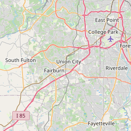
| South Fulton | 14.54 Km / 9.03 Miles |
| Union City | 14.69 Km / 9.13 Miles |
| Candler-McAfee | 14.84 Km / 9.22 Miles |
| Druid Hills | 15.03 Km / 9.34 Miles |
| Jonesboro | 16.27 Km / 10.11 Miles |
| Decatur | 16.54 Km / 10.28 Miles |
| Belvedere Park | 16.89 Km / 10.49 Miles |
| North Decatur | 17.40 Km / 10.81 Miles |
| Avondale Estates | 18.12 Km / 11.26 Miles |
| Fairburn | 18.90 Km / 11.74 Miles |
| North Druid Hills | 19.59 Km / 12.17 Miles |
| Scottdale | 19.76 Km / 12.28 Miles |
| Irondale | 20.51 Km / 12.74 Miles |
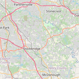
| Stockbridge | 20.80 Km / 12.92 Miles |
| Stonecrest | 22.51 Km / 13.99 Miles |
| Bonanza | 22.67 Km / 14.09 Miles |
| Clarkston | 22.91 Km / 14.24 Miles |
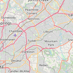
| Brookhaven | 22.98 Km / 14.28 Miles |
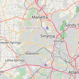
| Vinings | 23.31 Km / 14.48 Miles |
| Mableton | 23.76 Km / 14.76 Miles |
| Fayetteville | 23.87 Km / 14.83 Miles |
| Pine Lake | 24.03 Km / 14.93 Miles |