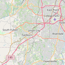
Riverdale Map, Satellite view of Riverdale, Georgia
Riverdale is a city located in Clayton County, Georgia, USA.
Location informations of Riverdale
Latitude of city of Riverdale is 33.57261 and longitude of city of Riverdale is -84.41326- What Country is Riverdale In? Riverdale is located in the United States of America.
- What State is Riverdale located in? Riverdale is located in Georgia.
- What County is Riverdale In? The County of Riverdale is Clayton County
Riverdale, Georgia (GA), USA Geographic Information
| Country | United States |
| Country Code | US |
| State Name | Georgia |
| Latitude | 33.57261 |
| Longitude | -84.41326 |
| DMS Lat | 33°34'21.396" N |
| DMS Long | 84°24'47.736" W |
| DMS coordinates : | 33°34'21.396" N 84°24'47.736" W |
Current Date and Time in Riverdale, Georgia, USA
| Riverdale Time Zone : America/New_York |
What day is it in Riverdale right now?Friday (April 25, 2025) |
What time is it?Current local time and date at Riverdale is 23:11:35 (04/25/2025) : (America/New_York) |
Postcode / zip code of Riverdale
Riverdale is the actual or alternate city name associated with 2 ZIP Codes by the US Postal Service.
List of all postal codes in Riverdale, Georgia, United States.
30274 Zip Code 30296 Zip Code
Area Codes Riverdale, Georgia, USA
Riverdale, Georgia covers 3 Area Codes
470 Area Code 678 Area Code 770 Area CodeOnline Map of Riverdale - road map, satellite view and street view


Check out our interactive map of Riverdale, Georgia and you'll easily find your way around the Riverdale major roads and highways.
Satellite Map of Riverdale, GA, USA
This is online map of the address Riverdale, GA, United States. You may use button to move and zoom in / out. The map information is for reference only.
Southern Regional Medical Center Heliport (2.37 Km / 1.47 Miles)
Rabbit Hole Heliport (6.84 Km / 4.25 Miles)
Hartsfield Jackson Atlanta International Airport (7.26 Km / 4.51 Miles)
Falcons Nest Heliport (7.29 Km / 4.53 Miles)
Morris Army Airfield (7.78 Km / 4.84 Miles)
Coleman Field (9.72 Km / 6.04 Miles)
AE153 Base Heliport (10.21 Km / 6.35 Miles)
Beck Field (10.65 Km / 6.62 Miles)
McLendon Airport (11.45 Km / 7.12 Miles)
South Fulton Medical Center Heliport (11.97 Km / 7.43 Miles)
Trico Heliport (12.29 Km / 7.64 Miles)
Stonewall Heliport (12.97 Km / 8.06 Miles)
Walker Field (13.49 Km / 8.38 Miles)
Bishops Airport (14.17 Km / 8.80 Miles)
Fort Mcpherson Heliport (15.64 Km / 9.72 Miles)
Piedmont Fayette Hospital Heliport (15.87 Km / 9.86 Miles)
Diamond S Airport (16.60 Km / 10.32 Miles)
Deerfield Landing Airport (18.05 Km / 11.21 Miles)
Willow Pond Aviation Inc Airport (18.31 Km / 11.38 Miles)
Piedmont Henry Hospital Heliport (18.36 Km / 11.41 Miles)
Utopian Academy for the Arts Charter School (551 m / 0.34 Miles)
Dubois Integrity Academy (660 m / 0.41 Miles)
Church Street Elementary School (1.12 Km / 0.70 Miles)
Riverdale Middle School (1.19 Km / 0.74 Miles)
Riverdale High School (2.00 Km / 1.24 Miles)
Charles R. Drew High School (2.24 Km / 1.39 Miles)
Harper Elementary School (2.36 Km / 1.47 Miles)
Riverdale Elementary School (2.37 Km / 1.47 Miles)
Sequoyah Middle School (2.62 Km / 1.63 Miles)
Martin Luther King- Jr. Elementary School (2.85 Km / 1.77 Miles)
Oliver Elementary School (3.09 Km / 1.92 Miles)
West Clayton Elementary School (3.77 Km / 2.34 Miles)
Lake Ridge Elementary School (4.07 Km / 2.53 Miles)
Callaway Elementary School (4.35 Km / 2.71 Miles)
Kendrick Middle School (4.66 Km / 2.89 Miles)
North Clayton High School (4.73 Km / 2.94 Miles)
North Clayton Middle School (4.80 Km / 2.98 Miles)
Tara Elementary School (4.92 Km / 3.06 Miles)
Northcutt Elementary School (4.95 Km / 3.08 Miles)
List of places near to Riverdale
| Name | Distance |
|---|---|
| Forest Park | 6.85 Km / 4.26 Miles |
| Morrow | 6.95 Km / 4.32 Miles |
| Jonesboro | 7.92 Km / 4.92 Miles |
| Lake City | 8.15 Km / 5.06 Miles |
| College Park | 8.96 Km / 5.57 Miles |
| Hapeville | 9.73 Km / 6.05 Miles |
| Irondale | 11.40 Km / 7.08 Miles |
| Conley | 11.41 Km / 7.09 Miles |
| Union City | 12.07 Km / 7.50 Miles |
| East Point | 12.13 Km / 7.54 Miles |
| South Fulton | 13.11 Km / 8.15 Miles |
| Bonanza | 13.85 Km / 8.61 Miles |
| Fayetteville | 14.31 Km / 8.89 Miles |
| Fairburn | 15.56 Km / 9.67 Miles |
| Stockbridge | 16.92 Km / 10.51 Miles |
| Gresham Park | 17.19 Km / 10.68 Miles |
| Lovejoy | 17.72 Km / 11.01 Miles |
| Panthersville | 19.89 Km / 12.36 Miles |
| Tyrone | 20.44 Km / 12.70 Miles |
| Atlanta | 21.18 Km / 13.16 Miles |
| Candler-McAfee | 21.58 Km / 13.41 Miles |
| Woolsey | 23.38 Km / 14.53 Miles |
| Hampton | 23.91 Km / 14.86 Miles |
| Druid Hills | 24.18 Km / 15.02 Miles |
| Belvedere Park | 24.35 Km / 15.13 Miles |
| Palmetto | 24.48 Km / 15.21 Miles |
| Decatur | 24.95 Km / 15.50 Miles |