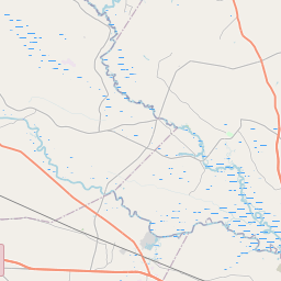
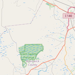
Hightsville Map, Satellite view of Hightsville, North Carolina
Hightsville is a census-designated place (CDP) located in New Hanover County, North Carolina, USA.
Location informations of Hightsville
Latitude of city of Hightsville is 34.26961 and longitude of city of Hightsville is -77.93165- What Country is Hightsville In? Hightsville is located in the United States of America.
- What State is Hightsville located in? Hightsville is located in North Carolina.
- What County is Hightsville In? The County of Hightsville is New Hanover County
Hightsville, North Carolina (NC), USA Geographic Information
| Country | United States |
| Country Code | US |
| State Name | North Carolina |
| Latitude | 34.26961 |
| Longitude | -77.93165 |
| DMS Lat | 34°16'10.596" N |
| DMS Long | 77°55'53.94" W |
| DMS coordinates : | 34°16'10.596" N 77°55'53.94" W |
Current Date and Time in Hightsville, North Carolina, USA
| Hightsville Time Zone : America/New_York |
What day is it in Hightsville right now?Thursday (March 13, 2025) |
What time is it?Current local time and date at Hightsville is 3/13/2025 - 9:45:33 AM |
Postcode / zip code of Hightsville
Hightsville is the actual or alternate city name associated with 1 ZIP Codes by the US Postal Service.
List of all postal codes in Hightsville, North Carolina, United States.
28401 Zip Code
Area Codes Hightsville, North Carolina, USA
Hightsville, North Carolina covers 1 Area Codes
910 Area CodeOnline Map of Hightsville - road map, satellite view and street view


Check out our interactive map of Hightsville, North Carolina and you'll easily find your way around the Hightsville major roads and highways.
Satellite Map of Hightsville, NC, USA
This is online map of the address Hightsville, NC, United States. You may use button to move and zoom in / out. The map information is for reference only.
Wilmington International Airport (2.67 Km / 1.66 Miles)
New Hanover County Sheriff'S Office Heliport (7.08 Km / 4.40 Miles)
210 Investors Heliport (11.88 Km / 7.38 Miles)
NHRMC-Ed North Heliport (15.89 Km / 9.87 Miles)
Brickhouse Field (16.15 Km / 10.04 Miles)
Pilots Ridge Airport (18.55 Km / 11.53 Miles)
Winnabow Airport (20.65 Km / 12.83 Miles)
Sandy Run Acres Airport (21.06 Km / 13.09 Miles)
Pettigrew Moore Aerodrome (22.95 Km / 14.26 Miles)
D.C. Virgo Preparatory Academy (2.25 Km / 1.40 Miles)
D.C. Virgo Preparatory Academy (2.28 Km / 1.42 Miles)
Wrightsboro Elementary (2.76 Km / 1.71 Miles)
R Freeman Sch of Engineering (3.19 Km / 1.98 Miles)
Douglass Academy (3.24 Km / 2.01 Miles)
A H Snipes Academy of Arts/Des (3.49 Km / 2.17 Miles)
New Hanover High (3.59 Km / 2.23 Miles)
Career Readiness Academy at Mosley PLC (4.06 Km / 2.52 Miles)
The International School at Gregory (4.20 Km / 2.61 Miles)
Williston Middle (4.39 Km / 2.73 Miles)
Forest Hills Global Elementary (4.63 Km / 2.88 Miles)
Cape Fear Community College (3.57 Km / 2.22 Miles)
List of places near to Hightsville
| Name | Distance |
|---|---|
| Wrightsboro | 2.31 Km / 1.44 Miles |
| Blue Clay Farms | 4.92 Km / 3.06 Miles |
| Wilmington | 5.02 Km / 3.12 Miles |
| Belville | 5.34 Km / 3.32 Miles |
| Northchase | 6.54 Km / 4.06 Miles |
| Kings Grant | 6.57 Km / 4.08 Miles |
| Navassa | 7.15 Km / 4.44 Miles |
| Murraysville | 8.26 Km / 5.13 Miles |
| Skippers Corner | 8.91 Km / 5.54 Miles |
| Castle Hayne | 10.01 Km / 6.22 Miles |
| Ogden | 10.39 Km / 6.46 Miles |
| Leland | 10.50 Km / 6.52 Miles |
| Bayshore | 13.43 Km / 8.35 Miles |
| Silver Lake | 13.54 Km / 8.41 Miles |
| Wrightsville Beach | 14.17 Km / 8.80 Miles |
| Porters Neck | 15.03 Km / 9.34 Miles |
| Myrtle Grove | 15.70 Km / 9.76 Miles |
| Rocky Point | 18.85 Km / 11.71 Miles |
| Sandy Creek | 20.23 Km / 12.57 Miles |
| Northwest | 21.62 Km / 13.43 Miles |
| Hampstead | 23.05 Km / 14.32 Miles |
| Sea Breeze | 23.25 Km / 14.45 Miles |