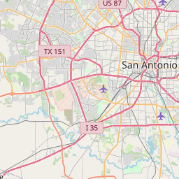
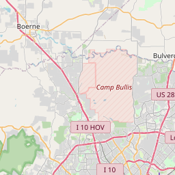
Lackland AFB Map, Satellite view of Lackland AFB, Texas
Lackland AFB is a census-designated place (CDP) located in Bexar County, Texas, USA.
Location informations of Lackland AFB
Latitude of city of Lackland AFB is 29.38666 and longitude of city of Lackland AFB is -98.61788- What Country is Lackland AFB In? Lackland AFB is located in the United States of America.
- What State is Lackland AFB located in? Lackland AFB is located in Texas.
- What County is Lackland AFB In? The County of Lackland AFB is Bexar County
Lackland AFB, Texas (TX), USA Geographic Information
| Country | United States |
| Country Code | US |
| State Name | Texas |
| Latitude | 29.38666 |
| Longitude | -98.61788 |
| DMS Lat | 29°23'11.976" N |
| DMS Long | 98°37'4.368" W |
| DMS coordinates : | 29°23'11.976" N 98°37'4.368" W |
Current Date and Time in Lackland AFB, Texas, USA
| Lackland AFB Time Zone : America/Chicago |
What day is it in Lackland AFB right now?Sunday (May 18, 2025) |
What time is it?Current local time and date at Lackland AFB is 5/18/2025 - 3:48:01 PM |
Postcode / zip code of Lackland AFB
Lackland AFB is the actual or alternate city name associated with 1 ZIP Codes by the US Postal Service.
List of all postal codes in Lackland AFB, Texas, United States.
78236 Zip Code
Online Map of Lackland AFB - road map, satellite view and street view


Check out our interactive map of Lackland AFB, Texas and you'll easily find your way around the Lackland AFB major roads and highways.
Satellite Map of Lackland AFB, TX, USA
This is online map of the address Lackland AFB, TX, United States. You may use button to move and zoom in / out. The map information is for reference only.
Wilford Hall Medical Center Heliport (1.34 Km / 0.83 Miles)
Lackland Air Force Base (3.57 Km / 2.22 Miles)
Standard Industries Airport (6.47 Km / 4.02 Miles)
Sony Microelectronics Helistop (6.80 Km / 4.23 Miles)
Southwest General Hospital Heliport (8.04 Km / 5.00 Miles)
H B Zachry Heliport (9.96 Km / 6.19 Miles)
Star Smith Field (11.39 Km / 7.08 Miles)
Christus Santa Rosa Westover Hills Heliport (11.72 Km / 7.28 Miles)
Riverview Airport (12.28 Km / 7.63 Miles)
Santa Rosa Helistop (12.34 Km / 7.67 Miles)
Baptist Medical Center Heliport (13.22 Km / 8.21 Miles)
Methodist Hospital Texsan Heliport (13.31 Km / 8.27 Miles)
Del Rio Heliport (13.58 Km / 8.44 Miles)
Methodist Hospital Metropolitan Helipad (13.72 Km / 8.53 Miles)
Medical Center Hospital Heliport (14.00 Km / 8.70 Miles)
University Health System Heliport (14.08 Km / 8.75 Miles)
Santa Rosa Northwest Hospital Heliport (14.12 Km / 8.78 Miles)
Methodist Hospital Heliport (14.19 Km / 8.82 Miles)
Stinson Municipal Airport (15.26 Km / 9.48 Miles)
Horizon Airport (16.16 Km / 10.04 Miles)
LACKLAND EL (427 m / 0.27 Miles)
VIRGINIA ALLRED STACEY JR/SR H S (1.02 Km / 0.63 Miles)
FRANK MADLA EL (1.78 Km / 1.11 Miles)
ALLEN EL (2.04 Km / 1.27 Miles)
RAYBURN MIDDLE (2.22 Km / 1.38 Miles)
LIGHTHOUSE CHARTER SCHOOL (2.53 Km / 1.57 Miles)
SUN VALLEY EL (2.85 Km / 1.77 Miles)
VALLEY HI EL (3.06 Km / 1.90 Miles)
FIVE PALMS EL (3.08 Km / 1.91 Miles)
CABLE EL (3.11 Km / 1.93 Miles)
WESTWOOD TERRACE EL (3.27 Km / 2.03 Miles)
NEIL ARMSTRONG EL (3.41 Km / 2.12 Miles)
HULL EL (3.51 Km / 2.18 Miles)
ALAN B SHEPARD MIDDLE (3.66 Km / 2.27 Miles)
IDEA BRACKENRIDGE ACADEMY (3.82 Km / 2.37 Miles)
IDEA BRACKENRIDGE COLLEGE PREPARATORY (3.82 Km / 2.37 Miles)
JONES MIDDLE (4.00 Km / 2.48 Miles)
LIGHTHOUSE CHARTER SCHOOL - B CAMPUS (4.01 Km / 2.49 Miles)
JAY H S (4.16 Km / 2.58 Miles)
H B GONZALEZ EL (4.18 Km / 2.60 Miles)
List of places near to Lackland AFB
| Name | Distance |
|---|---|
| Macdona | 9.81 Km / 6.10 Miles |
| Von Ormy | 11.15 Km / 6.93 Miles |
| Leon Valley | 12.07 Km / 7.50 Miles |
| San Antonio | 12.62 Km / 7.84 Miles |
| Balcones Heights | 12.96 Km / 8.05 Miles |
| Olmos Park | 16.26 Km / 10.10 Miles |
| Castle Hills | 18.09 Km / 11.24 Miles |
| Somerset | 18.24 Km / 11.33 Miles |
| Alamo Heights | 18.34 Km / 11.40 Miles |
| Terrell Hills | 18.92 Km / 11.76 Miles |
| LaCoste | 20.45 Km / 12.71 Miles |
| Helotes | 22.39 Km / 13.91 Miles |
| Shavano Park | 22.94 Km / 14.25 Miles |
| Lytle | 24.01 Km / 14.92 Miles |
| Kirby | 24.06 Km / 14.95 Miles |