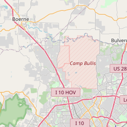
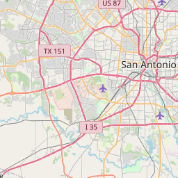
Leon Valley Map, Satellite view of Leon Valley, Texas
Leon Valley is a city located in Bexar County, Texas, USA.
Location informations of Leon Valley
Latitude of city of Leon Valley is 29.49523 and longitude of city of Leon Valley is -98.61863- What Country is Leon Valley In? Leon Valley is located in the United States of America.
- What State is Leon Valley located in? Leon Valley is located in Texas.
- What County is Leon Valley In? The County of Leon Valley is Bexar County
Leon Valley, Texas (TX), USA Geographic Information
| Country | United States |
| Country Code | US |
| State Name | Texas |
| Latitude | 29.49523 |
| Longitude | -98.61863 |
| DMS Lat | 29°29'42.828" N |
| DMS Long | 98°37'7.068" W |
| DMS coordinates : | 29°29'42.828" N 98°37'7.068" W |
Current Date and Time in Leon Valley, Texas, USA
| Leon Valley Time Zone : America/Chicago |
What day is it in Leon Valley right now?Sunday (May 18, 2025) |
What time is it?Current local time and date at Leon Valley is 5/18/2025 - 3:13:59 PM |
Postcode / zip code of Leon Valley
Leon Valley is the actual or alternate city name associated with 2 ZIP Codes by the US Postal Service.
List of all postal codes in Leon Valley, Texas, United States.
78238 Zip Code 78240 Zip Code
Online Map of Leon Valley - road map, satellite view and street view


Check out our interactive map of Leon Valley, Texas and you'll easily find your way around the Leon Valley major roads and highways.
Satellite Map of Leon Valley, TX, USA
This is online map of the address Leon Valley, TX, United States. You may use button to move and zoom in / out. The map information is for reference only.
Santa Rosa Northwest Hospital Heliport (3.40 Km / 2.11 Miles)
University Health System Heliport (4.02 Km / 2.50 Miles)
Medical Center Hospital Heliport (4.07 Km / 2.53 Miles)
Methodist Hospital Heliport (4.78 Km / 2.97 Miles)
Sony Microelectronics Helistop (5.99 Km / 3.72 Miles)
Methodist Hospital Texsan Heliport (6.91 Km / 4.29 Miles)
Christus Santa Rosa Westover Hills Heliport (8.04 Km / 4.99 Miles)
Bexar Metro Medical Heliport (10.33 Km / 6.42 Miles)
Wilford Hall Medical Center Heliport (10.89 Km / 6.77 Miles)
Lackland Air Force Base (12.87 Km / 8.00 Miles)
Methodist Hospital Metropolitan Helipad (13.73 Km / 8.53 Miles)
G W Heliport (13.79 Km / 8.57 Miles)
Santa Rosa Helistop (13.84 Km / 8.60 Miles)
Baptist Medical Center Heliport (14.06 Km / 8.74 Miles)
San Antonio International Airport (15.02 Km / 9.33 Miles)
Del Rio Heliport (15.35 Km / 9.54 Miles)
Viejo Ranch Ultralightport (15.90 Km / 9.88 Miles)
Camp Bullis Heliport (16.73 Km / 10.39 Miles)
Twin-Oaks Airport (17.36 Km / 10.78 Miles)
Southwest General Hospital Heliport (17.44 Km / 10.84 Miles)
SCHOOL AGED PARENTING PROGRAM (140 m / 0.09 Miles)
HOMEBOUND (147 m / 0.09 Miles)
LEON VALLEY EL (949 m / 0.59 Miles)
DRIGGERS EL (979 m / 0.61 Miles)
MORA EL (1.71 Km / 1.06 Miles)
NISD PKSA (1.72 Km / 1.07 Miles)
PUPIL PERSONNEL CAMPUS (1.72 Km / 1.07 Miles)
NISD INTERVENTION (1.72 Km / 1.07 Miles)
OAK HILLS TERRACE EL (2.00 Km / 1.24 Miles)
MARSHALL H S (2.08 Km / 1.29 Miles)
RHODES EL (2.50 Km / 1.55 Miles)
SCHOOL OF SCIENCE AND TECHNOLOGY DISCOVERY (2.53 Km / 1.57 Miles)
ELROD EL (2.65 Km / 1.65 Miles)
POWELL EL (2.69 Km / 1.67 Miles)
PREMIER H S SAN ANTONIO - WEST (2.84 Km / 1.76 Miles)
NEFF MIDDLE (3.05 Km / 1.89 Miles)
GLENOAKS EL (3.20 Km / 1.99 Miles)
HOLMES H S (3.31 Km / 2.06 Miles)
CONNALLY MIDDLE (3.64 Km / 2.26 Miles)
BASIS SAN ANTONIO PRI- MEDICAL CENTER CAMPUS (3.94 Km / 2.45 Miles)
Lamson Institute (1.88 Km / 1.17 Miles)
Galen College of Nursing-San Antonio (3.48 Km / 2.16 Miles)
Milan Institute-San Antonio Ingram (3.55 Km / 2.20 Miles)
Concorde Career College-San Antonio (3.56 Km / 2.21 Miles)
Vogue College of Cosmetology (3.63 Km / 2.25 Miles)
Alamo City Barber College (4.09 Km / 2.54 Miles)
The College of Health Care Professions-San Antonio (4.13 Km / 2.56 Miles)
Southern Careers Institute-San Antonio (4.17 Km / 2.59 Miles)
The University of Texas Health Science Center at San Antonio (4.40 Km / 2.73 Miles)
List of places near to Leon Valley
| Name | Distance |
|---|---|
| Balcones Heights | 6.53 Km / 4.06 Miles |
| San Antonio | 9.66 Km / 6.00 Miles |
| Castle Hills | 10.37 Km / 6.44 Miles |
| Helotes | 11.49 Km / 7.14 Miles |
| Shavano Park | 11.85 Km / 7.36 Miles |
| Lackland AFB | 12.07 Km / 7.50 Miles |
| Olmos Park | 12.82 Km / 7.97 Miles |
| Grey Forest | 14.67 Km / 9.12 Miles |
| Alamo Heights | 14.83 Km / 9.21 Miles |
| Hill Country Village | 15.71 Km / 9.76 Miles |
| Terrell Hills | 16.40 Km / 10.19 Miles |
| Hollywood Park | 17.28 Km / 10.74 Miles |
| Cross Mountain | 18.10 Km / 11.25 Miles |
| Macdona | 20.11 Km / 12.50 Miles |
| Kirby | 22.84 Km / 14.19 Miles |
| Von Ormy | 23.05 Km / 14.32 Miles |
| Windcrest | 23.18 Km / 14.40 Miles |
| Scenic Oaks | 23.69 Km / 14.72 Miles |