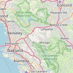
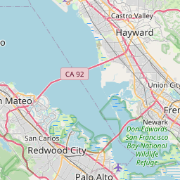
Pleasanton Map, Satellite view of Pleasanton, California
Pleasanton is a city located in Alameda County, California, USA.
Location informations of Pleasanton
Latitude of city of Pleasanton is 37.66243 and longitude of city of Pleasanton is -121.87468- What Country is Pleasanton In? Pleasanton is located in the United States of America.
- What State is Pleasanton located in? Pleasanton is located in California.
- What County is Pleasanton In? The County of Pleasanton is Alameda County
Pleasanton, California (CA), USA Geographic Information
| Country | United States |
| Country Code | US |
| State Name | California |
| Latitude | 37.66243 |
| Longitude | -121.87468 |
| DMS Lat | 37°39'44.748" N |
| DMS Long | 121°52'28.848" W |
| DMS coordinates : | 37°39'44.748" N 121°52'28.848" W |
Current Date and Time in Pleasanton, California, USA
| Pleasanton Time Zone : America/Los_Angeles |
What day is it in Pleasanton right now?Tuesday (September 2, 2025) |
What time is it?Current local time and date at Pleasanton is 9/2/2025 - 10:33:09 AM |
Postcode / zip code of Pleasanton
Pleasanton is the actual or alternate city name associated with 3 ZIP Codes by the US Postal Service.
List of all postal codes in Pleasanton, California, United States.
94566 Zip Code 94568 Zip Code 94588 Zip Code
Online Map of Pleasanton - road map, satellite view and street view


Check out our interactive map of Pleasanton, California and you'll easily find your way around the Pleasanton major roads and highways.
Satellite Map of Pleasanton, CA, USA
This is online map of the address Pleasanton, CA, United States. You may use button to move and zoom in / out. The map information is for reference only.
Stanford Health Care-Valleycare Heliport (3.60 Km / 2.24 Miles)
Camp Parks Heliport (5.35 Km / 3.32 Miles)
Livermore Municipal Airport (5.92 Km / 3.68 Miles)
Parks Air Force Base (7.52 Km / 4.67 Miles)
Livermore Sky Ranch (7.93 Km / 4.93 Miles)
Wente Airport (11.19 Km / 6.95 Miles)
Boneyard Airstrip (12.90 Km / 8.02 Miles)
Naval Outlying Landing Field Mays School (13.39 Km / 8.32 Miles)
Washington Hospital Parking Structure Heliport (14.81 Km / 9.20 Miles)
Washington Hospital Heliport (14.91 Km / 9.26 Miles)
Naval Air Station Livermore (14.97 Km / 9.30 Miles)
PG&E Livermore Training Center Heliport (15.08 Km / 9.37 Miles)
Wells Fargo Bank Operations Center Heliport (15.73 Km / 9.77 Miles)
Meadowlark Field (15.90 Km / 9.88 Miles)
Rancho Escondido Heliport (16.03 Km / 9.96 Miles)
Hummingbird Haven Airport (16.41 Km / 10.20 Miles)
Centerville Airport (17.80 Km / 11.06 Miles)
Sutter Medical Center Castro Valley Heliport (19.32 Km / 12.00 Miles)
Naval Outlying Landing Field Heath (19.82 Km / 12.31 Miles)
Sky Sailing Airport (19.94 Km / 12.39 Miles)
Amador Valley High (659 m / 0.41 Miles)
Village High (733 m / 0.46 Miles)
Alisal Elementary (1.11 Km / 0.69 Miles)
Valley View Elementary (1.12 Km / 0.70 Miles)
Pleasanton Middle (1.18 Km / 0.73 Miles)
Phoebe Apperson Hearst Elementary (1.49 Km / 0.93 Miles)
Walnut Grove Elementary (1.53 Km / 0.95 Miles)
Harvest Park Preschool Center (1.62 Km / 1.01 Miles)
Harvest Park Middle (1.62 Km / 1.01 Miles)
Vintage Hills Elementary (1.87 Km / 1.16 Miles)
Thomas S. Hart Middle (3.25 Km / 2.02 Miles)
Fairlands Elementary (3.33 Km / 2.07 Miles)
Henry P. Mohr Elementary (3.52 Km / 2.19 Miles)
Donlon Elementary (3.81 Km / 2.37 Miles)
Foothill High (4.09 Km / 2.54 Miles)
Lydiksen Elementary (4.53 Km / 2.81 Miles)
List of places near to Pleasanton
| Name | Distance |
|---|---|
| Dublin | 6.96 Km / 4.32 Miles |
| Sunol | 7.67 Km / 4.77 Miles |
| Livermore | 9.63 Km / 5.98 Miles |
| Norris Canyon | 13.57 Km / 8.43 Miles |
| Union City | 14.72 Km / 9.15 Miles |
| Camino Tassajara | 14.98 Km / 9.31 Miles |
| Fairview | 15.17 Km / 9.43 Miles |
| San Ramon | 15.92 Km / 9.89 Miles |
| Fremont | 16.18 Km / 10.05 Miles |
| Blackhawk | 17.84 Km / 11.09 Miles |
| Hayward | 18.16 Km / 11.28 Miles |
| Castro Valley | 18.96 Km / 11.78 Miles |
| Cherryland | 20.21 Km / 12.56 Miles |
| Diablo | 20.53 Km / 12.76 Miles |
| Newark | 20.75 Km / 12.89 Miles |
| Danville | 20.85 Km / 12.96 Miles |
| Ashland | 21.35 Km / 13.27 Miles |
| San Lorenzo | 22.08 Km / 13.72 Miles |