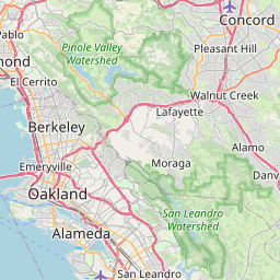
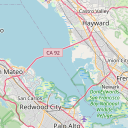
San Lorenzo Map, Satellite view of San Lorenzo, California
San Lorenzo is a census-designated place (CDP) located in Alameda County, California, USA.
Location informations of San Lorenzo
Latitude of city of San Lorenzo is 37.68104 and longitude of city of San Lorenzo is -122.12441- What Country is San Lorenzo In? San Lorenzo is located in the United States of America.
- What State is San Lorenzo located in? San Lorenzo is located in California.
- What County is San Lorenzo In? The County of San Lorenzo is Alameda County
San Lorenzo, California (CA), USA Geographic Information
| Country | United States |
| Country Code | US |
| State Name | California |
| Latitude | 37.68104 |
| Longitude | -122.12441 |
| DMS Lat | 37°40'51.744" N |
| DMS Long | 122°7'27.876" W |
| DMS coordinates : | 37°40'51.744" N 122°7'27.876" W |
Current Date and Time in San Lorenzo, California, USA
| San Lorenzo Time Zone : America/Los_Angeles |
What day is it in San Lorenzo right now?Tuesday (June 3, 2025) |
What time is it?Current local time and date at San Lorenzo is 6/3/2025 - 11:18:27 PM |
Postcode / zip code of San Lorenzo
San Lorenzo is the actual or alternate city name associated with 2 ZIP Codes by the US Postal Service.
List of all postal codes in San Lorenzo, California, United States.
94541 Zip Code 94580 Zip Code
Online Map of San Lorenzo - road map, satellite view and street view


Check out our interactive map of San Lorenzo, California and you'll easily find your way around the San Lorenzo major roads and highways.
Satellite Map of San Lorenzo, CA, USA
This is online map of the address San Lorenzo, CA, United States. You may use button to move and zoom in / out. The map information is for reference only.
Hayward Executive Airport (2.44 Km / 1.51 Miles)
Sutter Medical Center Castro Valley Heliport (3.68 Km / 2.29 Miles)
Boneyard Airstrip (9.29 Km / 5.77 Miles)
Metropolitan Oakland International Airport (9.60 Km / 5.97 Miles)
Naval Hospital Heliport (9.83 Km / 6.11 Miles)
Little Hands Airport (15.97 Km / 9.93 Miles)
US Coast Guard Base Alameda Helipad (16.20 Km / 10.07 Miles)
Laney College Heliport (17.70 Km / 11.00 Miles)
San Francisco Bay Airdrome (17.93 Km / 11.14 Miles)
Alameda County Parking Garage Heliport (18.18 Km / 11.30 Miles)
Washington Hospital Parking Structure Heliport (18.84 Km / 11.70 Miles)
Oakland Convention Center Heliport (18.84 Km / 11.71 Miles)
Washington Hospital Heliport (18.91 Km / 11.75 Miles)
Wells Fargo Bank Operations Center Heliport (19.54 Km / 12.14 Miles)
Centerville Airport (20.40 Km / 12.67 Miles)
San Mateo Airport (20.44 Km / 12.70 Miles)
Parks Air Force Base (20.57 Km / 12.78 Miles)
Camp Parks Heliport (20.59 Km / 12.79 Miles)
Cooley Field (20.63 Km / 12.82 Miles)
Ravenswood Substation Helipad (20.87 Km / 12.97 Miles)
Colonial Acres Elementary (699 m / 0.43 Miles)
Lorenzo Manor Elementary (841 m / 0.52 Miles)
San Lorenzo High (872 m / 0.54 Miles)
Grant Elementary (976 m / 0.61 Miles)
Bohannon Middle (1.21 Km / 0.75 Miles)
Arroyo High (1.27 Km / 0.79 Miles)
Hesperian Elementary (1.37 Km / 0.85 Miles)
East Bay Arts High (1.53 Km / 0.95 Miles)
Royal Sunset (Continuation) (1.58 Km / 0.98 Miles)
San Lorenzo Unified Preschool (1.59 Km / 0.99 Miles)
Edendale Middle (1.75 Km / 1.09 Miles)
Del Rey Elementary (1.86 Km / 1.15 Miles)
Bay Elementary (2.24 Km / 1.39 Miles)
Washington Manor Middle (2.35 Km / 1.46 Miles)
Cherryland Elementary (2.36 Km / 1.47 Miles)
Hillside Elementary (2.41 Km / 1.50 Miles)
Brenkwitz High (2.48 Km / 1.54 Miles)
Monroe Elementary (2.78 Km / 1.73 Miles)
Longwood Elementary (2.83 Km / 1.76 Miles)
Dayton Elementary (2.95 Km / 1.84 Miles)
Carrington College-San Leandro Campus (2.07 Km / 1.29 Miles)
Unitek College (2.34 Km / 1.46 Miles)
Chabot College (4.60 Km / 2.86 Miles)
Life Chiropractic College West (4.81 Km / 2.99 Miles)
List of places near to San Lorenzo
| Name | Distance |
|---|---|
| Ashland | 1.78 Km / 1.11 Miles |
| Cherryland | 1.87 Km / 1.16 Miles |
| Castro Valley | 3.65 Km / 2.27 Miles |
| Hayward | 4.07 Km / 2.53 Miles |
| San Leandro | 5.62 Km / 3.49 Miles |
| Fairview | 6.92 Km / 4.30 Miles |
| Union City | 13.25 Km / 8.23 Miles |
| Alameda | 13.93 Km / 8.66 Miles |
| Norris Canyon | 13.99 Km / 8.69 Miles |
| Dublin | 16.76 Km / 10.41 Miles |
| San Ramon | 16.93 Km / 10.52 Miles |
| Moraga | 17.12 Km / 10.64 Miles |
| Newark | 18.39 Km / 11.43 Miles |
| Piedmont | 18.52 Km / 11.51 Miles |
| Foster City | 18.77 Km / 11.66 Miles |
| Oakland | 18.81 Km / 11.69 Miles |
| Fremont | 19.00 Km / 11.81 Miles |
| Danville | 19.08 Km / 11.86 Miles |
| Alamo | 20.48 Km / 12.73 Miles |
| Emeryville | 21.89 Km / 13.60 Miles |
| San Mateo | 22.05 Km / 13.70 Miles |
| Pleasanton | 22.08 Km / 13.72 Miles |
| Castle Hill | 22.14 Km / 13.76 Miles |
| Belmont | 22.31 Km / 13.86 Miles |
| Orinda | 22.34 Km / 13.88 Miles |
| Diablo | 22.51 Km / 13.99 Miles |
| San Carlos | 22.75 Km / 14.14 Miles |
| Lafayette | 22.77 Km / 14.15 Miles |
| Sunol | 22.89 Km / 14.22 Miles |
| Saranap | 23.07 Km / 14.34 Miles |
| East Palo Alto | 23.64 Km / 14.69 Miles |
| North Fair Oaks | 23.84 Km / 14.81 Miles |
| Burlingame | 23.86 Km / 14.83 Miles |
| Redwood City | 23.90 Km / 14.85 Miles |
| San Miguel | 24.13 Km / 14.99 Miles |
| Brisbane | 24.25 Km / 15.07 Miles |
| Camino Tassajara | 24.57 Km / 15.27 Miles |
| Blackhawk | 24.58 Km / 15.27 Miles |
| Berkeley | 24.88 Km / 15.46 Miles |
| Millbrae | 24.89 Km / 15.47 Miles |