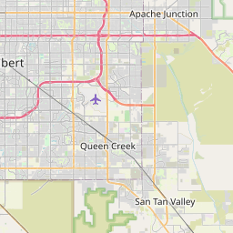
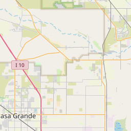
San Tan Valley Map, Satellite view of San Tan Valley, Arizona
San Tan Valley is a census-designated place (CDP) located in Pinal County, Arizona, USA.
Location informations of San Tan Valley
Latitude of city of San Tan Valley is 33.19110 and longitude of city of San Tan Valley is -111.52800- What Country is San Tan Valley In? San Tan Valley is located in the United States of America.
- What State is San Tan Valley located in? San Tan Valley is located in Arizona.
- What County is San Tan Valley In? The County of San Tan Valley is Pinal County
San Tan Valley, Arizona (AZ), USA Geographic Information
| Country | United States |
| Country Code | US |
| State Name | Arizona |
| Latitude | 33.1911 |
| Longitude | -111.528 |
| DMS Lat | 33°11'27.96" N |
| DMS Long | 111°31'40.8" W |
| DMS coordinates : | 33°11'27.96" N 111°31'40.8" W |
Current Date and Time in San Tan Valley, Arizona, USA
| San Tan Valley Time Zone : America/Phoenix |
What day is it in San Tan Valley right now?Tuesday (June 3, 2025) |
What time is it?Current local time and date at San Tan Valley is 6/3/2025 - 10:09:48 PM |
Postcode / zip code of San Tan Valley
San Tan Valley is the actual or alternate city name associated with 6 ZIP Codes by the US Postal Service.
List of all postal codes in San Tan Valley, Arizona, United States.
85128 Zip Code 85140 Zip Code 85142 Zip Code 85143 Zip Code 85240 Zip Code 85243 Zip Code
Online Map of San Tan Valley - road map, satellite view and street view


Check out our interactive map of San Tan Valley, Arizona and you'll easily find your way around the San Tan Valley major roads and highways.
Satellite Map of San Tan Valley, AZ, USA
This is online map of the address San Tan Valley, AZ, United States. You may use button to move and zoom in / out. The map information is for reference only.
Banner Ironwood Medical Center Heliport (4.48 Km / 2.78 Miles)
Bella Vista Farms Landing Strip (5.63 Km / 3.50 Miles)
Ray Schnepf Ranch Airport (7.16 Km / 4.45 Miles)
Rittenhouse Army Heliport (7.52 Km / 4.67 Miles)
Pegasus Airpark (8.53 Km / 5.30 Miles)
Barney Family Landing Strip (10.41 Km / 6.47 Miles)
Barnes Airfield (11.61 Km / 7.21 Miles)
Magma Farm Landing Strip (12.07 Km / 7.50 Miles)
Whisper Ranch Landing Strip (12.35 Km / 7.68 Miles)
Phoenix–Mesa Gateway Airport (17.55 Km / 10.90 Miles)
Florence Junction Airport (1951) (18.30 Km / 11.37 Miles)
MB Acres Airport (18.46 Km / 11.47 Miles)
Florence Military Reservation Airstrip (19.57 Km / 12.16 Miles)
Florence Junction Airport (1961) (20.01 Km / 12.43 Miles)
Womack Airport (20.09 Km / 12.49 Miles)
Gilbert Emergency Hospital Heliport (20.16 Km / 12.53 Miles)
Arizona General Hospital Mesa Heliport (20.48 Km / 12.72 Miles)
Mesquite Groves Landing Strip (21.85 Km / 13.58 Miles)
Banner Goldfield Medical Center Heliport (22.96 Km / 14.26 Miles)
Arizona State Prison Florence Heliport (23.04 Km / 14.32 Miles)
CAVIT - Poston Butte High School (2.50 Km / 1.55 Miles)
Poston Butte High School (2.51 Km / 1.56 Miles)
Champion San Tan (3.69 Km / 2.29 Miles)
J. O. Combs Middle School (3.89 Km / 2.42 Miles)
Circle Cross K8 STEM Academy (4.27 Km / 2.65 Miles)
Combs Traditional Academy (4.39 Km / 2.73 Miles)
Skyline Ranch Elementary School (4.75 Km / 2.95 Miles)
Ellsworth Elementary School (4.84 Km / 3.01 Miles)
List of places near to San Tan Valley
| Name | Distance |
|---|---|
| Queen Creek | 10.56 Km / 6.56 Miles |
| Blackwater | 18.50 Km / 11.50 Miles |
| Sacaton Flats Village | 19.36 Km / 12.03 Miles |
| Gold Canyon | 20.26 Km / 12.59 Miles |
| Upper Santan Village | 21.62 Km / 13.43 Miles |
| Florence | 22.06 Km / 13.71 Miles |
| Apache Junction | 23.05 Km / 14.32 Miles |
| Sacaton | 23.43 Km / 14.56 Miles |
| Coolidge | 23.73 Km / 14.75 Miles |
| Lower Santan Village | 24.55 Km / 15.25 Miles |