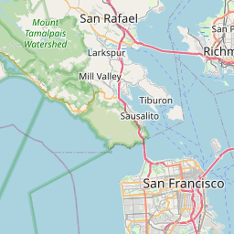
Santa Venetia Map, Satellite view of Santa Venetia, California
Santa Venetia is a census-designated place (CDP) located in Marin County, California, USA.
Location informations of Santa Venetia
Latitude of city of Santa Venetia is 37.99861 and longitude of city of Santa Venetia is -122.52528- What Country is Santa Venetia In? Santa Venetia is located in the United States of America.
- What State is Santa Venetia located in? Santa Venetia is located in California.
- What County is Santa Venetia In? The County of Santa Venetia is Marin County
Santa Venetia, California (CA), USA Geographic Information
| Country | United States |
| Country Code | US |
| State Name | California |
| Latitude | 37.99861 |
| Longitude | -122.52528 |
| DMS Lat | 37°59'54.996" N |
| DMS Long | 122°31'31.008" W |
| DMS coordinates : | 37°59'54.996" N 122°31'31.008" W |
Current Date and Time in Santa Venetia, California, USA
| Santa Venetia Time Zone : America/Los_Angeles |
What day is it in Santa Venetia right now?Monday (June 9, 2025) |
What time is it?Current local time and date at Santa Venetia is 02:29:54 (06/09/2025) : (America/Los_Angeles) |
Postcode / zip code of Santa Venetia
Santa Venetia is the actual or alternate city name associated with 2 ZIP Codes by the US Postal Service.
List of all postal codes in Santa Venetia, California, United States.
94901 Zip Code 94903 Zip Code
Area Codes Santa Venetia, California, USA
Santa Venetia, California covers 1 Area Codes
415 Area CodeOnline Map of Santa Venetia - road map, satellite view and street view


Check out our interactive map of Santa Venetia, California and you'll easily find your way around the Santa Venetia major roads and highways.
Satellite Map of Santa Venetia, CA, USA
This is online map of the address Santa Venetia, CA, United States. You may use button to move and zoom in / out. The map information is for reference only.
San Rafael / Marin County Airport (1.71 Km / 1.06 Miles)
San Rafael Airport (2.07 Km / 1.28 Miles)
San Francisco Bay Airport (4.38 Km / 2.72 Miles)
United States Coast Guard Pacific Strike Team Helipad (6.44 Km / 4.00 Miles)
San Rafel Private Heliport (6.69 Km / 4.15 Miles)
Hamilton Field (6.96 Km / 4.32 Miles)
Commodore Center Seaplane Base (13.36 Km / 8.30 Miles)
Commodore Center Heliport (13.40 Km / 8.32 Miles)
Marin County Airport - Gnoss Field (16.34 Km / 10.16 Miles)
Doctors Medical Center Heliport (17.22 Km / 10.70 Miles)
Angel Island Nike Base Heliport (17.38 Km / 10.80 Miles)
Fort McDowell East Garrison Heliport (17.77 Km / 11.04 Miles)
Sonoma Raceway Heliport Pad 2 (18.58 Km / 11.55 Miles)
Sonoma Raceway Heliport Pad 1 (18.75 Km / 11.65 Miles)
U of C - Richmond Field Station Heliport (19.39 Km / 12.05 Miles)
Alcatraz Heliport (21.25 Km / 13.21 Miles)
Mazza Airport (21.81 Km / 13.55 Miles)
Crissy Field (22.33 Km / 13.87 Miles)
Montgomery Airfield / Marina Airfield (22.66 Km / 14.08 Miles)
Commodore Heliport (23.02 Km / 14.30 Miles)
Venetia Valley K-8 (284 m / 0.18 Miles)
Old Gallinas (755 m / 0.47 Miles)
Coleman Elementary (2.33 Km / 1.45 Miles)
Vallecito Elementary (2.47 Km / 1.53 Miles)
Terra Linda High (2.54 Km / 1.58 Miles)
Sun Valley Elementary (2.72 Km / 1.69 Miles)
Marin County Special Education (2.73 Km / 1.70 Miles)
Marin County ROP (2.76 Km / 1.72 Miles)
Phoenix Academy (2.79 Km / 1.73 Miles)
Madrone High Continuation (3.18 Km / 1.97 Miles)
San Rafael High (3.24 Km / 2.02 Miles)
Short Elementary (3.55 Km / 2.21 Miles)
James B. Davidson Middle (3.60 Km / 2.24 Miles)
Laurel Dell Elementary (3.87 Km / 2.40 Miles)
Miller Creek Middle (4.03 Km / 2.51 Miles)
San Pedro Elementary (4.10 Km / 2.55 Miles)
Hidden Valley Elementary (4.31 Km / 2.68 Miles)
Bahia Vista Elementary (4.35 Km / 2.70 Miles)
Glenwood Elementary (4.42 Km / 2.74 Miles)
Brookside Elementary (4.48 Km / 2.78 Miles)
Dominican University of California (2.25 Km / 1.40 Miles)
University of Redlands Graduate School of Theology (4.75 Km / 2.95 Miles)
List of places near to Santa Venetia
| Name | Distance |
|---|---|
| San Rafael | 2.83 Km / 1.76 Miles |
| San Anselmo | 4.15 Km / 2.58 Miles |
| Ross | 4.79 Km / 2.98 Miles |
| Sleepy Hollow | 5.35 Km / 3.32 Miles |
| Fairfax | 5.72 Km / 3.55 Miles |
| Kentfield | 5.87 Km / 3.65 Miles |
| Lucas Valley-Marinwood | 6.47 Km / 4.02 Miles |
| Larkspur | 7.22 Km / 4.49 Miles |
| Corte Madera | 8.13 Km / 5.05 Miles |
| Mill Valley | 10.43 Km / 6.48 Miles |
| Alto | 10.48 Km / 6.51 Miles |
| Woodacre | 10.63 Km / 6.61 Miles |
| Strawberry | 11.40 Km / 7.08 Miles |
| San Geronimo | 12.25 Km / 7.61 Miles |
| Black Point-Green Point | 12.47 Km / 7.75 Miles |
| Novato | 12.71 Km / 7.90 Miles |
| Tamalpais-Homestead Valley | 13.33 Km / 8.28 Miles |
| North Richmond | 14.52 Km / 9.02 Miles |
| Marin City | 14.53 Km / 9.03 Miles |
| Lagunitas-Forest Knolls | 14.70 Km / 9.13 Miles |
| Belvedere | 14.97 Km / 9.30 Miles |
| Stinson Beach | 15.11 Km / 9.39 Miles |
| Tiburon | 15.15 Km / 9.41 Miles |
| Sausalito | 15.90 Km / 9.88 Miles |
| Muir Beach | 15.94 Km / 9.90 Miles |
| San Pablo | 16.27 Km / 10.11 Miles |
| Nicasio | 16.72 Km / 10.39 Miles |
| Richmond | 17.06 Km / 10.60 Miles |
| Montalvin Manor | 17.10 Km / 10.63 Miles |
| Bolinas | 17.26 Km / 10.72 Miles |
| Rollingwood | 17.52 Km / 10.89 Miles |
| Bayview | 18.12 Km / 11.26 Miles |
| Tara Hills | 18.32 Km / 11.38 Miles |
| East Richmond Heights | 19.49 Km / 12.11 Miles |
| Pinole | 19.85 Km / 12.33 Miles |
| El Sobrante | 20.30 Km / 12.61 Miles |
| Hercules | 20.84 Km / 12.95 Miles |
| El Cerrito | 20.87 Km / 12.97 Miles |
| Rodeo | 22.95 Km / 14.26 Miles |
| Albany | 23.50 Km / 14.60 Miles |
| Kensington | 23.61 Km / 14.67 Miles |