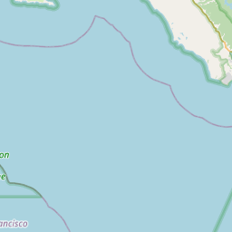
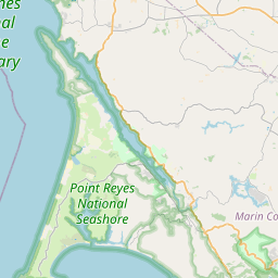
Tamalpais-Homestead Valley Map, Satellite view of Tamalpais-Homestead Valley, California
Tamalpais-Homestead Valley is a census-designated place (CDP) located in Marin County, California, USA.
Location informations of Tamalpais-Homestead Valley
Latitude of city of Tamalpais-Homestead Valley is 37.87913 and longitude of city of Tamalpais-Homestead Valley is -122.53789- What Country is Tamalpais-Homestead Valley In? Tamalpais-Homestead Valley is located in the United States of America.
- What State is Tamalpais-Homestead Valley located in? Tamalpais-Homestead Valley is located in California.
- What County is Tamalpais-Homestead Valley In? The County of Tamalpais-Homestead Valley is Marin County
Tamalpais-Homestead Valley, California (CA), USA Geographic Information
| Country | United States |
| Country Code | US |
| State Name | California |
| Latitude | 37.87913 |
| Longitude | -122.53789 |
| DMS Lat | 37°52'44.868" N |
| DMS Long | 122°32'16.404" W |
| DMS coordinates : | 37°52'44.868" N 122°32'16.404" W |
Current Date and Time in Tamalpais-Homestead Valley, California, USA
| Tamalpais-Homestead Valley Time Zone : America/Los_Angeles |
What day is it in Tamalpais-Homestead Valley right now?Tuesday (August 19, 2025) |
What time is it?Current local time and date at Tamalpais-Homestead Valley is 12:57:28 (08/19/2025) : (America/Los_Angeles) |
Postcode / zip code of Tamalpais-Homestead Valley
Tamalpais-Homestead Valley is the actual or alternate city name associated with 1 ZIP Codes by the US Postal Service.
List of all postal codes in Tamalpais-Homestead Valley, California, United States.
94941 Zip Code
Area Codes Tamalpais-Homestead Valley, California, USA
Tamalpais-Homestead Valley, California covers 1 Area Codes
415 Area CodeOnline Map of Tamalpais-Homestead Valley - road map, satellite view and street view


Check out our interactive map of Tamalpais-Homestead Valley, California and you'll easily find your way around the Tamalpais-Homestead Valley major roads and highways.
Satellite Map of Tamalpais-Homestead Valley, CA, USA
This is online map of the address Tamalpais-Homestead Valley, CA, United States. You may use button to move and zoom in / out. The map information is for reference only.
Commodore Center Heliport (2.19 Km / 1.36 Miles)
Commodore Center Seaplane Base (2.21 Km / 1.37 Miles)
San Rafel Private Heliport (8.73 Km / 5.42 Miles)
Angel Island Nike Base Heliport (9.67 Km / 6.01 Miles)
San Francisco Bay Airport (9.88 Km / 6.14 Miles)
Fort McDowell East Garrison Heliport (10.49 Km / 6.52 Miles)
Crissy Field (10.60 Km / 6.59 Miles)
San Francisco VA Medical Center Heliport (11.01 Km / 6.84 Miles)
Alcatraz Heliport (11.81 Km / 7.34 Miles)
Montgomery Airfield / Marina Airfield (11.85 Km / 7.36 Miles)
Commodore Heliport (13.20 Km / 8.20 Miles)
San Rafael / Marin County Airport (14.95 Km / 9.29 Miles)
San Rafael Airport (15.39 Km / 9.56 Miles)
San Francisco Downtown Heliport (15.59 Km / 9.68 Miles)
Treasure Island Naval Auxiliary Airfield (15.86 Km / 9.85 Miles)
Paul Mantz Seaplane Base (16.37 Km / 10.17 Miles)
Hall of Justice Heliport (16.45 Km / 10.22 Miles)
Treasure Island (Pan American / Clipper Cove) Seaplane Base (16.52 Km / 10.27 Miles)
Treasure Island Helipad (16.57 Km / 10.29 Miles)
UCSF Medical Center at Mission Bay Helipad (18.01 Km / 11.19 Miles)
Tamalpais Valley Elementary (1.03 Km / 0.64 Miles)
Tamalpais High (1.53 Km / 0.95 Miles)
Mill Valley Middle (2.16 Km / 1.34 Miles)
Park Elementary (2.71 Km / 1.69 Miles)
Old Mill Elementary (3.29 Km / 2.04 Miles)
Edna Maguire Elementary (3.43 Km / 2.13 Miles)
Strawberry Point Elementary (3.48 Km / 2.16 Miles)
Bayside Martin Luther King Jr. Academy (3.58 Km / 2.22 Miles)
Bel Aire Elementary (4.54 Km / 2.82 Miles)
List of places near to Tamalpais-Homestead Valley
| Name | Distance |
|---|---|
| Marin City | 2.78 Km / 1.73 Miles |
| Alto | 3.01 Km / 1.87 Miles |
| Mill Valley | 3.06 Km / 1.90 Miles |
| Strawberry | 3.22 Km / 2.00 Miles |
| Muir Beach | 4.26 Km / 2.65 Miles |
| Sausalito | 5.12 Km / 3.18 Miles |
| Corte Madera | 5.24 Km / 3.26 Miles |
| Larkspur | 6.12 Km / 3.80 Miles |
| Belvedere | 6.49 Km / 4.03 Miles |
| Tiburon | 7.16 Km / 4.45 Miles |
| Kentfield | 8.30 Km / 5.16 Miles |
| Ross | 9.39 Km / 5.83 Miles |
| Stinson Beach | 9.65 Km / 6.00 Miles |
| San Rafael | 10.52 Km / 6.54 Miles |
| San Anselmo | 10.83 Km / 6.73 Miles |
| Fairfax | 12.82 Km / 7.97 Miles |
| Santa Venetia | 13.33 Km / 8.28 Miles |
| Bolinas | 13.46 Km / 8.36 Miles |
| Sleepy Hollow | 15.16 Km / 9.42 Miles |
| San Francisco | 15.57 Km / 9.67 Miles |
| North Richmond | 17.38 Km / 10.80 Miles |
| Woodacre | 17.59 Km / 10.93 Miles |
| Richmond | 17.83 Km / 11.08 Miles |
| Lucas Valley-Marinwood | 18.26 Km / 11.35 Miles |
| San Geronimo | 18.56 Km / 11.53 Miles |
| San Pablo | 19.23 Km / 11.95 Miles |
| El Cerrito | 20.27 Km / 12.60 Miles |
| Daly City | 20.39 Km / 12.67 Miles |
| Lagunitas-Forest Knolls | 20.48 Km / 12.73 Miles |
| Rollingwood | 20.60 Km / 12.80 Miles |
| East Richmond Heights | 20.99 Km / 13.04 Miles |
| Albany | 21.09 Km / 13.10 Miles |
| Broadmoor | 21.94 Km / 13.63 Miles |
| Montalvin Manor | 22.48 Km / 13.97 Miles |
| Emeryville | 22.81 Km / 14.17 Miles |
| Kensington | 22.87 Km / 14.21 Miles |
| Tara Hills | 23.22 Km / 14.43 Miles |
| Berkeley | 23.29 Km / 14.47 Miles |
| Colma | 23.51 Km / 14.61 Miles |
| Bayview | 23.90 Km / 14.85 Miles |
| El Sobrante | 23.91 Km / 14.86 Miles |
| Nicasio | 24.70 Km / 15.35 Miles |
| Oakland | 24.88 Km / 15.46 Miles |