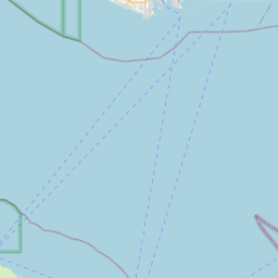
Seal Beach Map, Satellite view of Seal Beach, California
Seal Beach is a city located in Orange County, California, USA.
Location informations of Seal Beach
Latitude of city of Seal Beach is 33.74141 and longitude of city of Seal Beach is -118.10479- What Country is Seal Beach In? Seal Beach is located in the United States of America.
- What State is Seal Beach located in? Seal Beach is located in California.
- What County is Seal Beach In? The County of Seal Beach is Orange County
Seal Beach, California (CA), USA Geographic Information
| Country | United States |
| Country Code | US |
| State Name | California |
| Latitude | 33.74141 |
| Longitude | -118.10479 |
| DMS Lat | 33°44'29.076" N |
| DMS Long | 118°6'17.244" W |
| DMS coordinates : | 33°44'29.076" N 118°6'17.244" W |
Current Date and Time in Seal Beach, California, USA
| Seal Beach Time Zone : America/Los_Angeles |
What day is it in Seal Beach right now?Wednesday (June 4, 2025) |
What time is it?Current local time and date at Seal Beach is 6/4/2025 - 12:05:58 AM |
Postcode / zip code of Seal Beach
Seal Beach is the actual or alternate city name associated with 4 ZIP Codes by the US Postal Service.
List of all postal codes in Seal Beach, California, United States.
90720 Zip Code 90740 Zip Code 90743 Zip Code 92649 Zip Code
Online Map of Seal Beach - road map, satellite view and street view


Check out our interactive map of Seal Beach, California and you'll easily find your way around the Seal Beach major roads and highways.
Satellite Map of Seal Beach, CA, USA
This is online map of the address Seal Beach, CA, United States. You may use button to move and zoom in / out. The map information is for reference only.
Anaheim Bay Helipad (1.03 Km / 0.64 Miles)
Seal Beach Airport (Crawford Field) (1.18 Km / 0.73 Miles)
Boeing Seal Beach (Ground Level) Heliport (2.27 Km / 1.41 Miles)
Boeing Seal Beach (Rooftop) Heliport (2.48 Km / 1.54 Miles)
Rockwell Facility Heliport (2.61 Km / 1.62 Miles)
Platform Esther Heliport (2.65 Km / 1.65 Miles)
VA Medical Center Long Beach Heliport (4.07 Km / 2.53 Miles)
Boeing Huntington Beach Heliport (6.58 Km / 4.09 Miles)
Meadowlark Airport (6.67 Km / 4.14 Miles)
Ocean Club Helipad (7.04 Km / 4.37 Miles)
Los Alamitos Army Air Field (7.28 Km / 4.52 Miles)
Pacific Condominiums Helipad (7.63 Km / 4.74 Miles)
The Current Helipad (7.84 Km / 4.87 Miles)
Queen Mary Heliport (7.94 Km / 4.93 Miles)
Harbor Place Tower Condos Helipad (7.97 Km / 4.95 Miles)
Aqua Condominiums East Helipad (8.10 Km / 5.03 Miles)
Chase Bank Helipad (8.14 Km / 5.06 Miles)
Aero Long Beach 8 Helipad (8.18 Km / 5.08 Miles)
Aqua Condominiums West Helipad (8.19 Km / 5.09 Miles)
Westin Long Beach Helipad (8.23 Km / 5.11 Miles)
J. H. McGaugh Elementary (986 m / 0.61 Miles)
Naples Elementary (2.59 Km / 1.61 Miles)
Kettering Elementary (3.50 Km / 2.17 Miles)
Lowell Elementary (3.62 Km / 2.25 Miles)
Rogers Middle (3.75 Km / 2.33 Miles)
Eunice Sato Academy of Math & Science (4.25 Km / 2.64 Miles)
Francis Hopkinson Elementary (4.63 Km / 2.88 Miles)
Fremont Elementary (4.98 Km / 3.09 Miles)
California State University-Long Beach (4.65 Km / 2.89 Miles)
List of places near to Seal Beach
| Name | Distance |
|---|---|
| Rossmoor | 5.24 Km / 3.26 Miles |
| Los Alamitos | 7.48 Km / 4.65 Miles |
| Long Beach | 8.31 Km / 5.16 Miles |
| Signal Hill | 9.12 Km / 5.67 Miles |
| Westminster | 9.28 Km / 5.77 Miles |
| Hawaiian Gardens | 10.43 Km / 6.48 Miles |
| Cypress | 10.46 Km / 6.50 Miles |
| Midway City | 10.69 Km / 6.64 Miles |
| Stanton | 12.36 Km / 7.68 Miles |
| Lakewood | 12.77 Km / 7.93 Miles |
| La Palma | 12.85 Km / 7.98 Miles |
| Huntington Beach | 13.29 Km / 8.26 Miles |
| Cerritos | 13.52 Km / 8.40 Miles |
| Artesia | 13.98 Km / 8.69 Miles |
| Fountain Valley | 14.43 Km / 8.97 Miles |
| Garden Grove | 15.53 Km / 9.65 Miles |
| Bellflower | 15.64 Km / 9.72 Miles |
| Buena Park | 17.14 Km / 10.65 Miles |
| Paramount | 17.23 Km / 10.71 Miles |
| Norwalk | 18.01 Km / 11.19 Miles |
| Carson | 19.19 Km / 11.92 Miles |
| East Rancho Dominguez | 19.32 Km / 12.00 Miles |
| West Carson | 19.52 Km / 12.13 Miles |
| Compton | 20.21 Km / 12.56 Miles |
| Lomita | 20.24 Km / 12.58 Miles |
| Anaheim | 20.45 Km / 12.71 Miles |
| Costa Mesa | 20.51 Km / 12.74 Miles |
| Newport Beach | 21.22 Km / 13.19 Miles |
| La Mirada | 21.35 Km / 13.27 Miles |
| Santa Ana | 21.91 Km / 13.61 Miles |
| Fullerton | 21.92 Km / 13.62 Miles |
| Downey | 22.23 Km / 13.81 Miles |
| West Rancho Dominguez | 22.85 Km / 14.20 Miles |
| Santa Fe Springs | 22.96 Km / 14.27 Miles |
| Rolling Hills | 23.10 Km / 14.35 Miles |
| Willowbrook | 23.17 Km / 14.40 Miles |
| Lynwood | 23.20 Km / 14.42 Miles |
| Orange | 23.83 Km / 14.81 Miles |
| Rolling Hills Estates | 23.98 Km / 14.90 Miles |
| Torrance | 24.19 Km / 15.03 Miles |
| Gardena | 24.95 Km / 15.50 Miles |