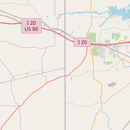
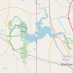
Shreveport Map, Satellite view of Shreveport, Louisiana
Shreveport is a city located in Bossier Parish, Caddo Parish, Louisiana, USA.
Location informations of Shreveport
Latitude of city of Shreveport is 32.46688 and longitude of city of Shreveport is -93.79219- What Country is Shreveport In? Shreveport is located in the United States of America.
- What State is Shreveport located in? Shreveport is located in Louisiana.
- What County is Shreveport In? Shreveport, Louisiana sits in Two different counties: Bossier Parish, Caddo Parish
Shreveport, Louisiana (LA), USA Geographic Information
| Country | United States |
| Country Code | US |
| State Name | Louisiana |
| Latitude | 32.46688 |
| Longitude | -93.79219 |
| DMS Lat | 32°28'0.768" N |
| DMS Long | 93°47'31.884" W |
| DMS coordinates : | 32°28'0.768" N 93°47'31.884" W |
Current Date and Time in Shreveport, Louisiana, USA
| Shreveport Time Zone : America/Chicago |
What day is it in Shreveport right now?Monday (June 2, 2025) |
What time is it?Current local time and date at Shreveport is 15:36:47 (06/02/2025) : (America/Chicago) |
Postcode / zip code of Shreveport
Shreveport is the actual or alternate city name associated with 39 ZIP Codes by the US Postal Service.
List of all postal codes in Shreveport, Louisiana, United States.
71033 Zip Code 71047 Zip Code 71101 Zip Code 71102 Zip Code 71103 Zip Code 71104 Zip Code 71105 Zip Code 71106 Zip Code 71107 Zip Code 71108 Zip Code 71109 Zip Code 71111 Zip Code 71112 Zip Code 71115 Zip Code 71118 Zip Code 71119 Zip Code 71120 Zip Code 71129 Zip Code 71130 Zip Code 71133 Zip Code 71134 Zip Code 71135 Zip Code 71136 Zip Code 71137 Zip Code 71138 Zip Code 71148 Zip Code 71149 Zip Code 71150 Zip Code 71151 Zip Code 71152 Zip Code 71153 Zip Code 71154 Zip Code 71156 Zip Code 71161 Zip Code 71162 Zip Code 71163 Zip Code 71164 Zip Code 71165 Zip Code 71166 Zip Code
Online Map of Shreveport - road map, satellite view and street view


Check out our interactive map of Shreveport, Louisiana and you'll easily find your way around the Shreveport major roads and highways.
Satellite Map of Shreveport, LA, USA
This is online map of the address Shreveport, LA, United States. You may use button to move and zoom in / out. The map information is for reference only.
Stovall Airport (2.13 Km / 1.33 Miles)
Willis-Knighton Medical Center Heliport (2.59 Km / 1.61 Miles)
Shreveport Greenwood Airport (3.01 Km / 1.87 Miles)
Lsu Health Science Center Heliport (3.20 Km / 1.99 Miles)
Shreveport Regional Airport (3.86 Km / 2.40 Miles)
Ochsner LSU Health Shreveport Saint Mary Medical Center Heliport (5.02 Km / 3.12 Miles)
Willis-Knighton South Hospital Heliport (7.14 Km / 4.44 Miles)
Horseshoe Heliport (7.30 Km / 4.53 Miles)
Schumpert Clinic South Heliport (8.23 Km / 5.11 Miles)
Metro Aviation Heliport (8.30 Km / 5.16 Miles)
Texaco Airport (8.30 Km / 5.16 Miles)
Christus Highland Heliport (8.62 Km / 5.35 Miles)
Willis-Knighton Pierremont Heliport (8.90 Km / 5.53 Miles)
Shreveport Downtown Airport (9.28 Km / 5.76 Miles)
Lucien Field (10.34 Km / 6.42 Miles)
Barksdale Air Force Base (12.75 Km / 7.92 Miles)
Bluebird Hill Airport (13.62 Km / 8.46 Miles)
Old Hickory Ranch Airport (13.74 Km / 8.54 Miles)
Tater Patch Ultralightport (13.79 Km / 8.57 Miles)
Juneau Ultralightport Airpark (14.29 Km / 8.88 Miles)
Werner Park Elementary School (1.14 Km / 0.71 Miles)
Midway Professional Development Center (1.29 Km / 0.80 Miles)
Fair Park Middle School (1.46 Km / 0.91 Miles)
Mooretown Elementary Professional Develop. Ctr. (1.85 Km / 1.15 Miles)
Claiborne Fundamental Elementary School (1.99 Km / 1.24 Miles)
Sunset Acres Elementary School (2.17 Km / 1.35 Miles)
Caddo Virtual Academy (2.26 Km / 1.40 Miles)
Queensborough Elementary School (2.40 Km / 1.49 Miles)
Caddo Career & Technical Center (2.41 Km / 1.50 Miles)
Judson Fundamental Elementary School (2.44 Km / 1.51 Miles)
Caddo Heights Math/Science Elementary School (2.55 Km / 1.58 Miles)
Oak Park Microsociety Elementary School (2.80 Km / 1.74 Miles)
Caddo Middle Career and Technology School (2.90 Km / 1.80 Miles)
AmiKiDs Caddo (3.15 Km / 1.96 Miles)
Alexander Learning Center (3.33 Km / 2.07 Miles)
Westwood Elementary School (3.50 Km / 2.17 Miles)
Woodlawn Leadership Academy (3.86 Km / 2.40 Miles)
Linwood Public Charter School (3.97 Km / 2.47 Miles)
South Highlands Elementary Magnet School (4.28 Km / 2.66 Miles)
Booker T. Washington New Technology High School (4.50 Km / 2.80 Miles)
Diesel Driving Academy-Shreveport (1.06 Km / 0.66 Miles)
Setting the Standard Barbering and Natural Hair Academy (2.00 Km / 1.24 Miles)
Digital Media Institute at InterTech (2.46 Km / 1.53 Miles)
Bos-Man's Barber College (2.80 Km / 1.74 Miles)
Louisiana State University Health Sciences Center-Shreveport (3.30 Km / 2.05 Miles)
Blalock's Professional Beauty College (4.61 Km / 2.86 Miles)