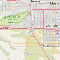
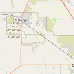
Sweet Water Village Map, Satellite view of Sweet Water Village, Arizona
Sweet Water Village is a census-designated place (CDP) located in Pinal County, Arizona, USA.
Location informations of Sweet Water Village
Latitude of city of Sweet Water Village is 33.12000 and longitude of city of Sweet Water Village is -111.83787- What Country is Sweet Water Village In? Sweet Water Village is located in the United States of America.
- What State is Sweet Water Village located in? Sweet Water Village is located in Arizona.
- What County is Sweet Water Village In? The County of Sweet Water Village is Pinal County
Sweet Water Village, Arizona (AZ), USA Geographic Information
| Country | United States |
| Country Code | US |
| State Name | Arizona |
| Latitude | 33.12 |
| Longitude | -111.83787 |
| DMS Lat | 33°7'12" N |
| DMS Long | 111°50'16.332" W |
| DMS coordinates : | 33°7'12" N 111°50'16.332" W |
Current Date and Time in Sweet Water Village, Arizona, USA
| Sweet Water Village Time Zone : America/Phoenix |
What day is it in Sweet Water Village right now?Monday (June 9, 2025) |
What time is it?Current local time and date at Sweet Water Village is 20:33:40 (06/09/2025) : (America/Phoenix) |
Postcode / zip code of Sweet Water Village
Sweet Water Village is the actual or alternate city name associated with 1 ZIP Codes by the US Postal Service.
List of all postal codes in Sweet Water Village, Arizona, United States.
85121 Zip Code
Area Codes Sweet Water Village, Arizona, USA
Sweet Water Village, Arizona covers 1 Area Codes
520 Area CodeOnline Map of Sweet Water Village - road map, satellite view and street view


Check out our interactive map of Sweet Water Village, Arizona and you'll easily find your way around the Sweet Water Village major roads and highways.
Satellite Map of Sweet Water Village, AZ, USA
This is online map of the address Sweet Water Village, AZ, United States. You may use button to move and zoom in / out. The map information is for reference only.
Seed Farm Airport (5.59 Km / 3.47 Miles)
Hu Hu Kam Memorial Hospital Helipad (8.91 Km / 5.54 Miles)
Van de Waerden Airport (10.71 Km / 6.65 Miles)
Jeppesen Ranch Heliport (12.03 Km / 7.48 Miles)
University of Arizona Maricopa Agricultural Center North Airport (13.42 Km / 8.34 Miles)
Mesquite Groves Landing Strip (13.74 Km / 8.54 Miles)
University of Arizona Maricopa Agricultural Center Airport (14.22 Km / 8.84 Miles)
MB Acres Airport (14.70 Km / 9.13 Miles)
Gila River Memorial Airport (15.40 Km / 9.57 Miles)
Ak-Chin Regional Airport (16.21 Km / 10.07 Miles)
Chandler Municipal Airport (16.77 Km / 10.42 Miles)
Chandler Airport (1929) (17.04 Km / 10.59 Miles)
Chandler Airport (1928) (18.43 Km / 11.45 Miles)
Banner Ocotillo Medical Center Helipad (18.55 Km / 11.53 Miles)
Hine Airport (18.95 Km / 11.77 Miles)
Casa Grande Municipal Airport (19.51 Km / 12.12 Miles)
Chandler Regional Hospital Heliport (20.08 Km / 12.48 Miles)
Mercy Gilbert Medical Center Heliport (20.31 Km / 12.62 Miles)
Whisper Ranch Landing Strip (20.58 Km / 12.79 Miles)
Lone Butte Landing Strip (21.15 Km / 13.14 Miles)
Skyline D5 (4.43 Km / 2.75 Miles)
Casa Blanca Community School (4.45 Km / 2.76 Miles)
List of places near to Sweet Water Village
| Name | Distance |
|---|---|
| Stotonic Village | 4.14 Km / 2.57 Miles |
| Casa Blanca | 4.69 Km / 2.91 Miles |
| Lower Santan Village | 5.51 Km / 3.42 Miles |
| Wet Camp Village | 6.29 Km / 3.91 Miles |
| Upper Santan Village | 8.96 Km / 5.57 Miles |
| Goodyear Village | 9.18 Km / 5.70 Miles |
| Sacaton | 10.37 Km / 6.44 Miles |
| Sun Lakes | 10.72 Km / 6.66 Miles |
| Sacate Village | 13.55 Km / 8.42 Miles |
| Sacaton Flats Village | 18.13 Km / 11.27 Miles |
| Chandler | 20.70 Km / 12.86 Miles |
| Maricopa | 20.72 Km / 12.87 Miles |
| Queen Creek | 23.45 Km / 14.57 Miles |