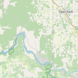
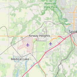
Town and Country Map, Satellite view of Town and Country, Washington
Town and Country is a census-designated place (CDP) located in Spokane County, Washington, USA.
Location informations of Town and Country
Latitude of city of Town and Country is 47.72739 and longitude of city of Town and Country is -117.42161- What Country is Town and Country In? Town and Country is located in the United States of America.
- What State is Town and Country located in? Town and Country is located in Washington.
- What County is Town and Country In? The County of Town and Country is Spokane County
Town and Country, Washington (WA), USA Geographic Information
| Country | United States |
| Country Code | US |
| State Name | Washington |
| Latitude | 47.72739 |
| Longitude | -117.42161 |
| DMS Lat | 47°43'38.604" N |
| DMS Long | 117°25'17.796" W |
| DMS coordinates : | 47°43'38.604" N 117°25'17.796" W |
Current Date and Time in Town and Country, Washington, USA
| Town and Country Time Zone : America/Los_Angeles |
What day is it in Town and Country right now?Sunday (June 8, 2025) |
What time is it?Current local time and date at Town and Country is 6/8/2025 - 7:22:52 AM |
Postcode / zip code of Town and Country
Town and Country is the actual or alternate city name associated with 2 ZIP Codes by the US Postal Service.
List of all postal codes in Town and Country, Washington, United States.
99208 Zip Code 99218 Zip Code
Area Codes Town and Country, Washington, USA
Town and Country, Washington covers 1 Area Codes
509 Area CodeOnline Map of Town and Country - road map, satellite view and street view


Check out our interactive map of Town and Country, Washington and you'll easily find your way around the Town and Country major roads and highways.
Satellite Map of Town and Country, WA, USA
This is online map of the address Town and Country, WA, United States. You may use button to move and zoom in / out. The map information is for reference only.
Holy Family Hospital Heliport (2.18 Km / 1.36 Miles)
Mead Flying Service Airport (8.18 Km / 5.08 Miles)
Multicare Deaconess Hospital Heliport (8.43 Km / 5.24 Miles)
Sacred Heart Medical Center Helistop (8.82 Km / 5.48 Miles)
Felts Field (8.89 Km / 5.52 Miles)
Tai's Landing Airport (10.60 Km / 6.58 Miles)
Pete's Airport (12.84 Km / 7.98 Miles)
Spokane International Airport (14.62 Km / 9.08 Miles)
Boyle R & D Airport (16.14 Km / 10.03 Miles)
Ox Meadows Airport (16.23 Km / 10.08 Miles)
Sunshine Acres Airport (16.72 Km / 10.39 Miles)
N A Degerstrom Yard Heliport (17.34 Km / 10.78 Miles)
Deer Park / Radial Flyer Airport (18.64 Km / 11.58 Miles)
Lee's Airport (18.74 Km / 11.65 Miles)
Mullan Hill Airport (19.22 Km / 11.95 Miles)
Birdhouse Heliport (19.76 Km / 12.28 Miles)
Pathfinder Helicopter Heliport (20.61 Km / 12.81 Miles)
Isaacson Airport (20.91 Km / 12.99 Miles)
Fairchild Air Force Base (21.54 Km / 13.38 Miles)
Sky Meadows Airpark (22.35 Km / 13.89 Miles)
Linwood Elementary (550 m / 0.34 Miles)
Evergreen Elementary School (1.05 Km / 0.65 Miles)
Shiloh Hills Elementary (1.68 Km / 1.04 Miles)
Madison Elementary (2.16 Km / 1.34 Miles)
Ridgeview Elementary (2.19 Km / 1.36 Miles)
Salk Middle School (2.37 Km / 1.47 Miles)
Lidgerwood Elementary (2.46 Km / 1.53 Miles)
Garry Middle School (2.52 Km / 1.57 Miles)
Mead Education Partnership Prog (2.64 Km / 1.64 Miles)
Balboa Elementary (2.77 Km / 1.72 Miles)
Prairie View Elementary (2.78 Km / 1.72 Miles)
Willard Elementary (3.26 Km / 2.02 Miles)
Shadle Park High School (3.38 Km / 2.10 Miles)
Excelsior Youth Center School (3.41 Km / 2.12 Miles)
Whitman Elementary (3.49 Km / 2.17 Miles)
Westview Elementary (3.55 Km / 2.21 Miles)
Glover Middle School (3.75 Km / 2.33 Miles)
Arlington Elementary (3.86 Km / 2.40 Miles)
Indian Trail Elementary (3.88 Km / 2.41 Miles)
Riverpoint Academy (3.99 Km / 2.48 Miles)
Inland Massage Institute (2.61 Km / 1.62 Miles)
Whitworth University-Adult Degree Programs (2.80 Km / 1.74 Miles)
Whitworth University (2.91 Km / 1.81 Miles)
List of places near to Town and Country
| Name | Distance |
|---|---|
| Country Homes | 2.68 Km / 1.67 Miles |
| Fairwood | 4.40 Km / 2.73 Miles |
| Mead | 6.68 Km / 4.15 Miles |
| Spokane | 7.64 Km / 4.75 Miles |
| Millwood | 11.59 Km / 7.20 Miles |
| Spokane Valley | 14.91 Km / 9.26 Miles |
| Green Bluff | 15.79 Km / 9.81 Miles |
| Airway Heights | 15.81 Km / 9.82 Miles |
| Fairchild AFB | 20.85 Km / 12.96 Miles |
| Four Lakes | 22.54 Km / 14.01 Miles |