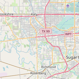
Meadows Place Map, Satellite view of Meadows Place, Texas
Meadows Place is a city located in Fort Bend County, Texas, USA.
Location informations of Meadows Place
Latitude of city of Meadows Place is 29.65134 and longitude of city of Meadows Place is -95.58800- What Country is Meadows Place In? Meadows Place is located in the United States of America.
- What State is Meadows Place located in? Meadows Place is located in Texas.
- What County is Meadows Place In? The County of Meadows Place is Fort Bend County
Meadows Place, Texas (TX), USA Geographic Information
| Country | United States |
| Country Code | US |
| State Name | Texas |
| Latitude | 29.65134 |
| Longitude | -95.588 |
| DMS Lat | 29°39'4.824" N |
| DMS Long | 95°35'16.8" W |
| DMS coordinates : | 29°39'4.824" N 95°35'16.8" W |
Current Date and Time in Meadows Place, Texas, USA
| Meadows Place Time Zone : America/Chicago |
What day is it in Meadows Place right now?Wednesday (May 28, 2025) |
What time is it?Current local time and date at Meadows Place is 17:14:32 (05/28/2025) : (America/Chicago) |
Postcode / zip code of Meadows Place
Meadows Place is the actual or alternate city name associated with 1 ZIP Codes by the US Postal Service.
List of all postal codes in Meadows Place, Texas, United States.
77477 Zip Code
Online Map of Meadows Place - road map, satellite view and street view


Check out our interactive map of Meadows Place, Texas and you'll easily find your way around the Meadows Place major roads and highways.
Satellite Map of Meadows Place, TX, USA
This is online map of the address Meadows Place, TX, United States. You may use button to move and zoom in / out. The map information is for reference only.
Sugar Grove Heliport (1.09 Km / 0.68 Miles)
Avsi-Sugar Land Heliport (2.07 Km / 1.29 Miles)
G H Hart Nr 2 Heliport (3.49 Km / 2.17 Miles)
Ball Park Heliport (3.91 Km / 2.43 Miles)
Durwood Greene Construction Company Heliport (3.98 Km / 2.47 Miles)
Kaneb Heliport (4.32 Km / 2.68 Miles)
CHI St. Luke's Hospital Heliport (5.81 Km / 3.61 Miles)
Channel Two Heliport (7.25 Km / 4.51 Miles)
Sugar Land Regional Airport (7.37 Km / 4.58 Miles)
Houston Methodist Sugar Land Hospital Helipad (7.87 Km / 4.89 Miles)
Andrau Airpark (7.91 Km / 4.92 Miles)
Memorial Hermann Southwest Hospital Heliport (8.11 Km / 5.04 Miles)
Houston Police Department Westside Heliport (8.60 Km / 5.34 Miles)
West Houston Medical Center Heliport (8.61 Km / 5.35 Miles)
ESD 100 Training Field Heliport (9.62 Km / 5.98 Miles)
B & S Warehouse Heliport (10.10 Km / 6.27 Miles)
Community Hospital Heliport (10.12 Km / 6.29 Miles)
Westchase Heliport (10.23 Km / 6.36 Miles)
Pearce Industries Heliport (12.32 Km / 7.66 Miles)
First Bank Plaza Garage Heliport (12.51 Km / 7.77 Miles)
MEADOWS EL (333 m / 0.21 Miles)
ARROW ACADEMY - LIBERATION ACADEMY (808 m / 0.50 Miles)
CUMMINGS EL (1.41 Km / 0.88 Miles)
SMITH EL (1.61 Km / 1.00 Miles)
STEP CHARTER EL (1.74 Km / 1.08 Miles)
KLENTZMAN INT (1.74 Km / 1.08 Miles)
BARRINGTON PLACE EL (1.93 Km / 1.20 Miles)
KENNEDY EL (2.66 Km / 1.65 Miles)
HOLUB MIDDLE (2.84 Km / 1.76 Miles)
BOONE EL (3.01 Km / 1.87 Miles)
MATA INT (3.03 Km / 1.89 Miles)
HARMONY SCIENCE ACADEMY-SUGAR LAND (3.08 Km / 1.91 Miles)
OLLE MIDDLE (3.11 Km / 1.93 Miles)
HARMONY SCHOOL OF EXCELLENCE - SUGAR LAND (3.15 Km / 1.96 Miles)
DULLES MIDDLE (3.21 Km / 1.99 Miles)
HARMONY SCHOOL OF INNOVATION-SUGAR LAND (3.26 Km / 2.02 Miles)
HORN EL (3.37 Km / 2.09 Miles)
PHOENIX SCHOOL AT SOUTHWEST SCHOOLS (3.52 Km / 2.18 Miles)
DULLES H S (3.53 Km / 2.19 Miles)
DULLES EL (3.84 Km / 2.39 Miles)
North American University (561 m / 0.35 Miles)
Ogle School Hair Skin Nails-Stafford (1.82 Km / 1.13 Miles)
Ocean Corporation (2.32 Km / 1.44 Miles)
Houston International College Cardiotech Ultrasound School (2.70 Km / 1.67 Miles)
List of places near to Meadows Place
| Name | Distance |
|---|---|
| Stafford | 3.57 Km / 2.22 Miles |
| Sugar Land | 5.74 Km / 3.57 Miles |
| Fifth Street | 6.88 Km / 4.28 Miles |
| Four Corners | 7.00 Km / 4.35 Miles |
| Mission Bend | 8.91 Km / 5.54 Miles |
| Missouri City | 11.04 Km / 6.86 Miles |
| Bellaire | 13.87 Km / 8.62 Miles |
| Piney Point Village | 13.88 Km / 8.62 Miles |
| Bunker Hill Village | 14.08 Km / 8.75 Miles |
| Pecan Grove | 14.16 Km / 8.80 Miles |
| Hedwig Village | 15.60 Km / 9.69 Miles |
| Southside Place | 15.82 Km / 9.83 Miles |
| Hunters Creek Village | 15.98 Km / 9.93 Miles |
| West University Place | 16.64 Km / 10.34 Miles |
| Thompsons | 17.08 Km / 10.61 Miles |
| Spring Valley Village | 17.40 Km / 10.81 Miles |
| Hilshire Village | 18.21 Km / 11.32 Miles |
| Richmond | 18.39 Km / 11.43 Miles |
| Fresno | 18.47 Km / 11.48 Miles |
| Cinco Ranch | 19.37 Km / 12.04 Miles |
| Sienna Plantation | 19.94 Km / 12.39 Miles |
| Arcola | 20.92 Km / 13.00 Miles |
| Cumings | 21.94 Km / 13.63 Miles |
| Rosenberg | 23.76 Km / 14.76 Miles |
| Houston | 24.36 Km / 15.14 Miles |