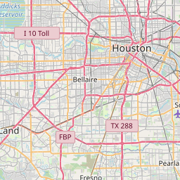
Southside Place Map, Satellite view of Southside Place, Texas
Southside Place is a city located in Harris County, Texas, USA.
Location informations of Southside Place
Latitude of city of Southside Place is 29.70606 and longitude of city of Southside Place is -95.43688- What Country is Southside Place In? Southside Place is located in the United States of America.
- What State is Southside Place located in? Southside Place is located in Texas.
- What County is Southside Place In? The County of Southside Place is Harris County
Southside Place, Texas (TX), USA Geographic Information
| Country | United States |
| Country Code | US |
| State Name | Texas |
| Latitude | 29.70606 |
| Longitude | -95.43688 |
| DMS Lat | 29°42'21.816" N |
| DMS Long | 95°26'12.768" W |
| DMS coordinates : | 29°42'21.816" N 95°26'12.768" W |
Current Date and Time in Southside Place, Texas, USA
| Southside Place Time Zone : America/Chicago |
What day is it in Southside Place right now?Monday (April 28, 2025) |
What time is it?Current local time and date at Southside Place is 23:29:39 (04/28/2025) : (America/Chicago) |
Postcode / zip code of Southside Place
Southside Place is the actual or alternate city name associated with 2 ZIP Codes by the US Postal Service.
List of all postal codes in Southside Place, Texas, United States.
77005 Zip Code 77025 Zip Code
Online Map of Southside Place - road map, satellite view and street view


Check out our interactive map of Southside Place, Texas and you'll easily find your way around the Southside Place major roads and highways.
Satellite Map of Southside Place, TX, USA
This is online map of the address Southside Place, TX, United States. You may use button to move and zoom in / out. The map information is for reference only.
Ktrk Tv Station Heliport (2.27 Km / 1.41 Miles)
Prudential Heliport (2.38 Km / 1.48 Miles)
Sw Police Station Nr 4 Heliport (2.42 Km / 1.51 Miles)
Kriv Fox 26 Television Heliport (2.60 Km / 1.62 Miles)
Pin Oak Stables Heliport (2.80 Km / 1.74 Miles)
Horlock Heliport (3.15 Km / 1.96 Miles)
Shell I C Heliport (3.18 Km / 1.98 Miles)
Texas Childrens Downtown Heliport (3.31 Km / 2.05 Miles)
The Women's Hospital of Texas Heliport (3.48 Km / 2.16 Miles)
CHI Baylor St Luke's Medical Center Heliport (3.62 Km / 2.25 Miles)
Post Oak Central Heliport (3.71 Km / 2.31 Miles)
Methodist Hospital Alkek Heliport (3.73 Km / 2.32 Miles)
Tenneco Lab Helistop (3.80 Km / 2.36 Miles)
Harris County Courthouse Heliport (4.02 Km / 2.50 Miles)
John S Dunn Heliport (4.14 Km / 2.57 Miles)
Williams Tower Garage Heliport (4.26 Km / 2.65 Miles)
Medical Center Heliport (4.27 Km / 2.65 Miles)
GWS Incorporated Construction Heliport (4.44 Km / 2.76 Miles)
Veterans Affairs Medical Center Heliport (4.52 Km / 2.81 Miles)
The Huntingdon Heliport (4.89 Km / 3.04 Miles)
PERSHING MIDDLE (514 m / 0.32 Miles)
TWAIN EL (825 m / 0.51 Miles)
WEST UNIVERSITY EL (1.08 Km / 0.67 Miles)
RICE SCH /LA ESCUELA RICE (1.86 Km / 1.15 Miles)
LONGFELLOW EL (2.14 Km / 1.33 Miles)
HORN EL (2.17 Km / 1.35 Miles)
PIN OAK MIDDLE (2.44 Km / 1.52 Miles)
ROBERTS EL (2.49 Km / 1.55 Miles)
CHALLENGE EARLY COLLEGE H S (2.61 Km / 1.62 Miles)
CONDIT EL (2.95 Km / 1.83 Miles)
SHRINERS HOSPITALS FOR CHILDREN (3.02 Km / 1.88 Miles)
EXCEL ACADEMY (MURWORTH) (3.05 Km / 1.90 Miles)
EXCEL ACADEMY (3.06 Km / 1.90 Miles)
JUVENILE JUSTICE AEP (3.06 Km / 1.90 Miles)
HC JJAEP - EXCEL ACADEMY (3.06 Km / 1.90 Miles)
HARRIS CO JJAEP (3.06 Km / 1.90 Miles)
JJAEP DISCIPLINARY SCHOOL (3.06 Km / 1.90 Miles)
ALIEF ISD J J A E P (3.06 Km / 1.90 Miles)
EXCEL ACADEMY (JJAEP) (3.06 Km / 1.90 Miles)
HARRIS CO J J A E P (3.06 Km / 1.90 Miles)
The Art Institute of Houston (2.82 Km / 1.75 Miles)
Vet Tech Institute of Houston (3.11 Km / 1.93 Miles)
The University of Texas Health Science Center at Houston (3.27 Km / 2.03 Miles)
College of Health Care Professions (The) (3.47 Km / 2.16 Miles)
Rice University (3.61 Km / 2.25 Miles)
Houston Graduate School of Theology (3.79 Km / 2.35 Miles)
The University of Texas MD Anderson Cancer Center (3.87 Km / 2.41 Miles)
Baylor College of Medicine (4.00 Km / 2.49 Miles)
List of places near to Southside Place
| Name | Distance |
|---|---|
| West University Place | 1.36 Km / 0.85 Miles |
| Bellaire | 2.12 Km / 1.32 Miles |
| Hunters Creek Village | 9.13 Km / 5.67 Miles |
| Piney Point Village | 9.80 Km / 6.09 Miles |
| Houston | 10.00 Km / 6.21 Miles |
| Hilshire Village | 10.69 Km / 6.64 Miles |
| Hedwig Village | 11.09 Km / 6.89 Miles |
| Bunker Hill Village | 11.28 Km / 7.01 Miles |
| Spring Valley Village | 11.34 Km / 7.05 Miles |
| Stafford | 15.32 Km / 9.52 Miles |
| Meadows Place | 15.82 Km / 9.83 Miles |
| Fifth Street | 16.31 Km / 10.13 Miles |
| Brookside Village | 17.09 Km / 10.62 Miles |
| Missouri City | 18.58 Km / 11.55 Miles |
| Fresno | 18.62 Km / 11.57 Miles |
| Pearland | 20.01 Km / 12.43 Miles |
| South Houston | 20.04 Km / 12.45 Miles |
| Galena Park | 20.19 Km / 12.55 Miles |
| Jacinto City | 20.76 Km / 12.90 Miles |
| Sugar Land | 21.41 Km / 13.30 Miles |
| Four Corners | 21.74 Km / 13.51 Miles |
| Pasadena | 22.06 Km / 13.71 Miles |
| Mission Bend | 22.21 Km / 13.80 Miles |
| Arcola | 23.52 Km / 14.61 Miles |
| Jersey Village | 23.58 Km / 14.65 Miles |
| Aldine | 23.76 Km / 14.76 Miles |
| Iowa Colony | 24.95 Km / 15.50 Miles |