Sienna Plantation Map, Satellite view of Sienna Plantation, Texas
Sienna Plantation is a census-designated place (CDP) located in Fort Bend County, Texas, USA.
Location informations of Sienna Plantation
Latitude of city of Sienna Plantation is 29.48607 and longitude of city of Sienna Plantation is -95.50800- What Country is Sienna Plantation In? Sienna Plantation is located in the United States of America.
- What State is Sienna Plantation located in? Sienna Plantation is located in Texas.
- What County is Sienna Plantation In? The County of Sienna Plantation is Fort Bend County
Sienna Plantation, Texas (TX), USA Geographic Information
| Country | United States |
| Country Code | US |
| State Name | Texas |
| Latitude | 29.48607 |
| Longitude | -95.508 |
| DMS Lat | 29°29'9.852" N |
| DMS Long | 95°30'28.8" W |
| DMS coordinates : | 29°29'9.852" N 95°30'28.8" W |
Current Date and Time in Sienna Plantation, Texas, USA
| Sienna Plantation Time Zone : America/Chicago |
What day is it in Sienna Plantation right now?Monday (June 2, 2025) |
What time is it?Current local time and date at Sienna Plantation is 6/2/2025 - 5:52:47 PM |
Postcode / zip code of Sienna Plantation
Sienna Plantation is the actual or alternate city name associated with 2 ZIP Codes by the US Postal Service.
List of all postal codes in Sienna Plantation, Texas, United States.
77459 Zip Code 77583 Zip Code
Area Codes Sienna Plantation, Texas, USA
Sienna Plantation, Texas covers 3 Area Codes
281 Area Code 713 Area Code 832 Area CodeOnline Map of Sienna Plantation - road map, satellite view and street view
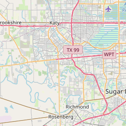


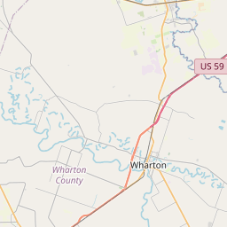


Check out our interactive map of Sienna Plantation, Texas and you'll easily find your way around the Sienna Plantation major roads and highways.
Satellite Map of Sienna Plantation, TX, USA
This is online map of the address Sienna Plantation, TX, United States. You may use button to move and zoom in / out. The map information is for reference only.
Houston Southwest Airport (3.74 Km / 2.33 Miles)
Flyin' B Airport (9.97 Km / 6.19 Miles)
Community Hospital Heliport (10.10 Km / 6.28 Miles)
Helitrans Heliport (10.30 Km / 6.40 Miles)
Life Flight/Refuel Heliport (11.52 Km / 7.16 Miles)
Bayless Airport (11.86 Km / 7.37 Miles)
W A Parish Power Plant Heliport (12.34 Km / 7.67 Miles)
Memorial Hermann Pearland Hospital Heliport (14.53 Km / 9.03 Miles)
BB Airpark (15.12 Km / 9.40 Miles)
HCA Houston Healthcare Pearland Heliport (15.25 Km / 9.48 Miles)
Durwood Greene Construction Company Heliport (16.48 Km / 10.24 Miles)
Houston Methodist Sugar Land Hospital Helipad (16.50 Km / 10.25 Miles)
Kaneb Heliport (17.12 Km / 10.64 Miles)
CHI St. Luke's Hospital Heliport (17.15 Km / 10.66 Miles)
Wolfe Air Park (17.51 Km / 10.88 Miles)
Lift Crane Heliport (17.61 Km / 10.94 Miles)
G H Hart Nr 2 Heliport (17.88 Km / 11.11 Miles)
Speed Shore Company Headquarters Heliport (18.22 Km / 11.32 Miles)
Pearce Industries Heliport (18.82 Km / 11.69 Miles)
Meyer Field (18.83 Km / 11.70 Miles)
RIDGE POINT H S (731 m / 0.45 Miles)
DONALD LEONETTI EL (1.71 Km / 1.06 Miles)
RONALD THORNTON MIDDLE (1.90 Km / 1.18 Miles)
SIENNA CROSSING EL (2.16 Km / 1.34 Miles)
SCANLAN OAKS EL (2.57 Km / 1.60 Miles)
FERNDELL HENRY CENTER FOR LEARNING (3.69 Km / 2.29 Miles)
BILLY BAINES MIDDLE (3.92 Km / 2.44 Miles)
HERITAGE ROSE EL (4.38 Km / 2.72 Miles)
FORT BEND CO ALTER (4.46 Km / 2.77 Miles)
WALTER MOSES BURTON EL (4.83 Km / 3.00 Miles)
List of places near to Sienna Plantation
| Name | Distance |
|---|---|
| Arcola | 4.23 Km / 2.63 Miles |
| Thompsons | 7.56 Km / 4.70 Miles |
| Fresno | 8.29 Km / 5.15 Miles |
| Iowa Colony | 8.96 Km / 5.57 Miles |
| Missouri City | 8.97 Km / 5.57 Miles |
| Sandy Point | 11.48 Km / 7.13 Miles |
| Fifth Street | 13.16 Km / 8.18 Miles |
| Manvel | 14.75 Km / 9.17 Miles |
| Rosharon | 15.59 Km / 9.69 Miles |
| Stafford | 16.50 Km / 10.25 Miles |
| Sugar Land | 19.27 Km / 11.97 Miles |
| Pearland | 19.50 Km / 12.12 Miles |
| Bonney | 19.72 Km / 12.25 Miles |
| Meadows Place | 19.94 Km / 12.39 Miles |
| Brookside Village | 20.94 Km / 13.01 Miles |
| Bellaire | 24.89 Km / 15.47 Miles |
| Four Corners | 24.93 Km / 15.49 Miles |