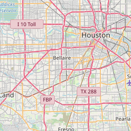
Brookside Village Map, Satellite view of Brookside Village, Texas
Brookside Village is a city located in Brazoria County, Texas, USA.
Location informations of Brookside Village
Latitude of city of Brookside Village is 29.58690 and longitude of city of Brookside Village is -95.32522- What Country is Brookside Village In? Brookside Village is located in the United States of America.
- What State is Brookside Village located in? Brookside Village is located in Texas.
- What County is Brookside Village In? The County of Brookside Village is Brazoria County
Brookside Village, Texas (TX), USA Geographic Information
| Country | United States |
| Country Code | US |
| State Name | Texas |
| Latitude | 29.5869 |
| Longitude | -95.32522 |
| DMS Lat | 29°35'12.84" N |
| DMS Long | 95°19'30.792" W |
| DMS coordinates : | 29°35'12.84" N 95°19'30.792" W |
Current Date and Time in Brookside Village, Texas, USA
| Brookside Village Time Zone : America/Chicago |
What day is it in Brookside Village right now?Friday (June 6, 2025) |
What time is it?Current local time and date at Brookside Village is 6/6/2025 - 4:48:12 PM |
Postcode / zip code of Brookside Village
Brookside Village is the actual or alternate city name associated with 1 ZIP Codes by the US Postal Service.
List of all postal codes in Brookside Village, Texas, United States.
77581 Zip Code
Online Map of Brookside Village - road map, satellite view and street view


Check out our interactive map of Brookside Village, Texas and you'll easily find your way around the Brookside Village major roads and highways.
Satellite Map of Brookside Village, TX, USA
This is online map of the address Brookside Village, TX, United States. You may use button to move and zoom in / out. The map information is for reference only.
Gulfcoast Heliport (1.37 Km / 0.85 Miles)
M D K Field Heliport (2.06 Km / 1.28 Miles)
Joe Rye Heliport (2.10 Km / 1.30 Miles)
Skyway Manor Airport (3.49 Km / 2.17 Miles)
Bradair Heliport (4.10 Km / 2.55 Miles)
Metro Heli-Pad Heliport (4.22 Km / 2.62 Miles)
Speed Shore Company Headquarters Heliport (4.42 Km / 2.75 Miles)
Pearland Heliport (5.33 Km / 3.31 Miles)
Rowan Heliport (6.13 Km / 3.81 Miles)
HCA Houston Healthcare Pearland Heliport (6.47 Km / 4.02 Miles)
Memorial Hermann Pearland Hospital Heliport (6.56 Km / 4.08 Miles)
Club House Nr 1 Heliport (7.76 Km / 4.82 Miles)
William P Hobby Airport (7.90 Km / 4.91 Miles)
Houston Police Department Southeast Heliport (7.91 Km / 4.92 Miles)
A&A Flying Service Airport (8.16 Km / 5.07 Miles)
Police Helicopter Patrol Heliport (8.46 Km / 5.25 Miles)
Houston Airpark (8.93 Km / 5.55 Miles)
Sky Ranch Airport (9.03 Km / 5.61 Miles)
Pearland Regional Airport (10.86 Km / 6.74 Miles)
Flyin' B Airport (10.99 Km / 6.83 Miles)
E A LAWHON EL (482 m / 0.30 Miles)
SAM JAMISON MIDDLE (3.64 Km / 2.26 Miles)
FROST EL (3.86 Km / 2.40 Miles)
H C CARLESTON EL (3.87 Km / 2.41 Miles)
ROGERS MIDDLE (4.07 Km / 2.53 Miles)
CHALLENGER EL (4.41 Km / 2.74 Miles)
ILTEXAS HOUSTON OREM EL (4.51 Km / 2.80 Miles)
ILTEXAS HOUSTON OREM MIDDLE (4.51 Km / 2.80 Miles)
BERRY MILLER J H (4.52 Km / 2.81 Miles)
BARBARA COCKRELL EL (4.79 Km / 2.97 Miles)
LEON H SABLATURA MIDDLE (4.83 Km / 3.00 Miles)
PEARLAND J H WEST (4.94 Km / 3.07 Miles)
List of places near to Brookside Village
| Name | Distance |
|---|---|
| Pearland | 3.47 Km / 2.16 Miles |
| South Houston | 12.12 Km / 7.53 Miles |
| Fresno | 12.97 Km / 8.06 Miles |
| Manvel | 14.17 Km / 8.80 Miles |
| Iowa Colony | 14.53 Km / 9.03 Miles |
| Friendswood | 15.13 Km / 9.40 Miles |
| Pasadena | 16.13 Km / 10.02 Miles |
| Arcola | 16.94 Km / 10.53 Miles |
| Southside Place | 17.09 Km / 10.62 Miles |
| West University Place | 17.96 Km / 11.16 Miles |
| Bellaire | 18.48 Km / 11.48 Miles |
| Galena Park | 18.71 Km / 11.63 Miles |
| Alvin | 19.76 Km / 12.28 Miles |
| Missouri City | 20.56 Km / 12.78 Miles |
| Webster | 20.75 Km / 12.89 Miles |
| Sienna Plantation | 20.94 Km / 13.01 Miles |
| Fifth Street | 21.90 Km / 13.61 Miles |
| Jacinto City | 21.93 Km / 13.63 Miles |
| Hillcrest | 22.51 Km / 13.99 Miles |
| Houston | 22.95 Km / 14.26 Miles |
| Nassau Bay | 23.13 Km / 14.37 Miles |
| Deer Park | 23.49 Km / 14.60 Miles |
| League City | 23.52 Km / 14.61 Miles |
| Stafford | 23.65 Km / 14.70 Miles |