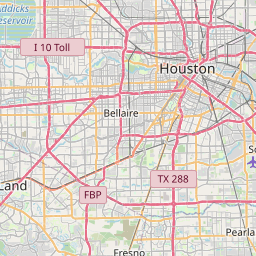
South Houston Map, Satellite view of South Houston, Texas
South Houston is a city located in Harris County, Texas, USA.
Location informations of South Houston
Latitude of city of South Houston is 29.66301 and longitude of city of South Houston is -95.23549- What Country is South Houston In? South Houston is located in the United States of America.
- What State is South Houston located in? South Houston is located in Texas.
- What County is South Houston In? The County of South Houston is Harris County
South Houston, Texas (TX), USA Geographic Information
| Country | United States |
| Country Code | US |
| State Name | Texas |
| Latitude | 29.66301 |
| Longitude | -95.23549 |
| DMS Lat | 29°39'46.836" N |
| DMS Long | 95°14'7.764" W |
| DMS coordinates : | 29°39'46.836" N 95°14'7.764" W |
Current Date and Time in South Houston, Texas, USA
| South Houston Time Zone : America/Chicago |
What day is it in South Houston right now?Sunday (April 27, 2025) |
What time is it?Current local time and date at South Houston is 4/27/2025 - 8:56:46 AM |
Postcode / zip code of South Houston
South Houston is the actual or alternate city name associated with 4 ZIP Codes by the US Postal Service.
List of all postal codes in South Houston, Texas, United States.
77260 Zip Code 77502 Zip Code 77504 Zip Code 77587 Zip Code
Online Map of South Houston - road map, satellite view and street view


Check out our interactive map of South Houston, Texas and you'll easily find your way around the South Houston major roads and highways.
Satellite Map of South Houston, TX, USA
This is online map of the address South Houston, TX, United States. You may use button to move and zoom in / out. The map information is for reference only.
3321 Westside Heliport (3.25 Km / 2.02 Miles)
Centerpoint Energy South Houston Heliport (3.26 Km / 2.03 Miles)
Police Helicopter Patrol Heliport (4.06 Km / 2.52 Miles)
Memorial Hospital Heliport (4.46 Km / 2.77 Miles)
William P Hobby Airport (4.63 Km / 2.88 Miles)
Pasadena Post Office Heliport (4.84 Km / 3.01 Miles)
Police Heliport (5.01 Km / 3.11 Miles)
Bayshore Medical Center Heliport (5.18 Km / 3.22 Miles)
Marine Consultants Inc Heliport (6.07 Km / 3.77 Miles)
Rowan Heliport (6.12 Km / 3.81 Miles)
Lewis Electric Apparatus Repair Inc Heliport (6.77 Km / 4.21 Miles)
CHI Saint Lukes Health Patients Medical Center Heliport (7.44 Km / 4.62 Miles)
US Coast Guard Port Safety Station Heliport (7.58 Km / 4.71 Miles)
Houston Police Department Southeast Heliport (8.10 Km / 5.03 Miles)
Diamond Heliport (9.09 Km / 5.65 Miles)
Bradair Heliport (9.28 Km / 5.77 Miles)
Memorial Hermann Southeast Hospital Heliport (9.39 Km / 5.83 Miles)
Ellington Airport (9.66 Km / 6.00 Miles)
Shell Deer Park Refinery Heliport (10.56 Km / 6.56 Miles)
Ethyl Corp Heliport (10.70 Km / 6.65 Miles)
MATTHYS EL (670 m / 0.42 Miles)
SOUTH HOUSTON EL (857 m / 0.53 Miles)
SOUTH HOUSTON INT (907 m / 0.56 Miles)
STEVENSON MIDDLE (1.26 Km / 0.78 Miles)
QUEENS INT (1.67 Km / 1.04 Miles)
PEARL HALL EL (1.90 Km / 1.18 Miles)
FREEMAN EL (1.91 Km / 1.19 Miles)
HOUSTON CAN ACADEMY - HOBBY (2.17 Km / 1.35 Miles)
L F SMITH ELEMENTARY (2.17 Km / 1.35 Miles)
PATTERSON EL (2.26 Km / 1.40 Miles)
RICK SCHNEIDER MIDDLE (2.26 Km / 1.40 Miles)
SOUTH HOUSTON HIGH SCHOOL (2.66 Km / 1.65 Miles)
NELDA SULLIVAN MIDDLE (2.68 Km / 1.67 Miles)
WILLIAMS ELEMENTARY (2.76 Km / 1.72 Miles)
BONNER EL (2.82 Km / 1.75 Miles)
EARNESTEEN MILSTEAD MIDDLE (2.97 Km / 1.84 Miles)
GARFIELD EL (3.01 Km / 1.87 Miles)
CHAVEZ H S (3.24 Km / 2.01 Miles)
SOUTH SHAVER EL (3.26 Km / 2.03 Miles)
RUCKER EL (3.53 Km / 2.20 Miles)
Interactive College of Technology (3.70 Km / 2.30 Miles)
Aviation Institute of Maintenance-Houston (4.58 Km / 2.85 Miles)
List of places near to South Houston
| Name | Distance |
|---|---|
| Pasadena | 4.03 Km / 2.50 Miles |
| Galena Park | 7.86 Km / 4.88 Miles |
| Jacinto City | 11.61 Km / 7.21 Miles |
| Deer Park | 11.76 Km / 7.31 Miles |
| Brookside Village | 12.12 Km / 7.53 Miles |
| Cloverleaf | 14.21 Km / 8.83 Miles |
| Pearland | 14.63 Km / 9.09 Miles |
| Channelview | 17.15 Km / 10.66 Miles |
| Friendswood | 17.43 Km / 10.83 Miles |
| Webster | 17.96 Km / 11.16 Miles |
| Nassau Bay | 19.19 Km / 11.92 Miles |
| Southside Place | 20.04 Km / 12.45 Miles |
| West University Place | 20.11 Km / 12.50 Miles |
| Houston | 20.14 Km / 12.51 Miles |
| Taylor Lake Village | 20.40 Km / 12.68 Miles |
| La Porte | 20.88 Km / 12.97 Miles |
| Shoreacres | 21.44 Km / 13.32 Miles |
| El Lago | 21.46 Km / 13.33 Miles |
| Bellaire | 22.09 Km / 13.73 Miles |
| Morgan's Point | 22.78 Km / 14.15 Miles |
| League City | 22.79 Km / 14.16 Miles |
| Clear Lake Shores | 23.49 Km / 14.60 Miles |
| Highlands | 24.50 Km / 15.22 Miles |
| Seabrook | 24.66 Km / 15.32 Miles |
| Fresno | 24.71 Km / 15.35 Miles |
| Kemah | 24.72 Km / 15.36 Miles |